DJI Flight Hub 2
DJI FlightHub 2
Smart Cloud-Based Drone Operations
All-in-one centralized drone management platform
DJI FlightHub 2 is a cloud-based drone operation and management platform that enables remote control, intelligent flight scheduling, flexible mission planning, and seamless third-party system integration.
Powered by next-generation AI algorithms and a multimodal language model (LLM), the platform transforms workflows in engineering, construction, public safety, emergency response, mapping, and infrastructure inspection — enabling fully automated air-to-ground operations with powerful situational awareness and command capabilities.
1. Real-Time Remote Control
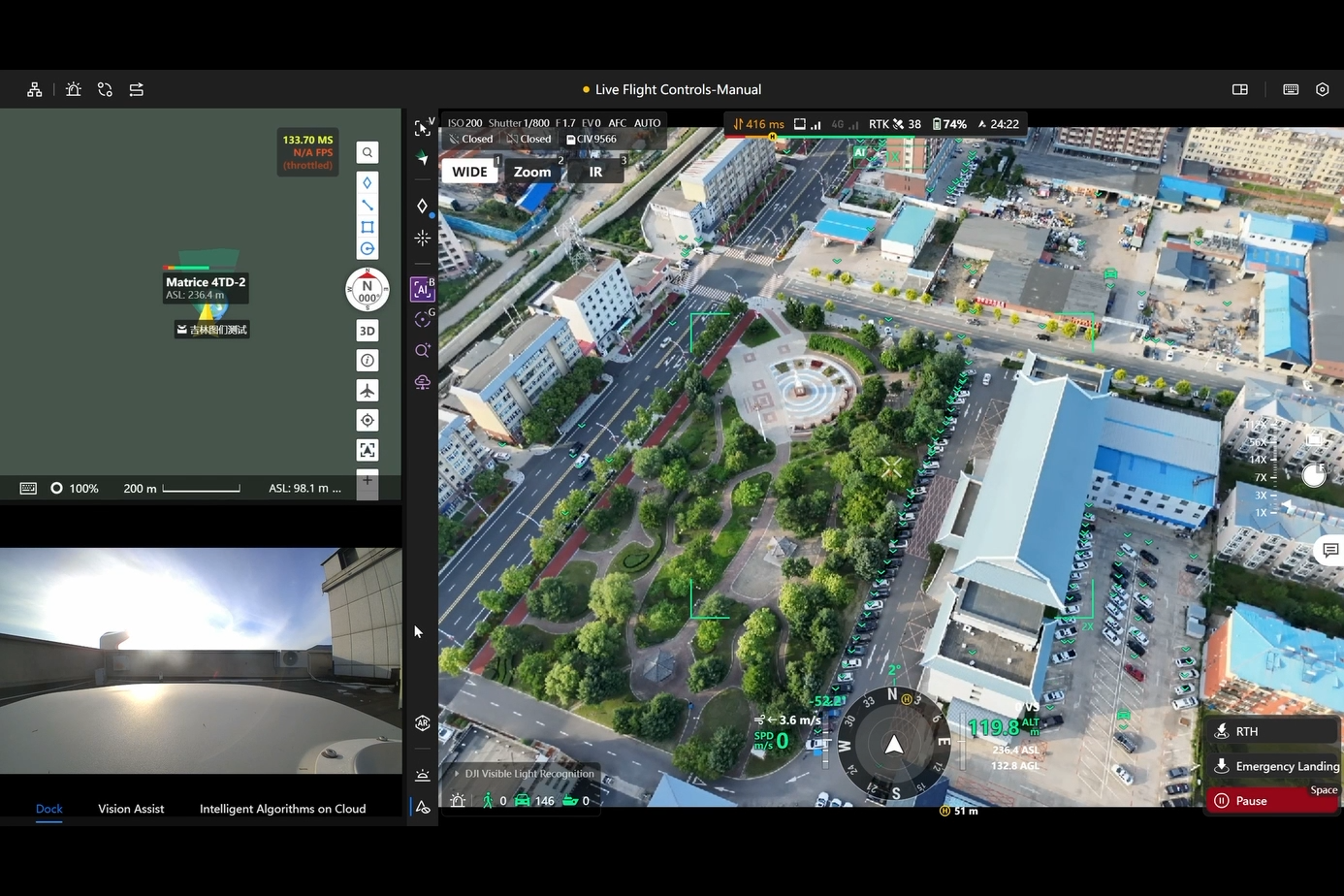
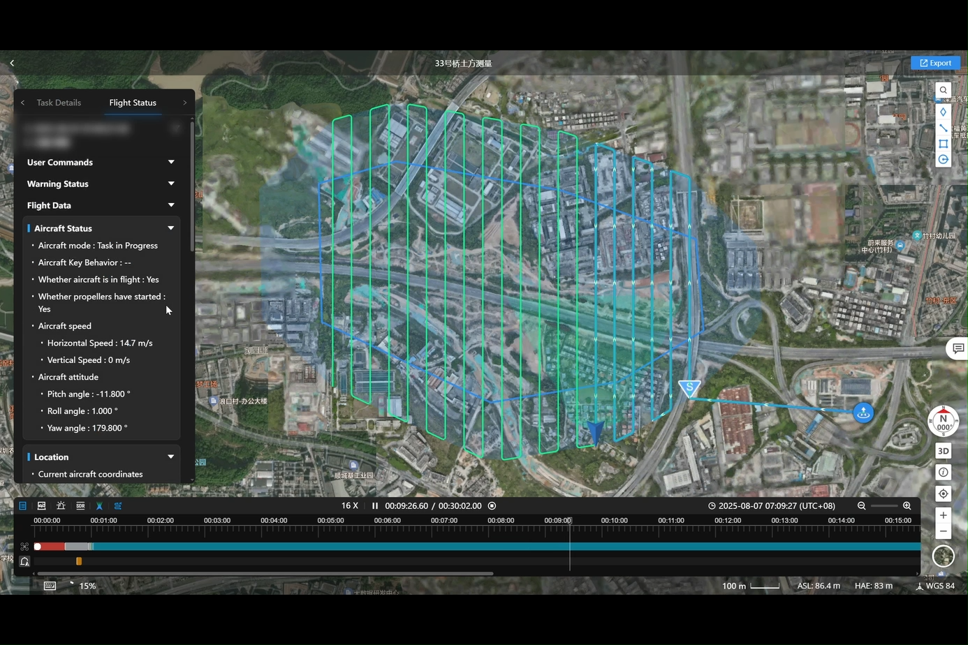
Virtual Cockpit
• Control drones easily using a mouse and keyboard
• Mouse-look view and drag-to-zoom for fast, precise camera control
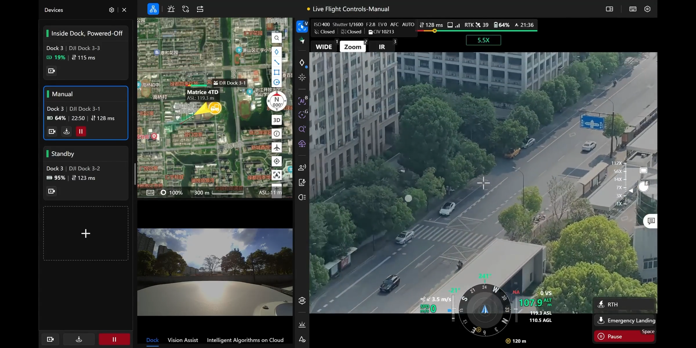
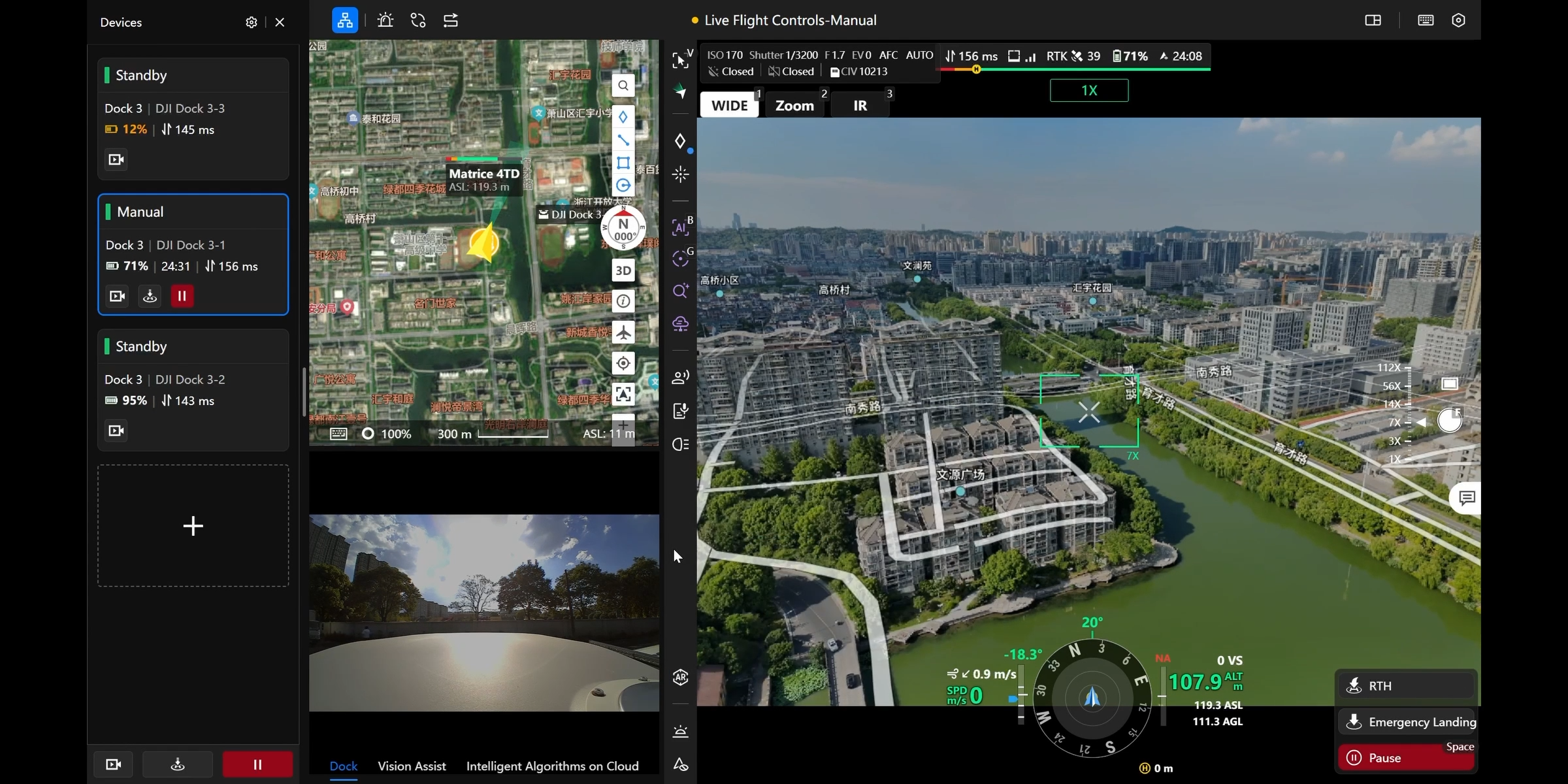
Multi-Drone Control
• Operate multiple drones simultaneously within the same cockpit interface
• One-click mission switching and Return-to-Home for efficient fleet coordination
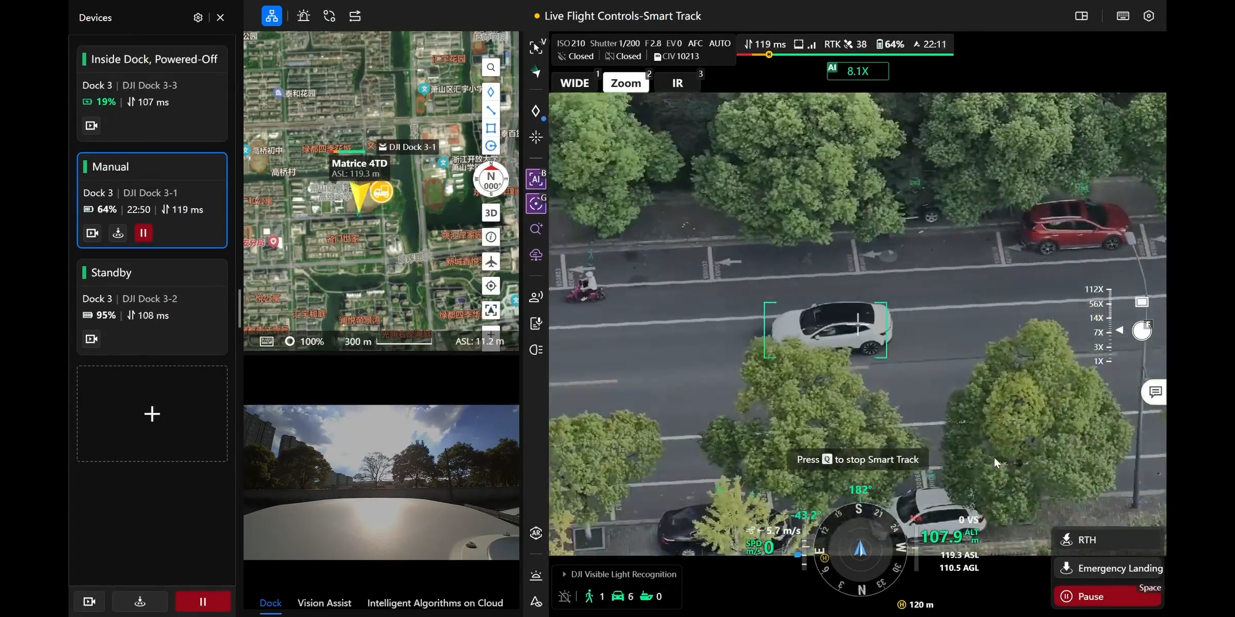
Intelligent Tracking
• Supports detection of vehicles, vessels, people, and more
• Auto-counting, alerting, and continuous tracking for optimized surveillance
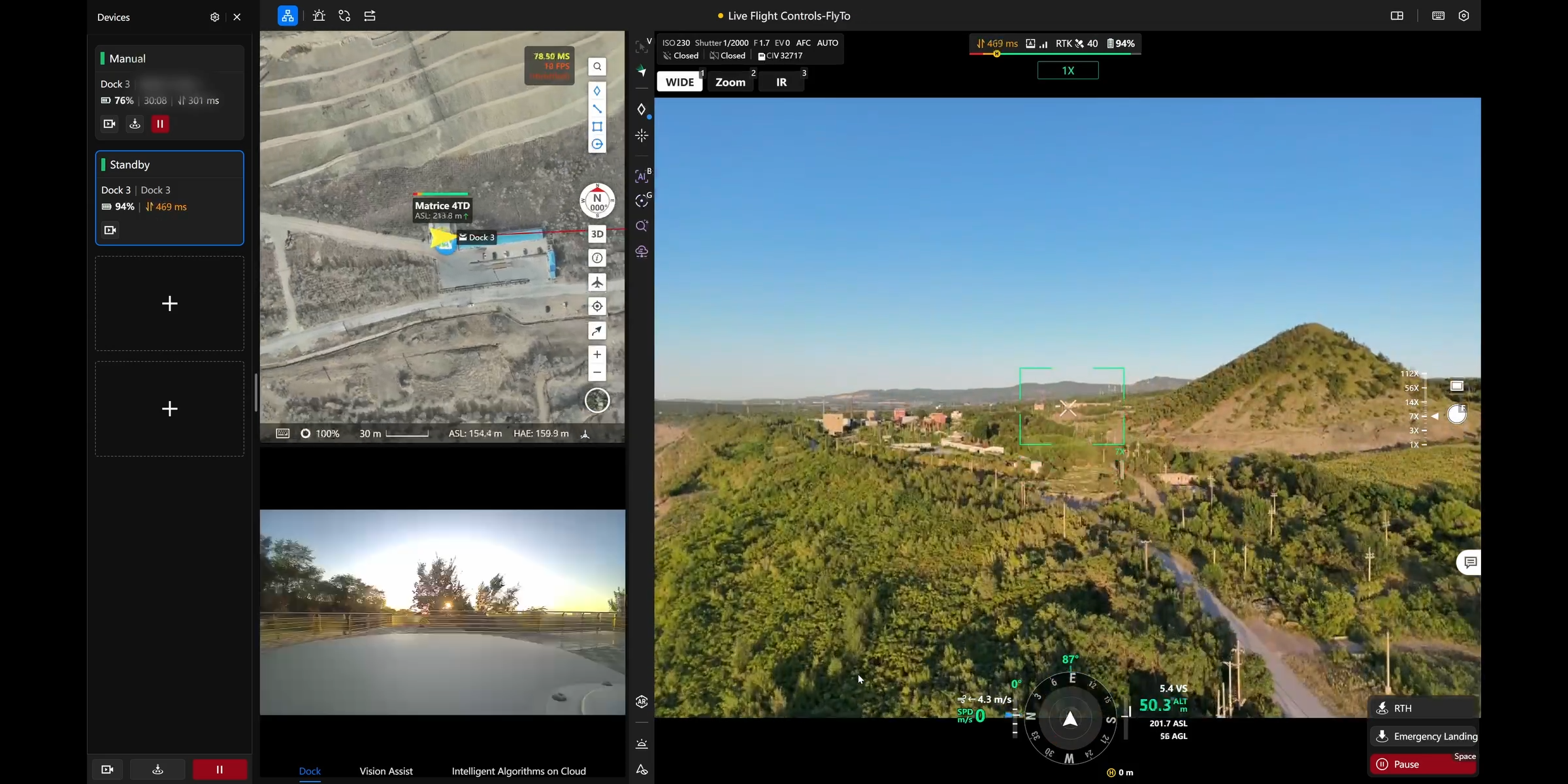
FlyTo Mission
• Select any point on the map → system auto-generates an optimal route
• Drone flies to target safely and quickly, ideal for emergency response
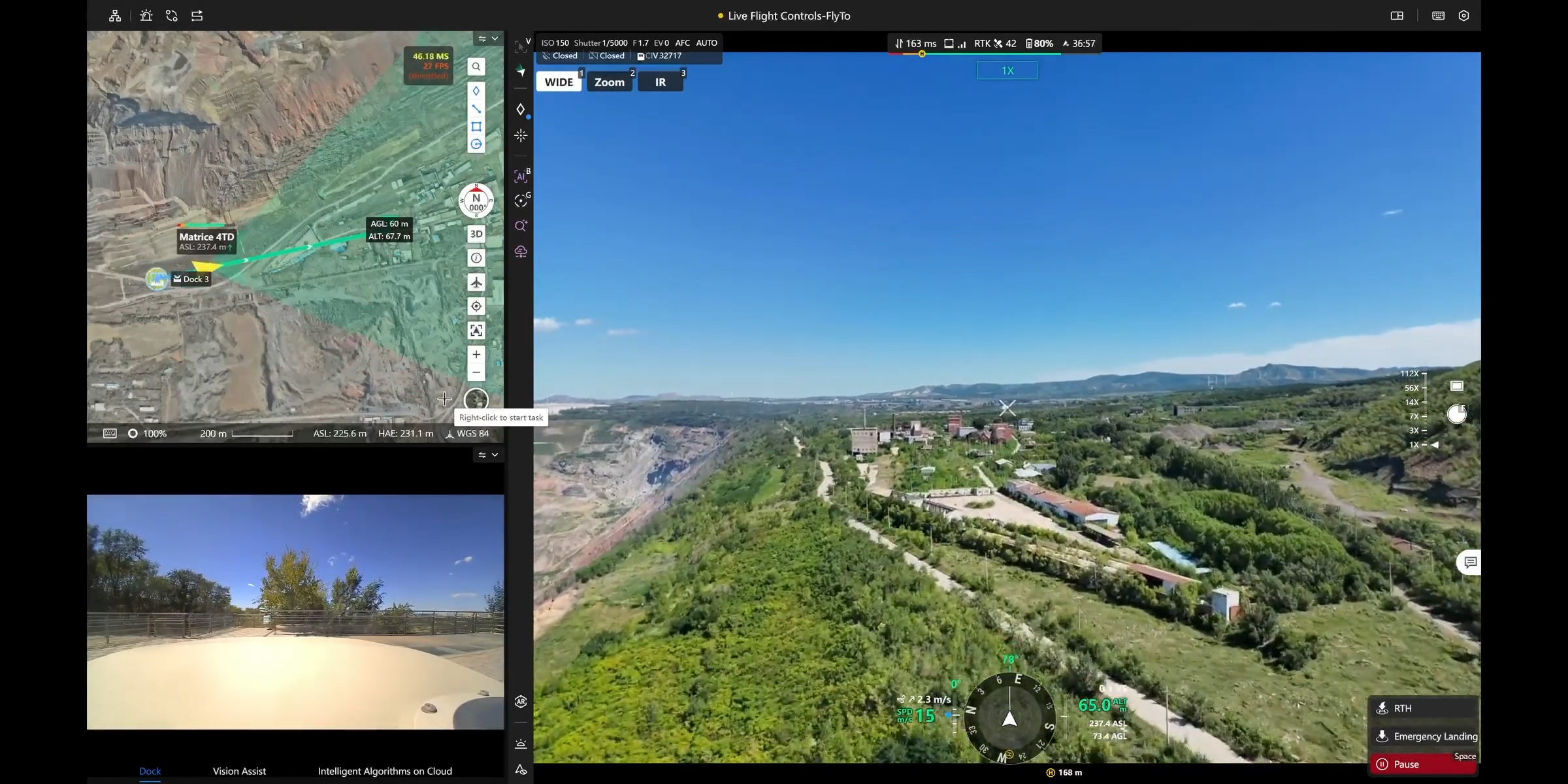
AR Map Overlay
• 3D building and road data overlaid directly onto the live video feed
• Enhances situational awareness in complex environments
2. Ground-to-Cloud Collaboration
Centralized Dashboard
• Displays device status, mission progress, and flight statistics in real time
• Enables fast decision-making with clear and intuitive data visuals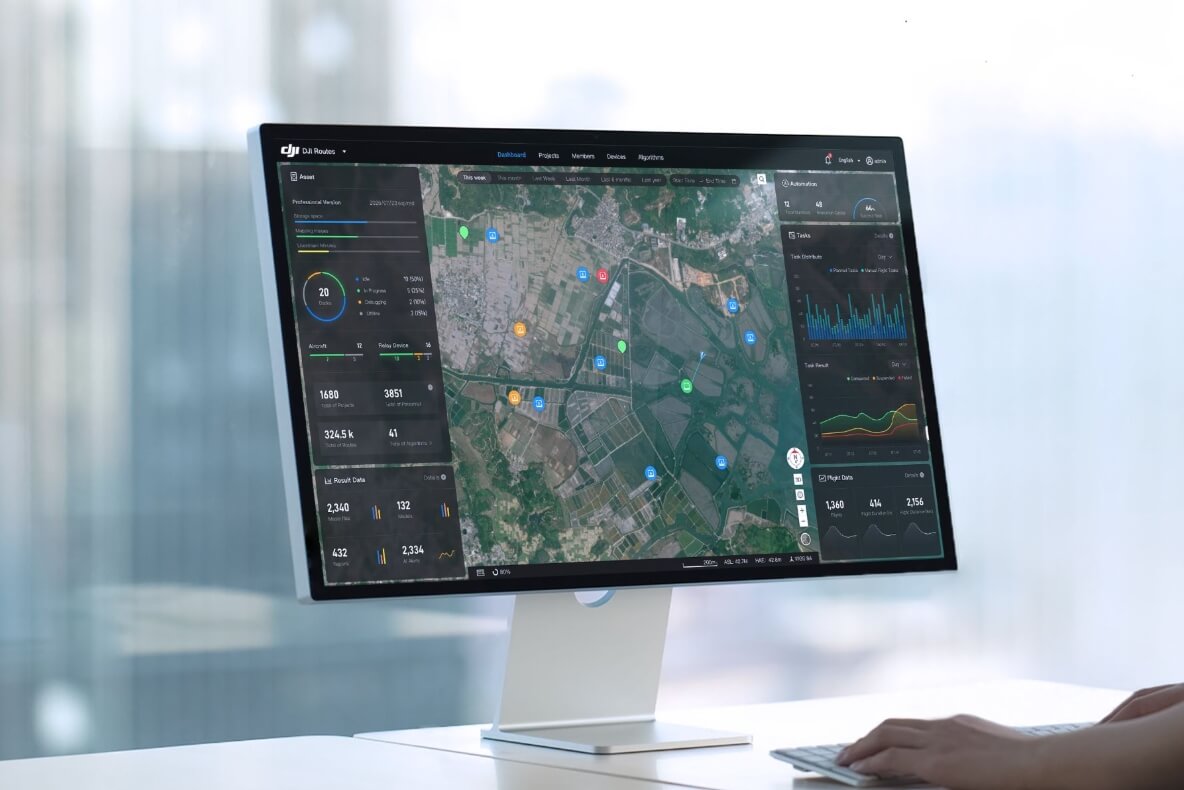
Live Annotations
• Mark objects, draw mission areas, and assign zones directly on the shared interface
• All edits sync instantly across all connected users
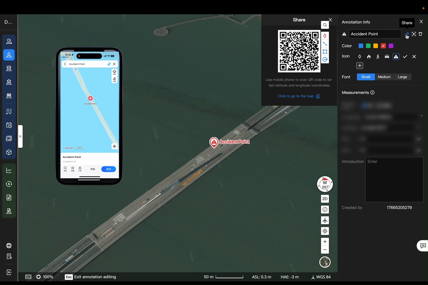
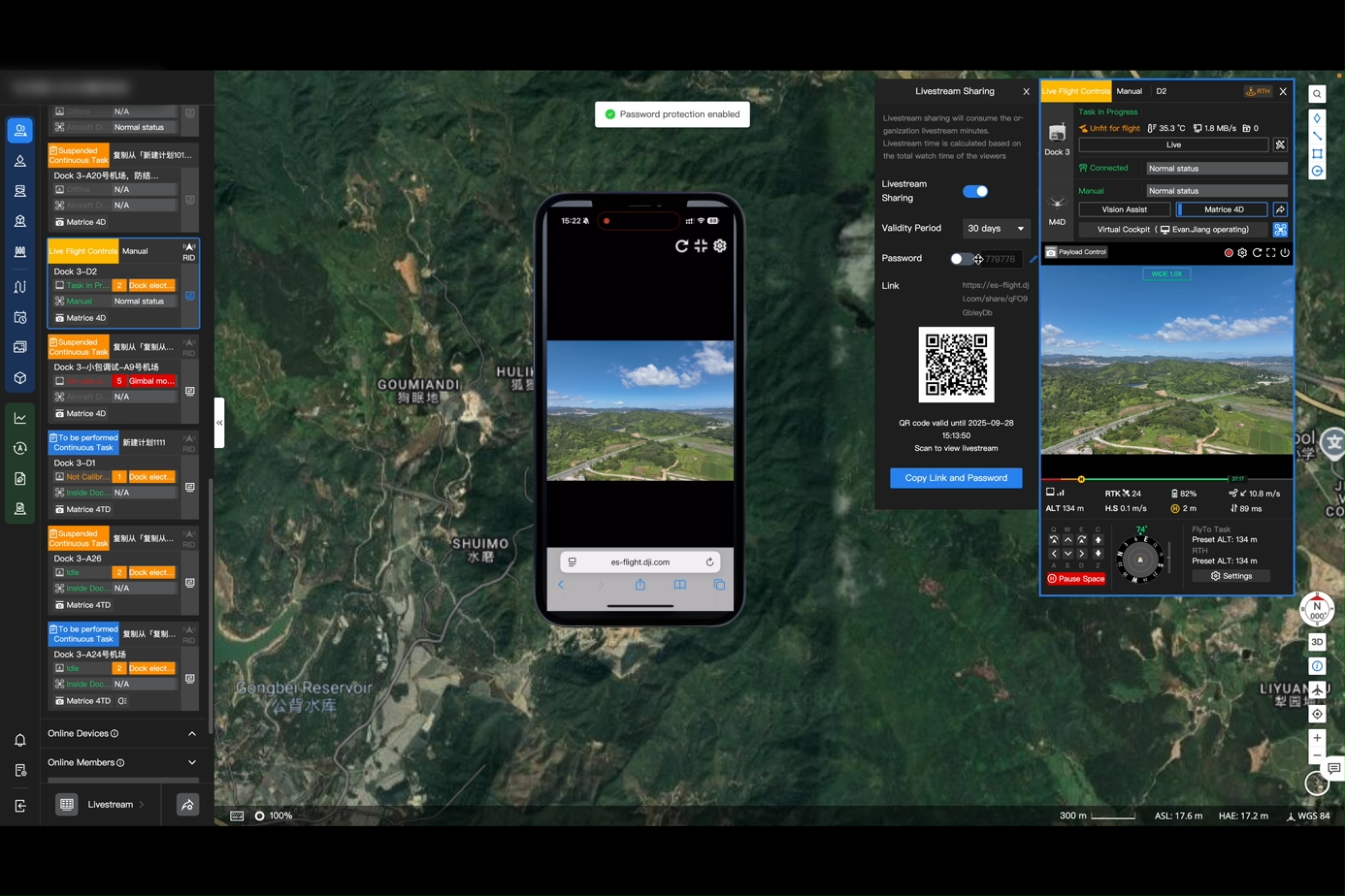
Live Broadcast Sharing
• Generate livestream links instantly, share via QR code for immediate access
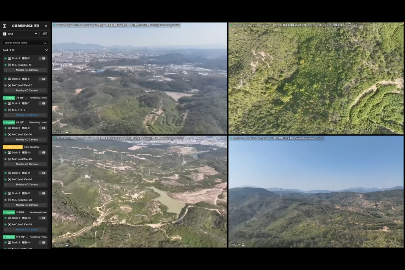
Multi-Channel Streaming
• View multiple drone streams simultaneously
• Flexible layout selection for full situational awareness
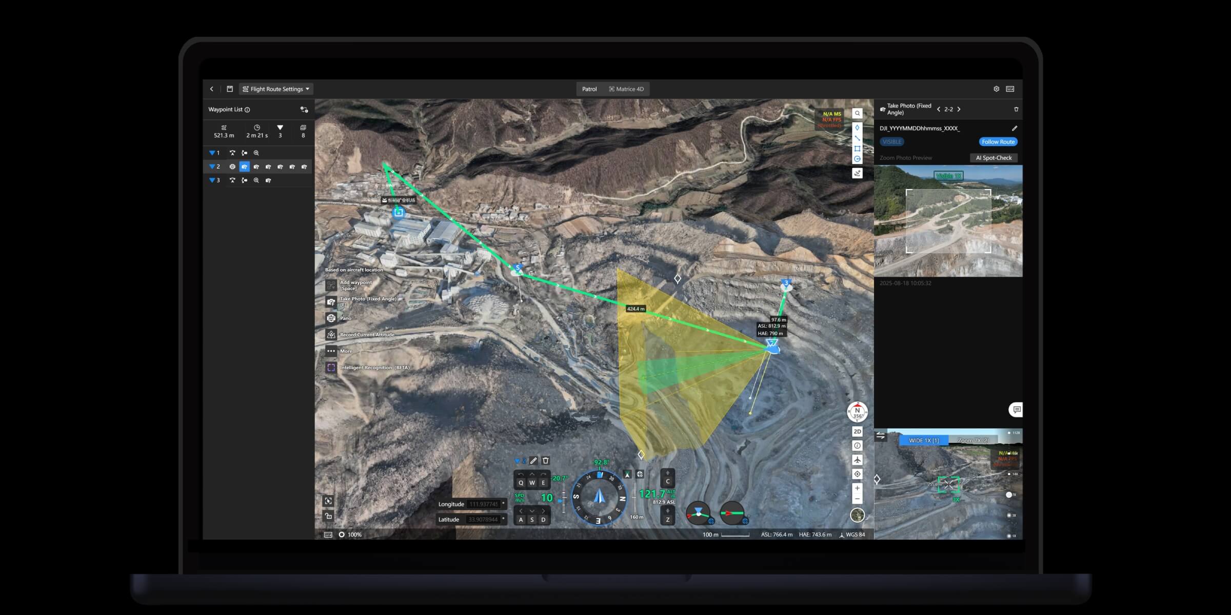
3. Comprehensive Mission Planning
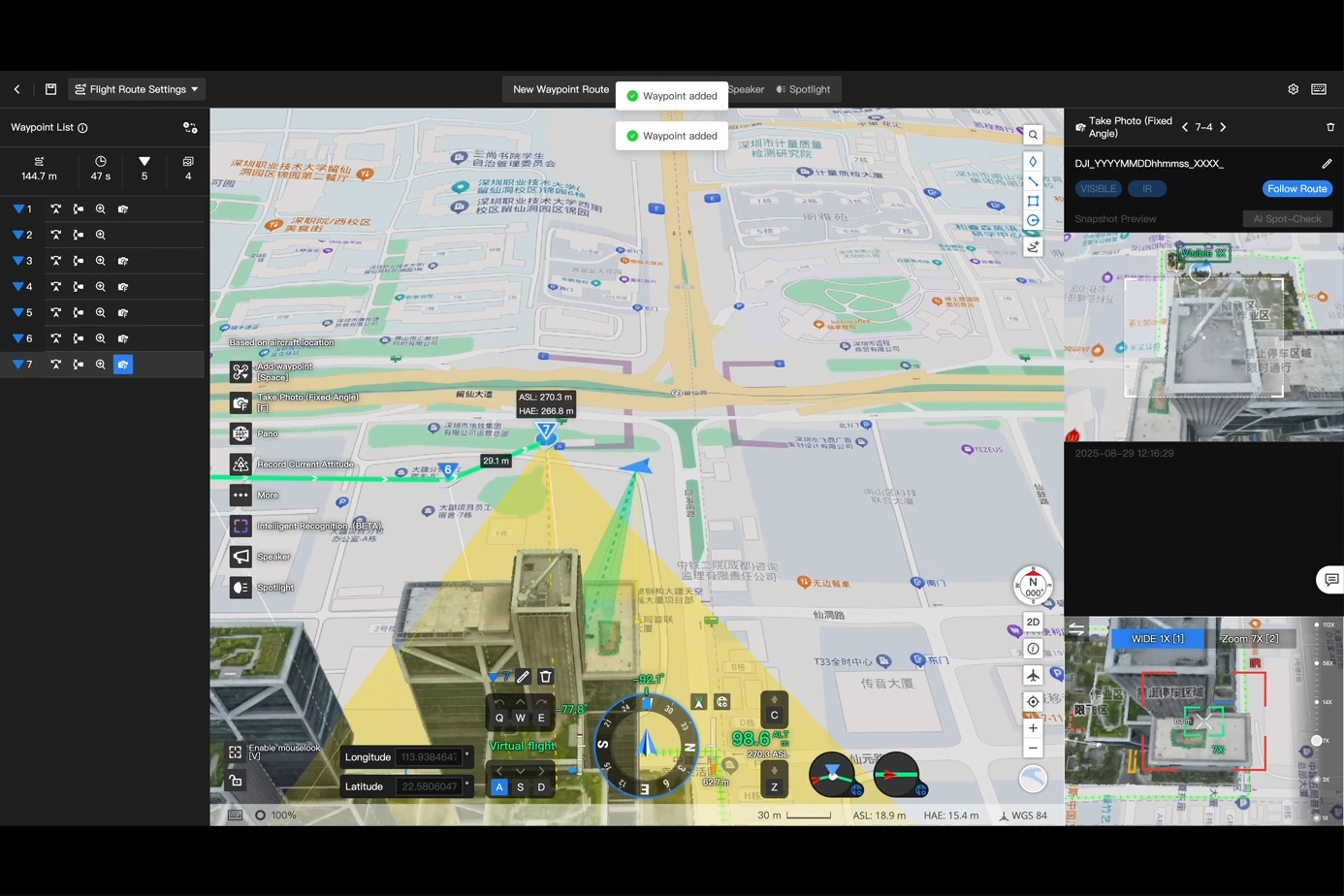
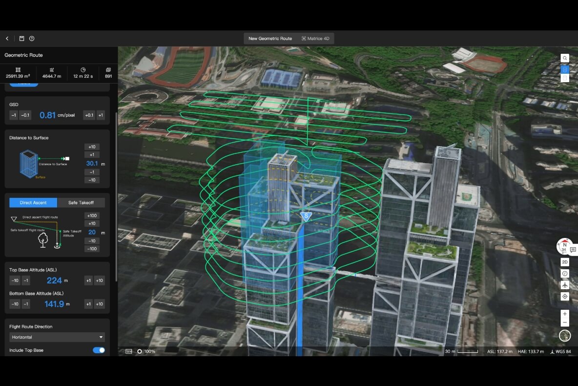
3D Route Editing
• Create waypoint missions directly on 3D models
• Supports object-based inspection points along the route
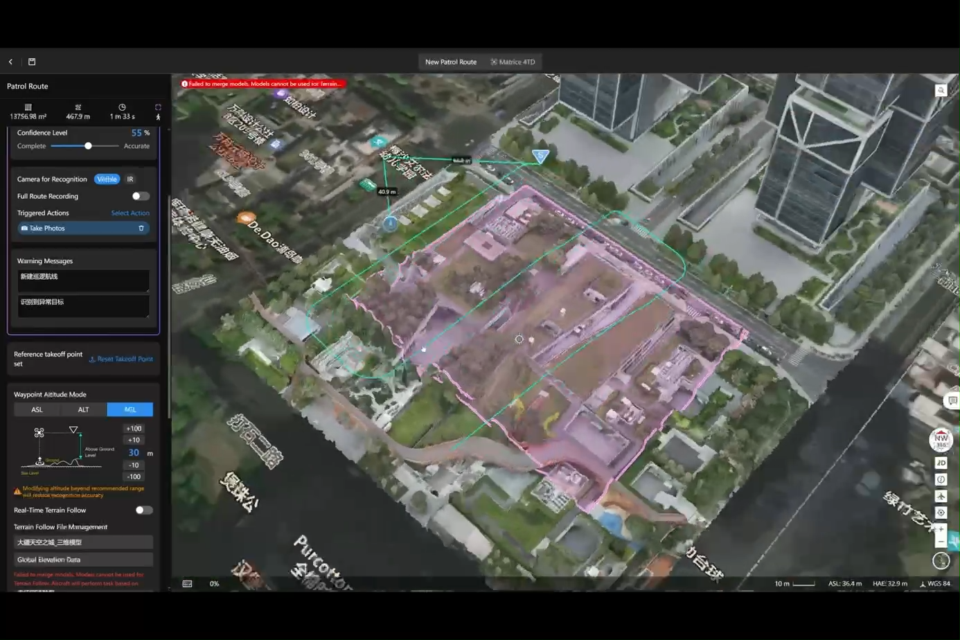
Patrol Missions
• Auto-generate patrol routes based on regions or target objects
• Drones scan, record, and alert when detecting targets
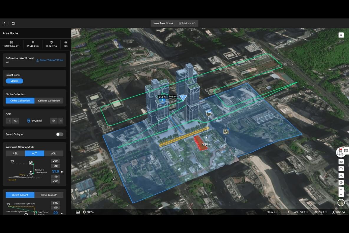
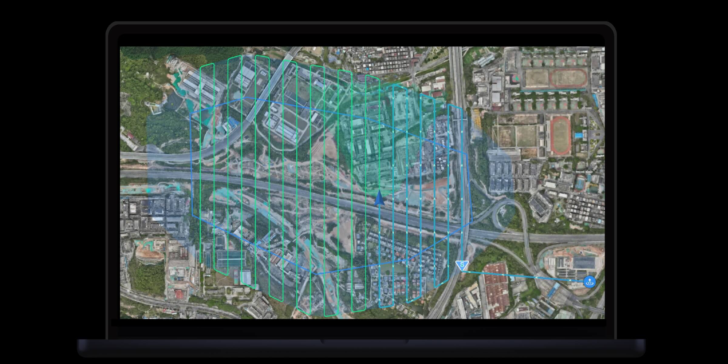
2D/3D Mapping Missions
• Ideal for surveying and large-area mapping
• Adjustable overlap settings, auto no-fly zone avoidance
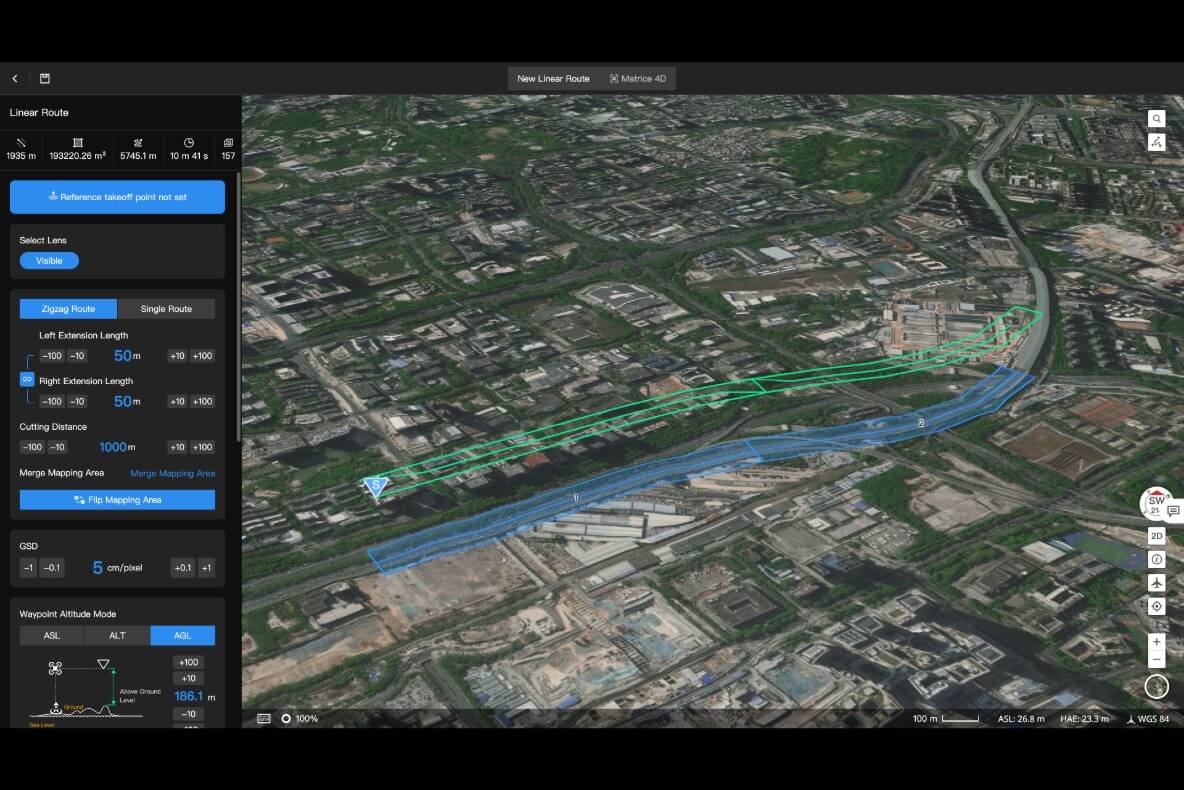
Linear Route Missions (Pipelines, Powerlines, Roads, Rivers...)
• Auto-split long routes into multiple flights
• Perfect for infrastructure inspection
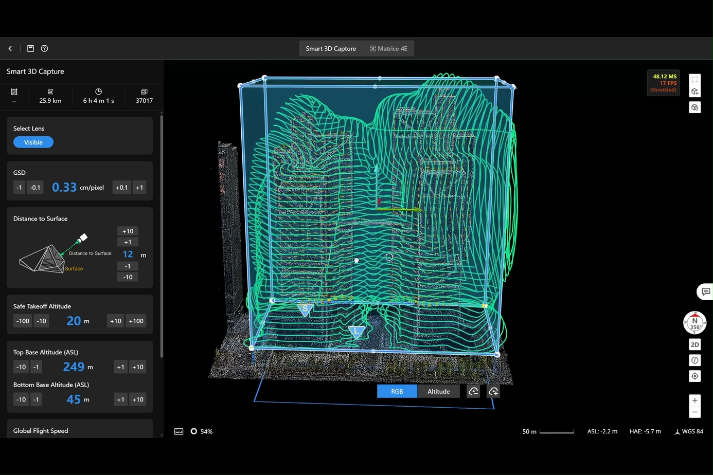
Smart 3D Scanning
• Generates surface-fitted flight paths to capture high-detail 3D datasets
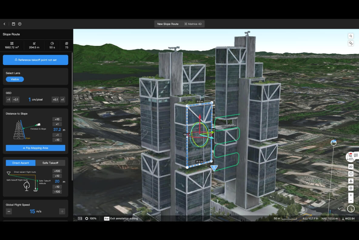
Slope / Single-Side Missions
• For bridges, slopes, retaining walls, cliff faces, and tilted structures
Building Envelope Mission
• Auto-plan routes around buildings in 3D, with visual safety assessment
All mission plans auto-sync to the remote controller — no manual transfer required.
4. Intelligent Algorithms for Precision Inspection
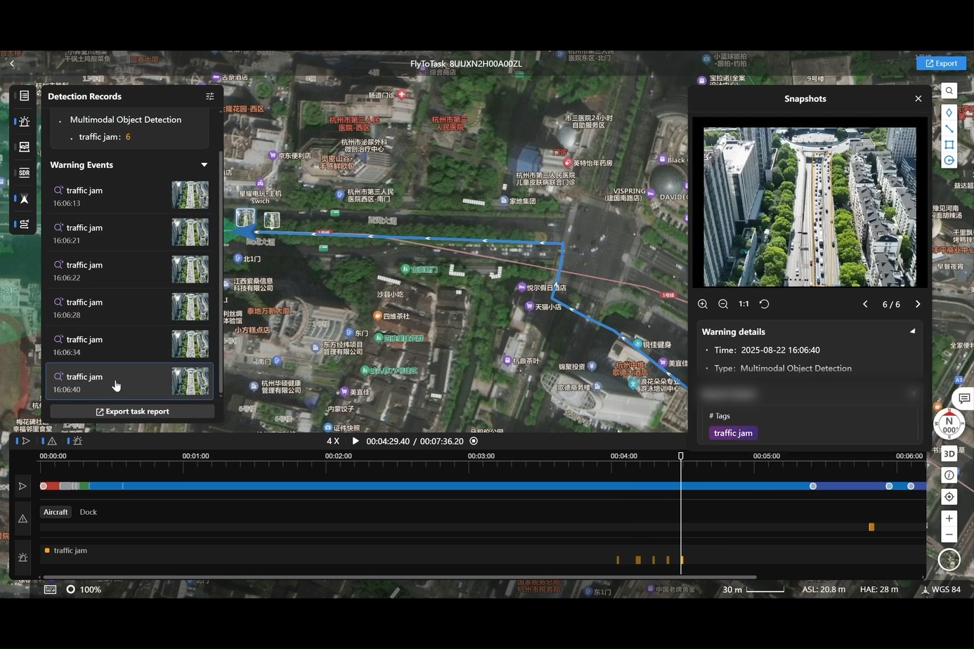
Smart Detection
• AI automatically detects & counts vehicles, vessels, etc.
• Supports integration of third-party AI models
Automated Alerts
• System auto-creates incident alerts with:
– object type
– coordinates
– timestamp
– captured image
• Auto-generated incident reports for traceability
Smart Patrol
• Combines auto route + AI detection → fully automated patrol workflow
• Auto-alert, auto-record, auto-report

5. Multimodal Language Model (LLM)
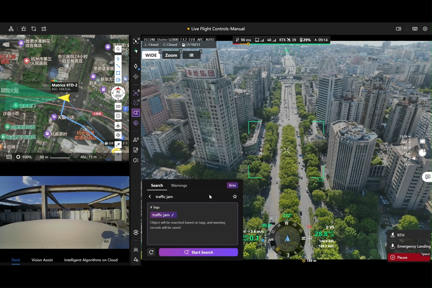
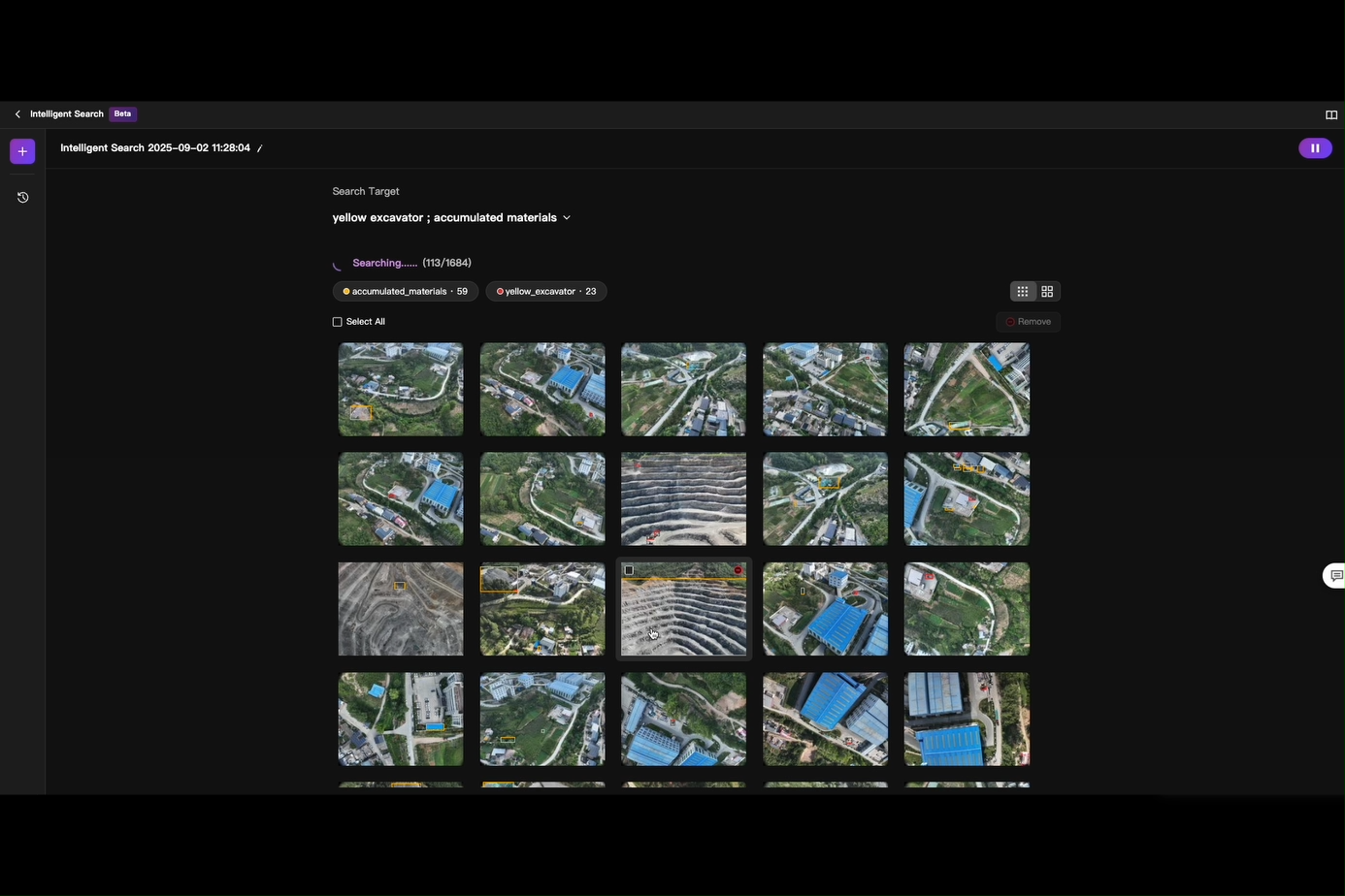
Multimodal Recognition
• Search for targets using text or image prompts
• System understands requests, auto-detects and alerts
Multimodal Image Search
• Input image or keywords → retrieves related drone media from database
• Extremely useful for rapid reporting and investigation
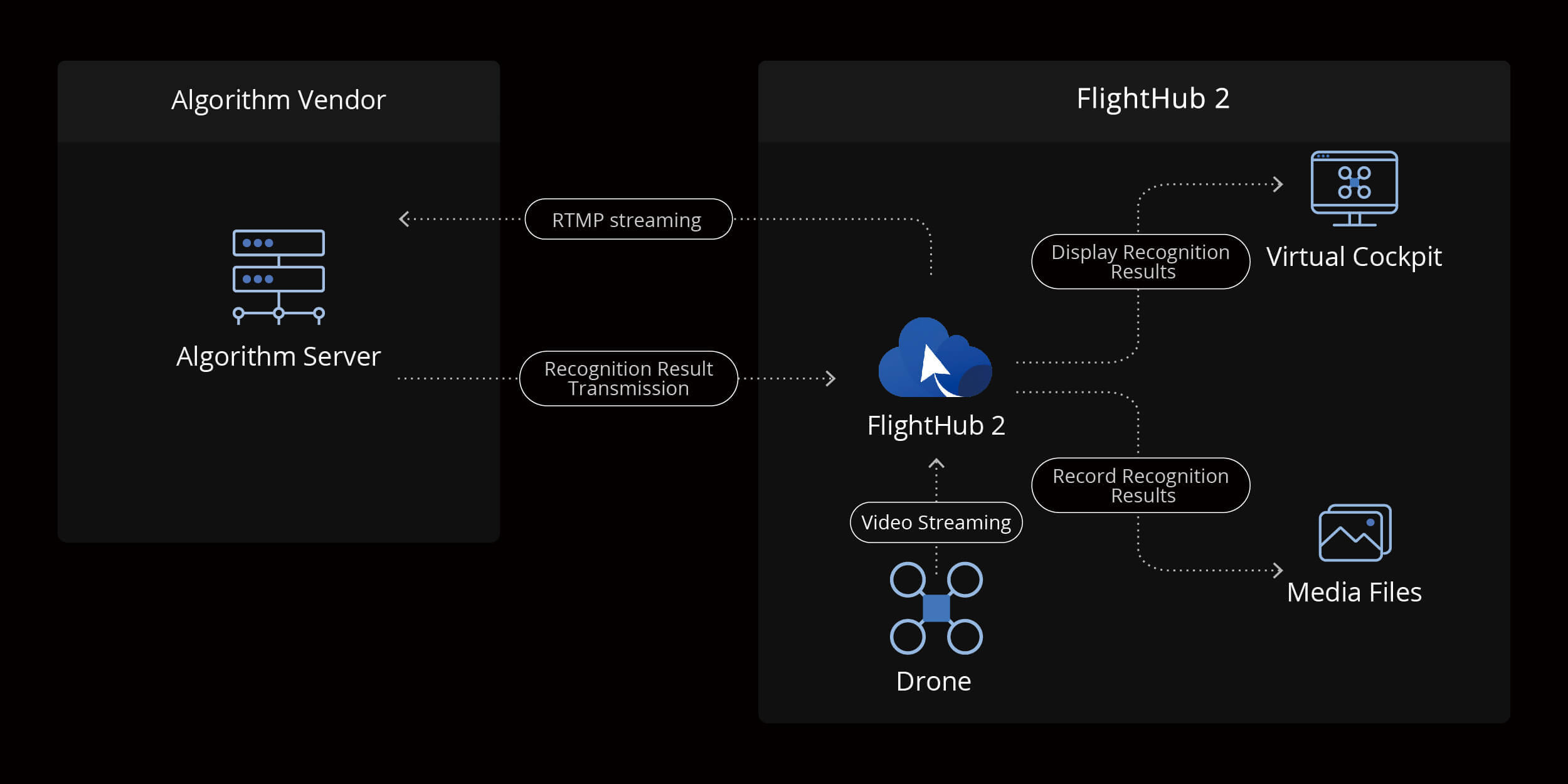
6. Open Algorithms – Smarter Than Ever
On-Drone AI
• Supports custom third-party algorithms on drone compute modules & Manifold 3
• Virtual Cockpit allows switching between built-in and external algorithms
• Expandable detection, analysis, and recognition capabilities
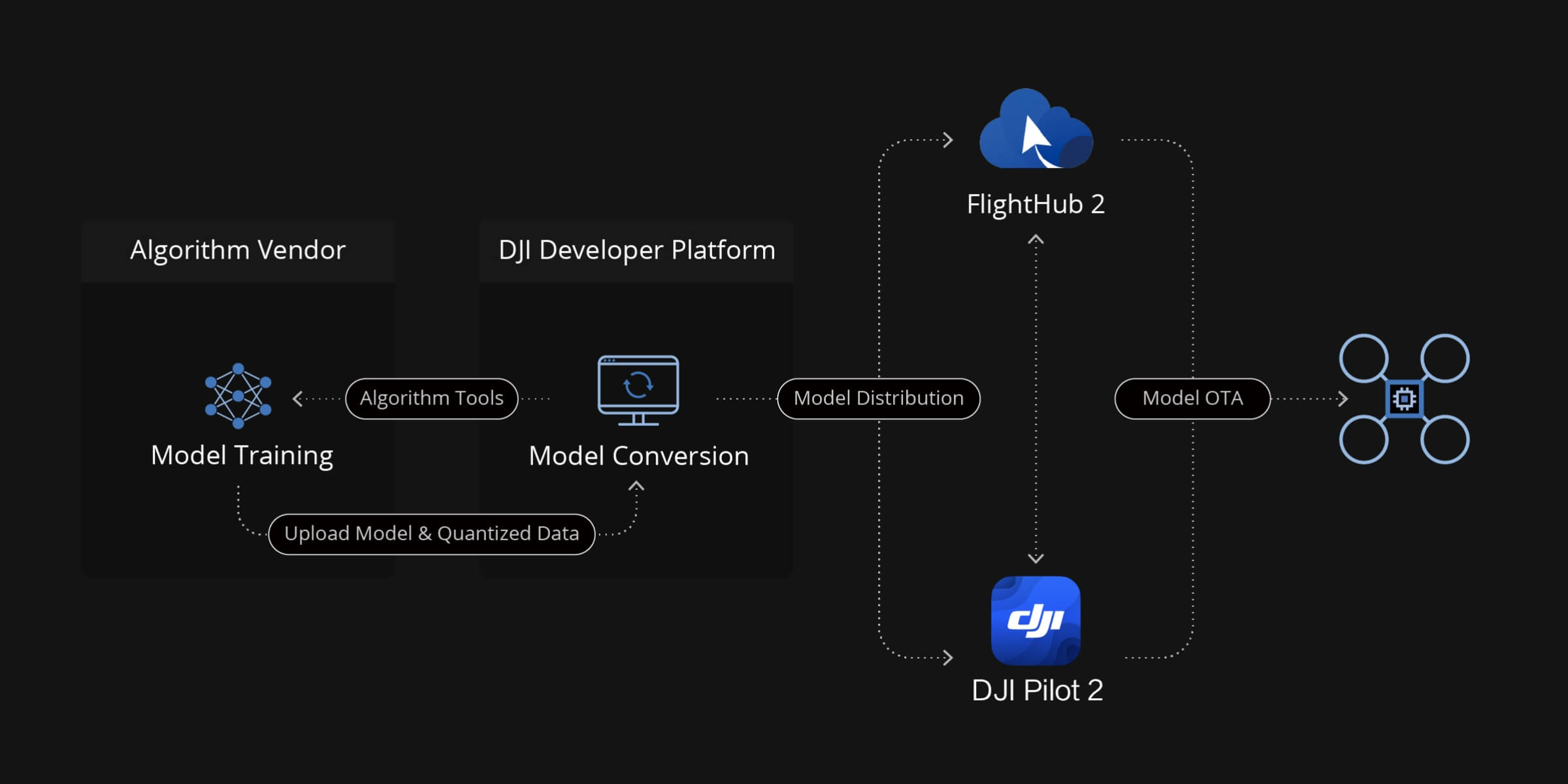
Cloud-Based AI
• Manage, deploy, and activate AI models directly from the cloud
• Virtual Cockpit can call cloud AI models in real time
• Enables high-performance inference without depending on drone hardware
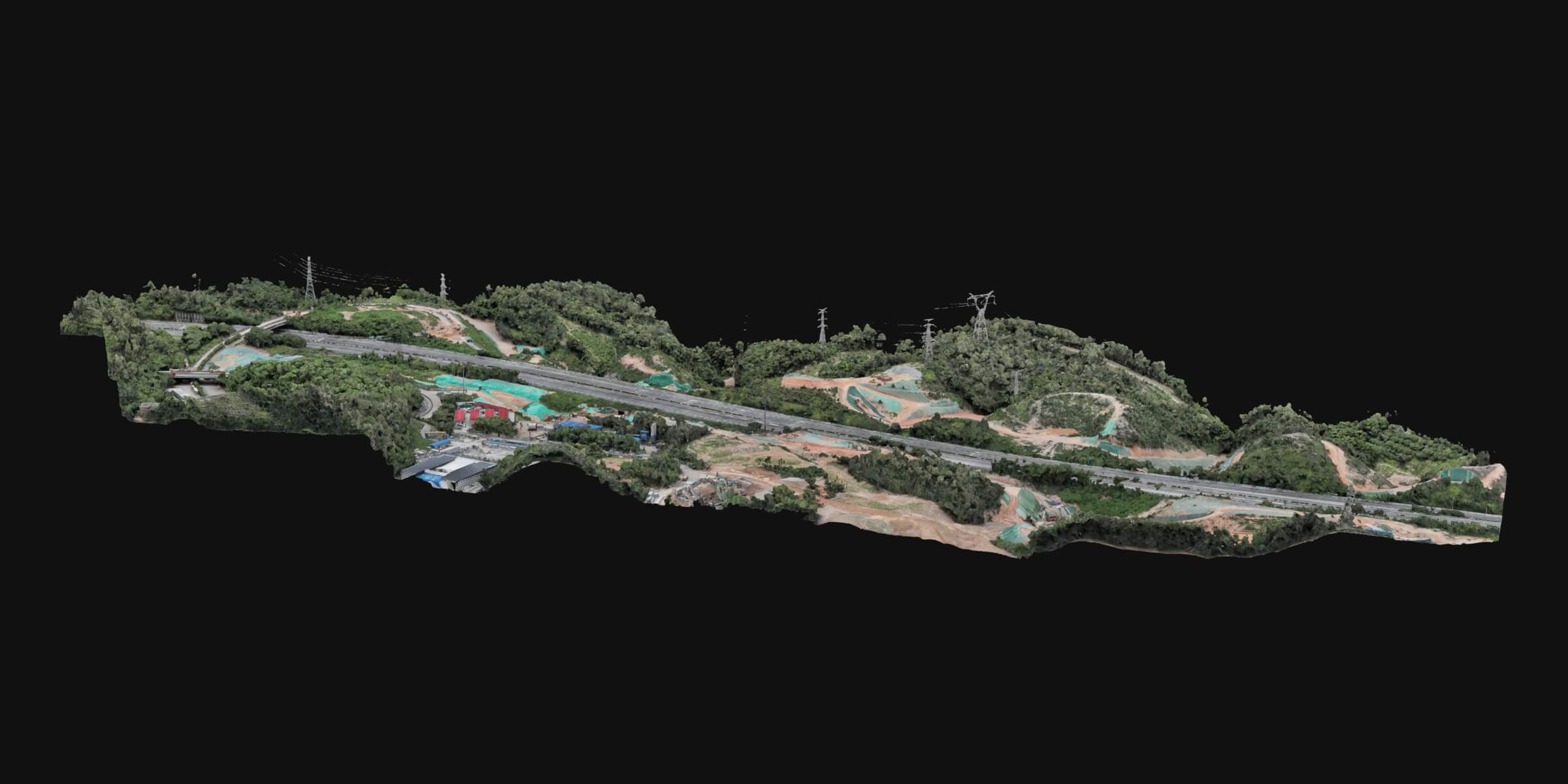
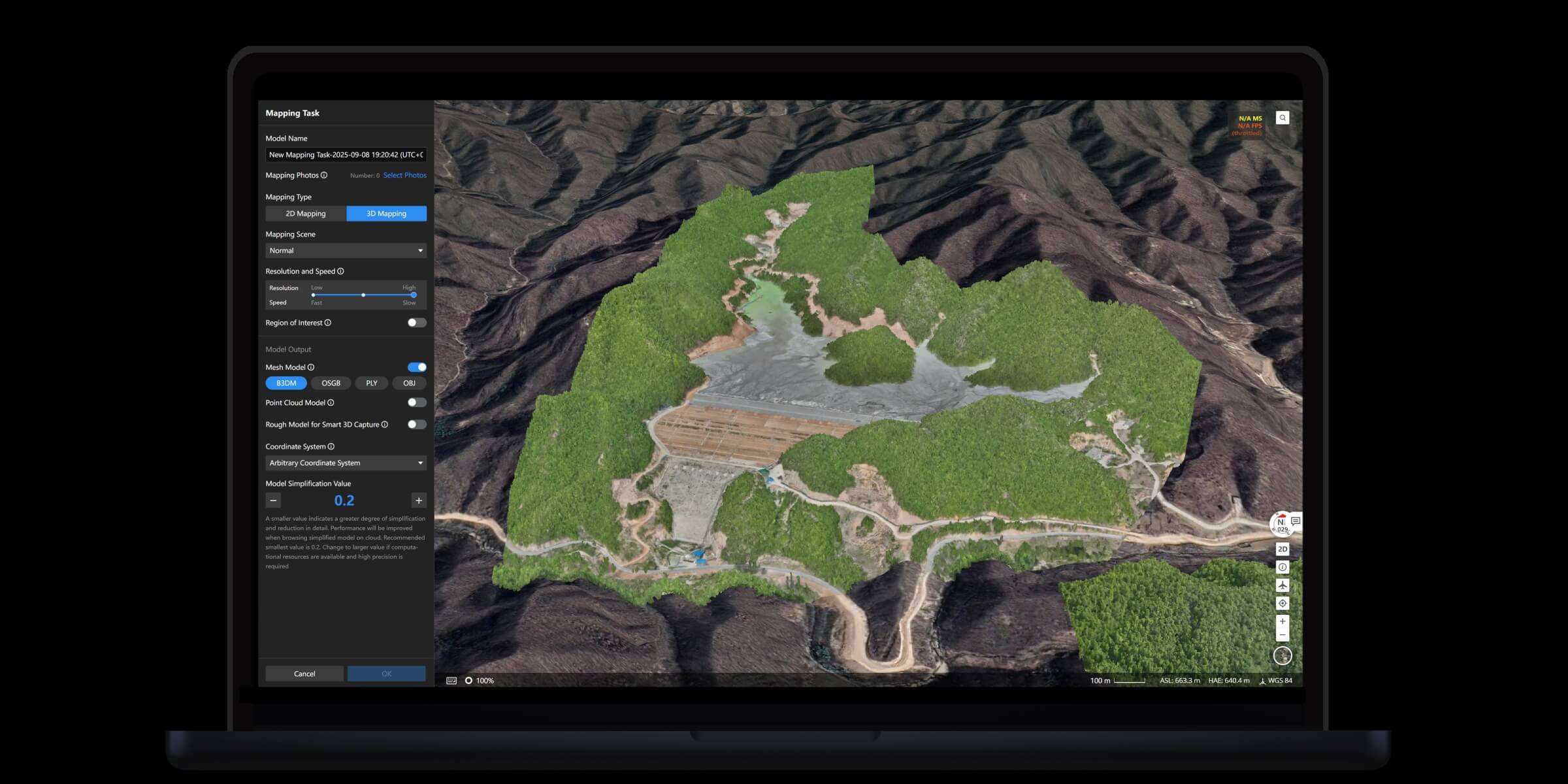
Cloud Modeling
• Auto-generate 2D/3D models and point clouds from flight data
• Supports real-time modeling during flight
• Measurement accuracy: 1:500 mapping standard, export to industry formats
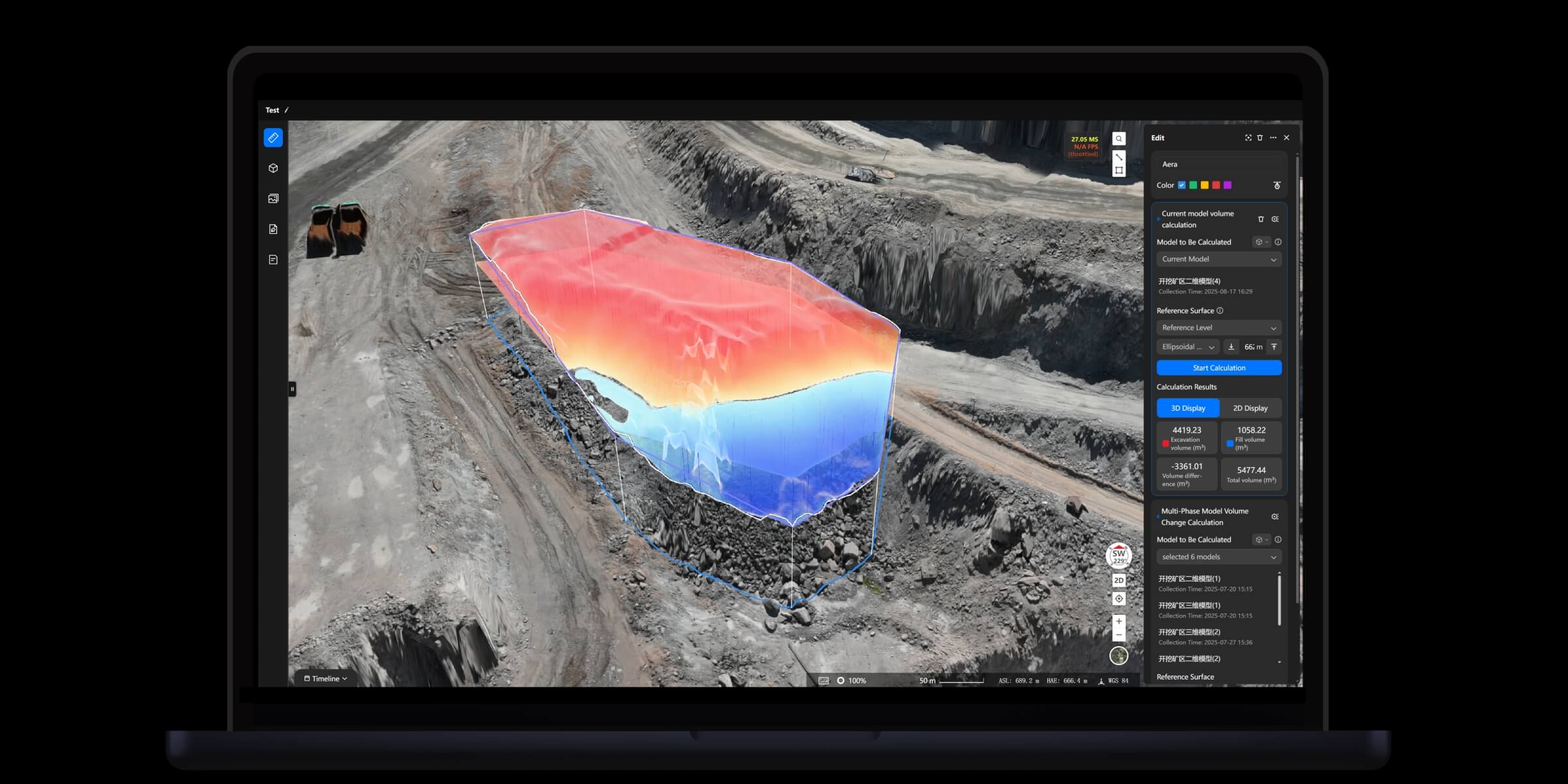
Analyzer Toolset
• Import PDF, DXF design files and align coordinates for comparison
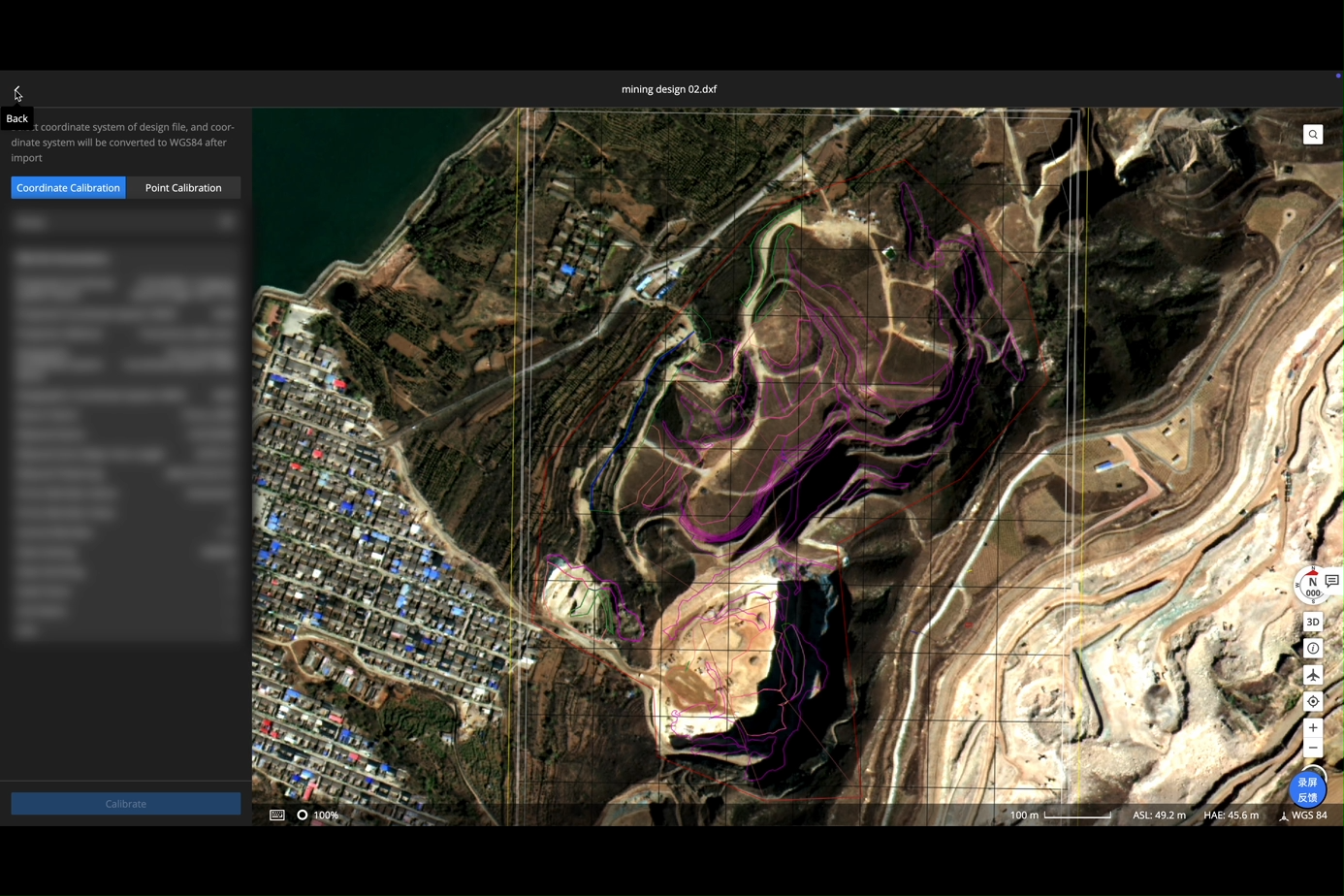
• Timeline-based change analysis
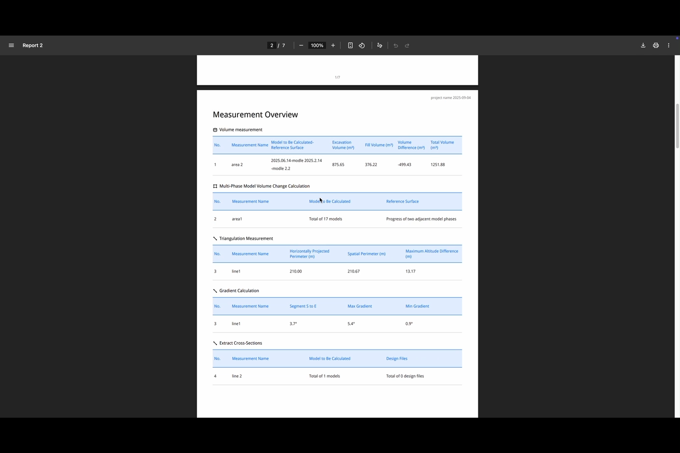
• Built-in measurement tools: distance, elevation, area, volume
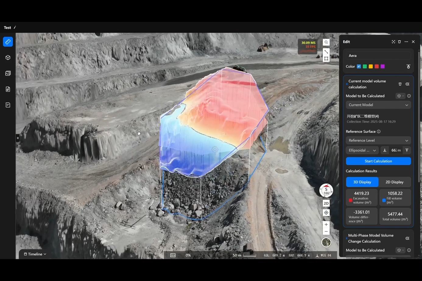
• Auto-generate measurement and progress reports
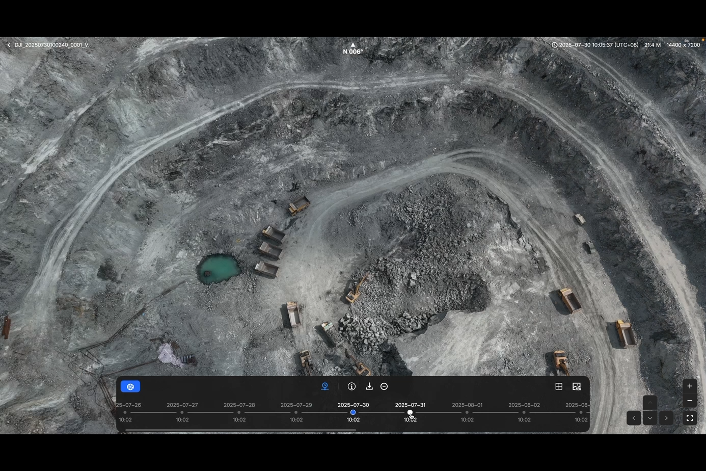
7. Data Application
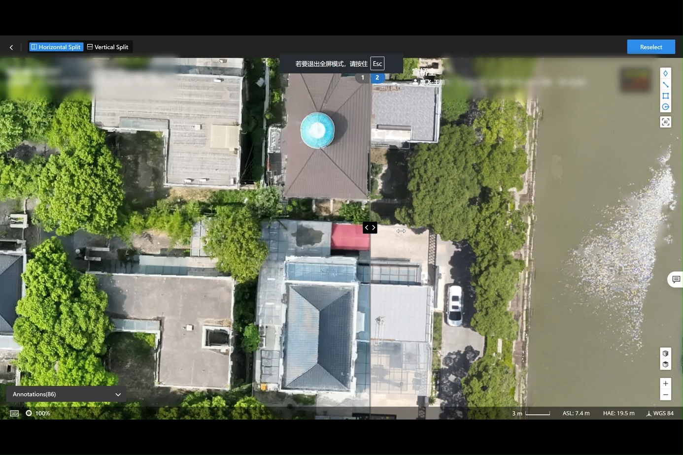
Result Comparison
• Side-by-side comparison of photos, videos, or 2D maps
• Annotations sync directly to the map layer
• Helps teams analyze differences across inspections
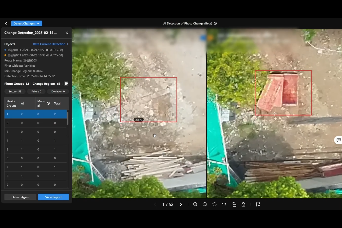
Change Detection
• Auto-detect changes between two top-down images or orthomosaics
• Generates detection reports with change-area statistics
• Ideal for structural monitoring, terrain shifts, infrastructure security
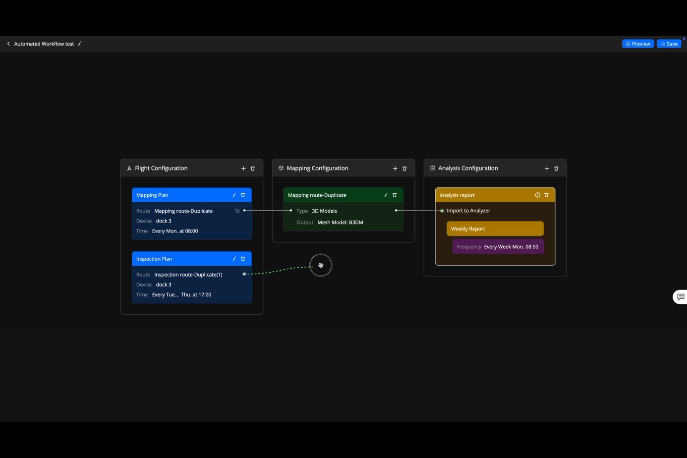
8. Seamless Automated Workflows
Flight Route Planning
• Multiple planning modes for complex terrains and diverse mission needs
Flight Scheduling
• Automated recurring missions by task type
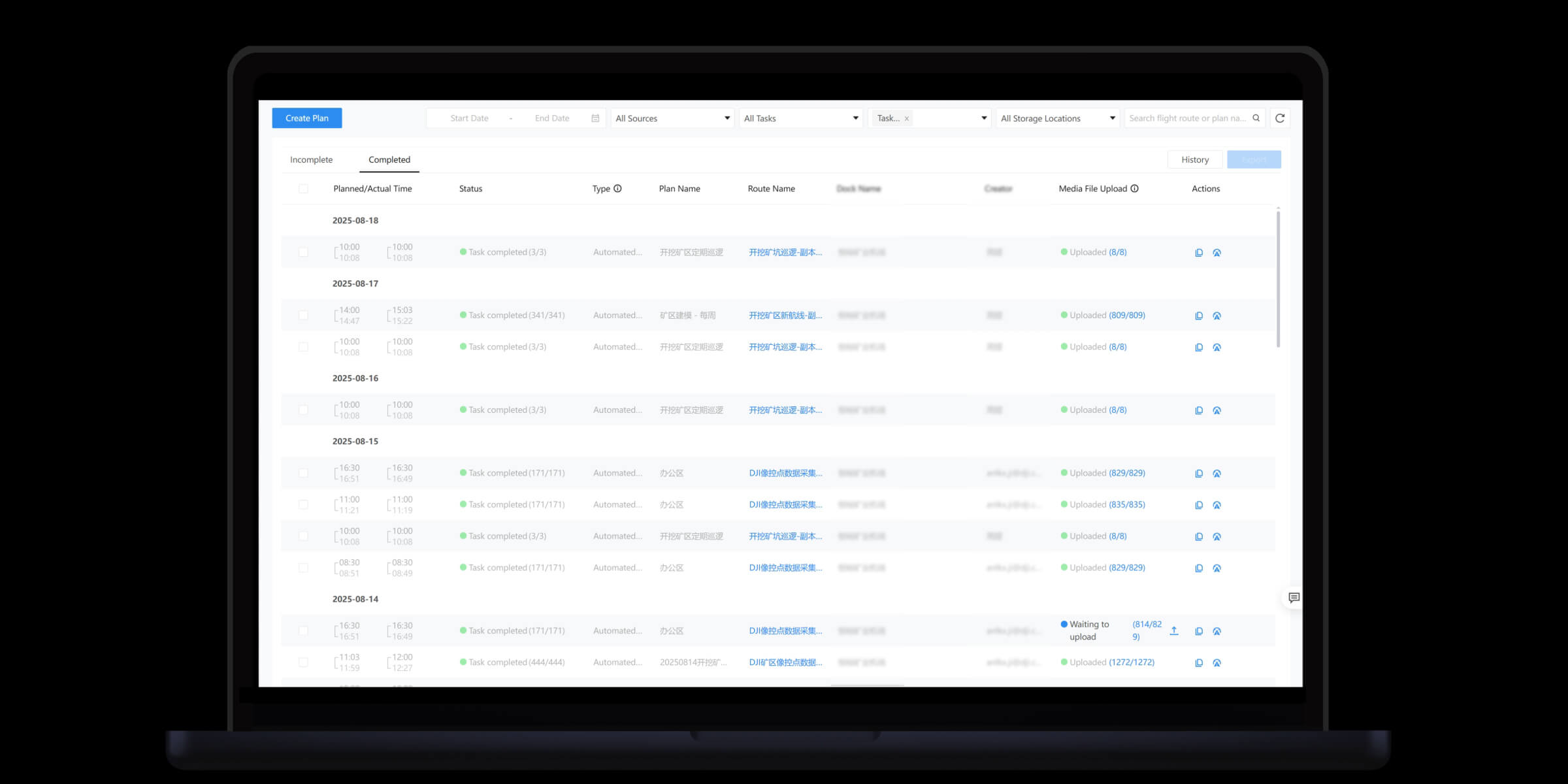
Task Execution
• Drones fly automatically, capturing consistent, high-accuracy data
Cloud Modeling
• Survey results auto-uploaded to cloud for fast 2D/3D modeling
Data Analysis
• Data auto-synced to Analyzer tool for assessment & decision-making
Drag-and-Drop Workflow Builder
• Full pipeline automation: collect → model → analyze → report
• Enables fully scheduled, periodic, unattended operations
9. Operational Safety & Compliance
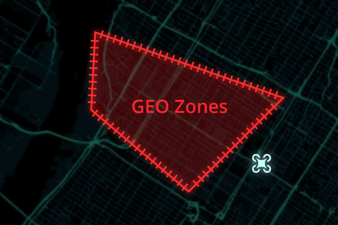
Custom GEO Zone
• Define mission areas, no-fly zones, no-landing zones, and obstacles
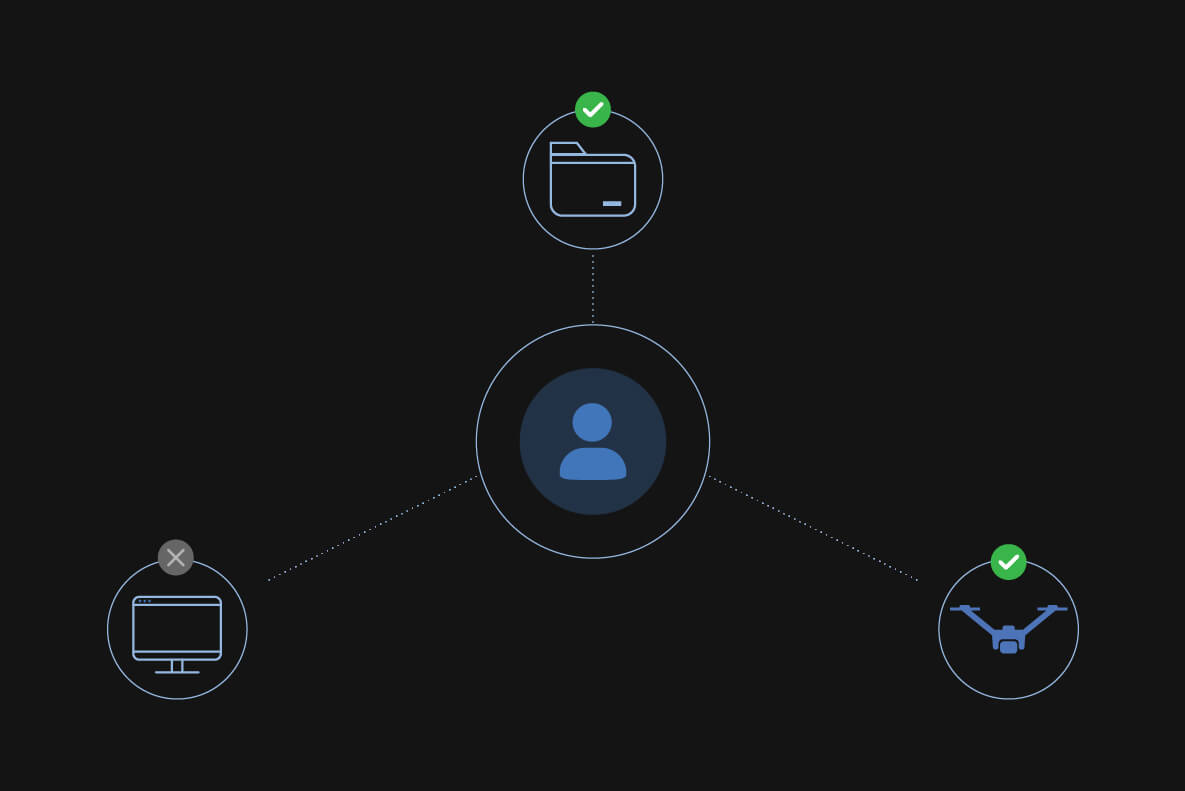
Role-Based Project Permissions
• Custom access control for secure and orderly task management
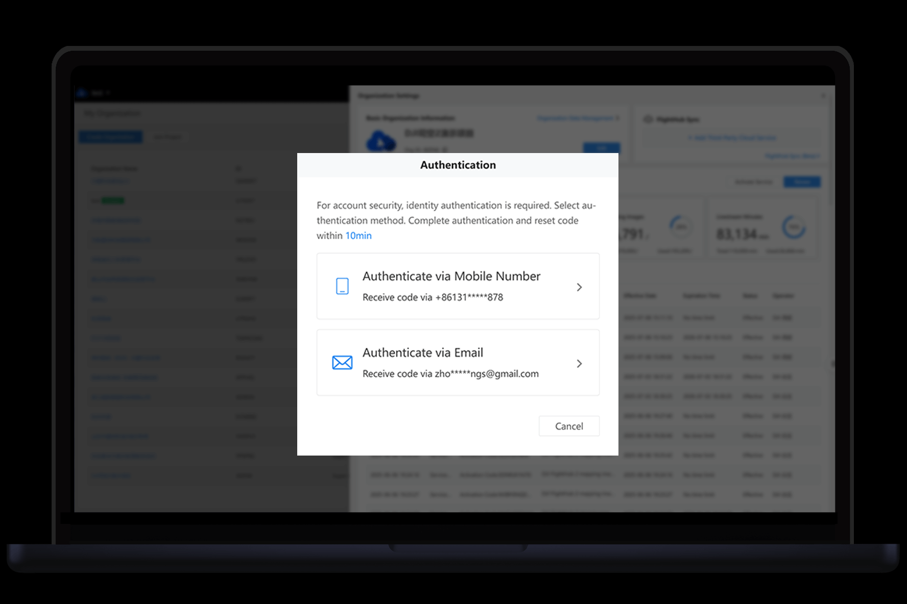
Secure Login Authentication
• Supports SSO & MFA
• Blocks unauthorized access and protects system data
ADS-B
• Receives nearby manned aircraft signals, warns of airspace conflict
• Enhances low-altitude flight safety

Localized Compliance
• Activates geofencing, backup control links, remote ID per regional laws
10. Remote Operations & Maintenance
Flight Records
• Logs all manual and remote flights with drone status and operator actions
• One-click export of summary and detailed logs
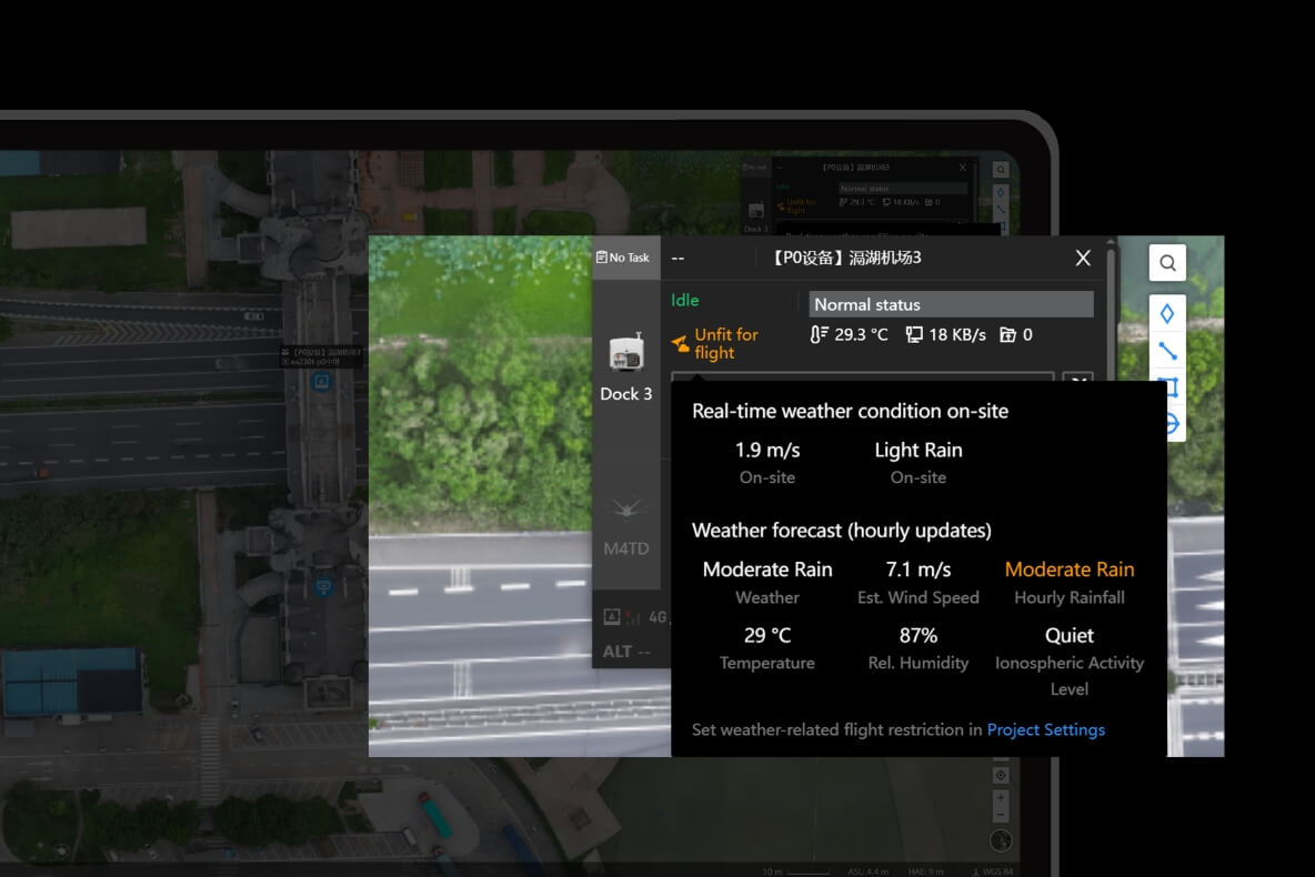
Alerts
• Auto-alerts for abnormal weather, strong winds, device risks, etc.
• Prevents mission failure and equipment damage
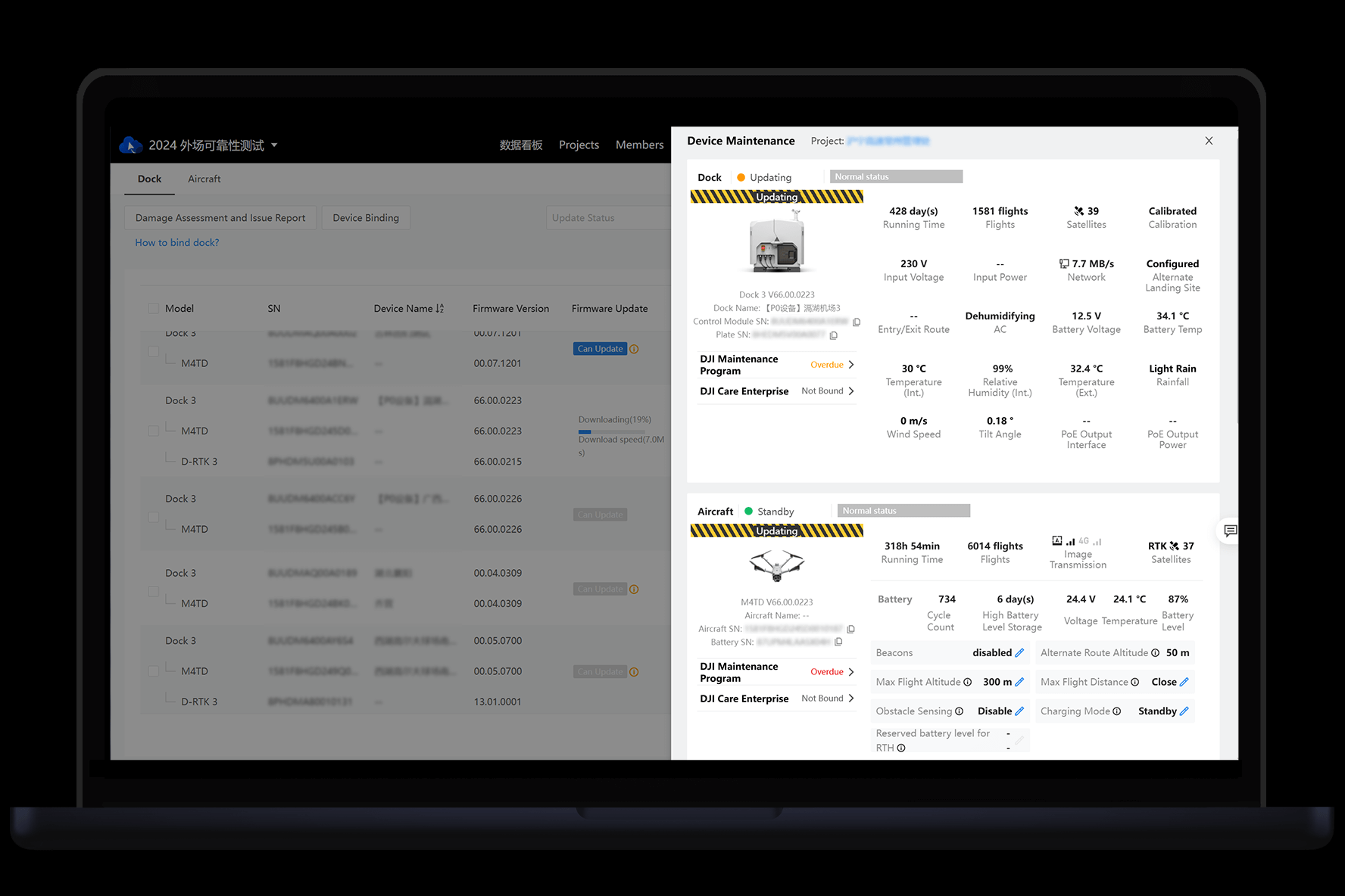
Remote Maintenance
• Check DJI Dock and drone status remotely
• Adjust settings without onsite presence → saves travel cost
11. Secure & Flexible Integration
OpenAPI
• RESTful API for direct access to core platform functions
• Easy integration with enterprise software systems
• Reduces development cost, supports custom workflows
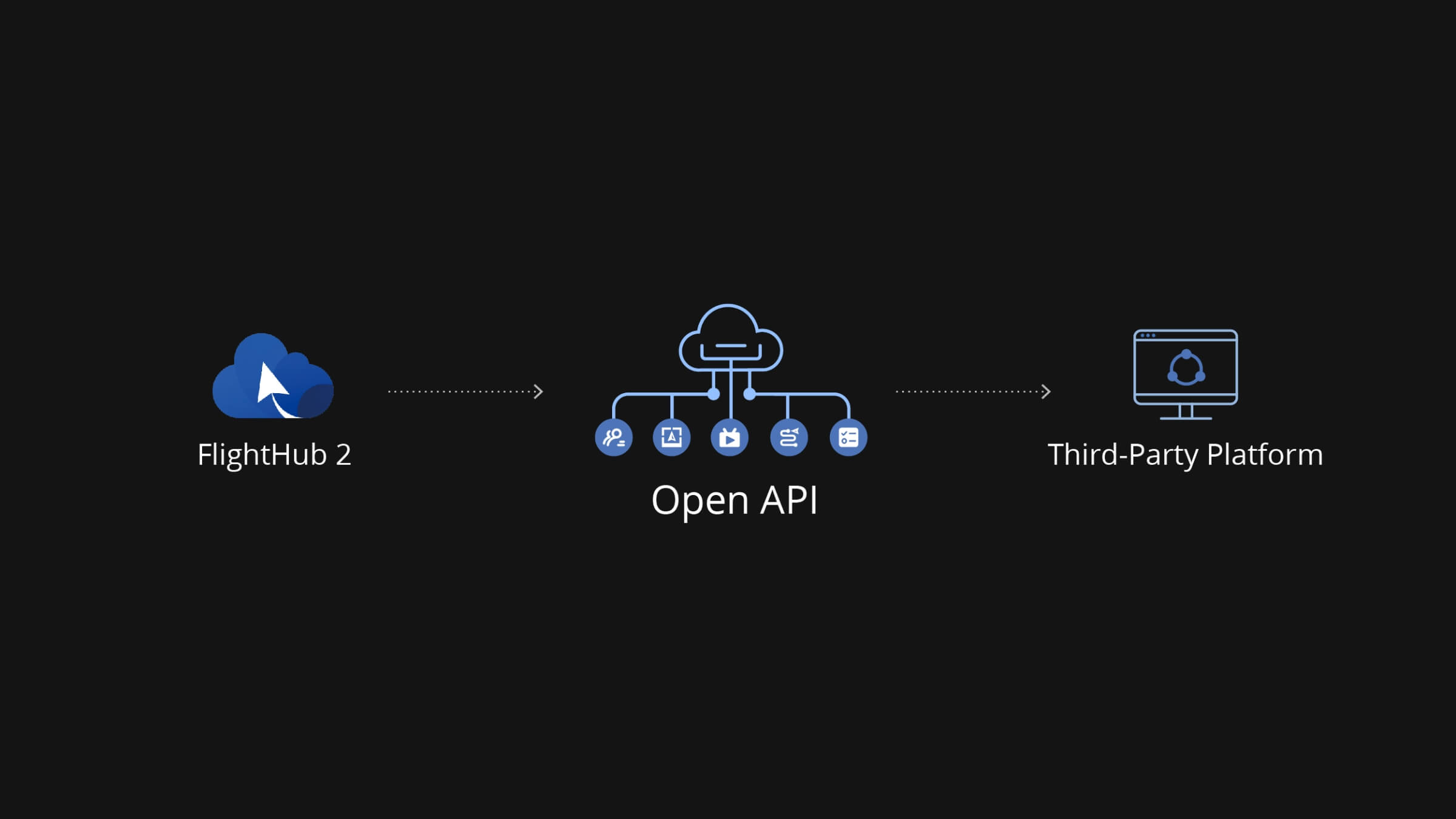
* OpenAPI capability varies between Cloud and On-Premises versions.
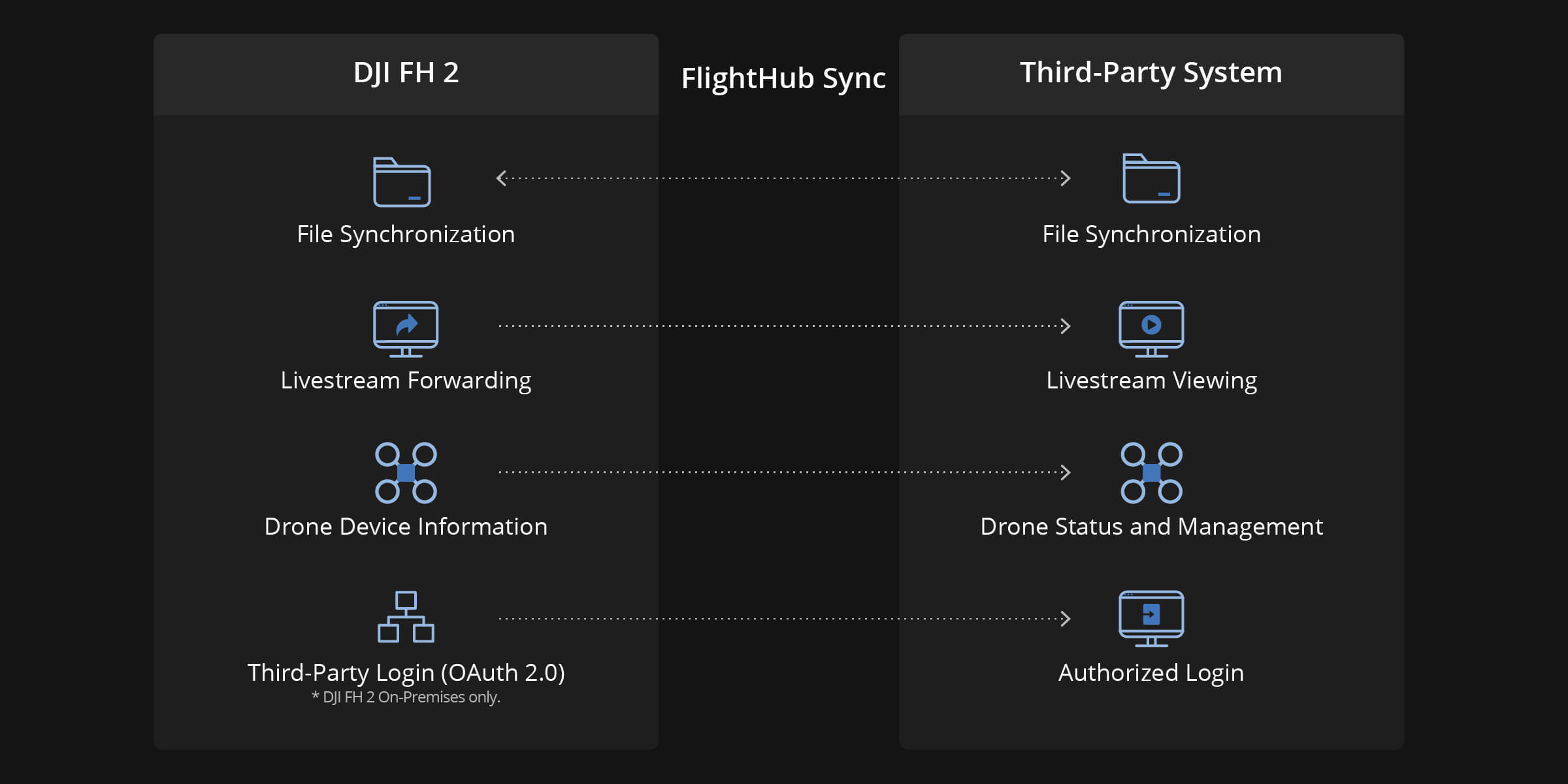
FlightHub Sync
• No-code integration via visual configuration
• Sync media, livestream, and mission data to internal systems
DJI FlightHub 2 On-Premises
• Private deployment and All-In-One option for organizations requiring full data control

12. Data Security
| DJI FlightHub 2 (Cloud) | DJI FlightHub 2 On-Premises | |
|---|---|---|
| Data Storage | Alibaba Cloud (China) / AWS (US & EU) | Fully local, no Internet dependency |
| Security Certifications | ISO/IEC 27001, ISO 27701 | ISO/IEC 27001, ISO 27701 (system level) |
| Protection Level | Global-standard cloud security | Completely isolated intranet |
| Privacy Control | Compliant with international data & privacy laws | 100% self-managed by enterprise |
13. Supported Devices
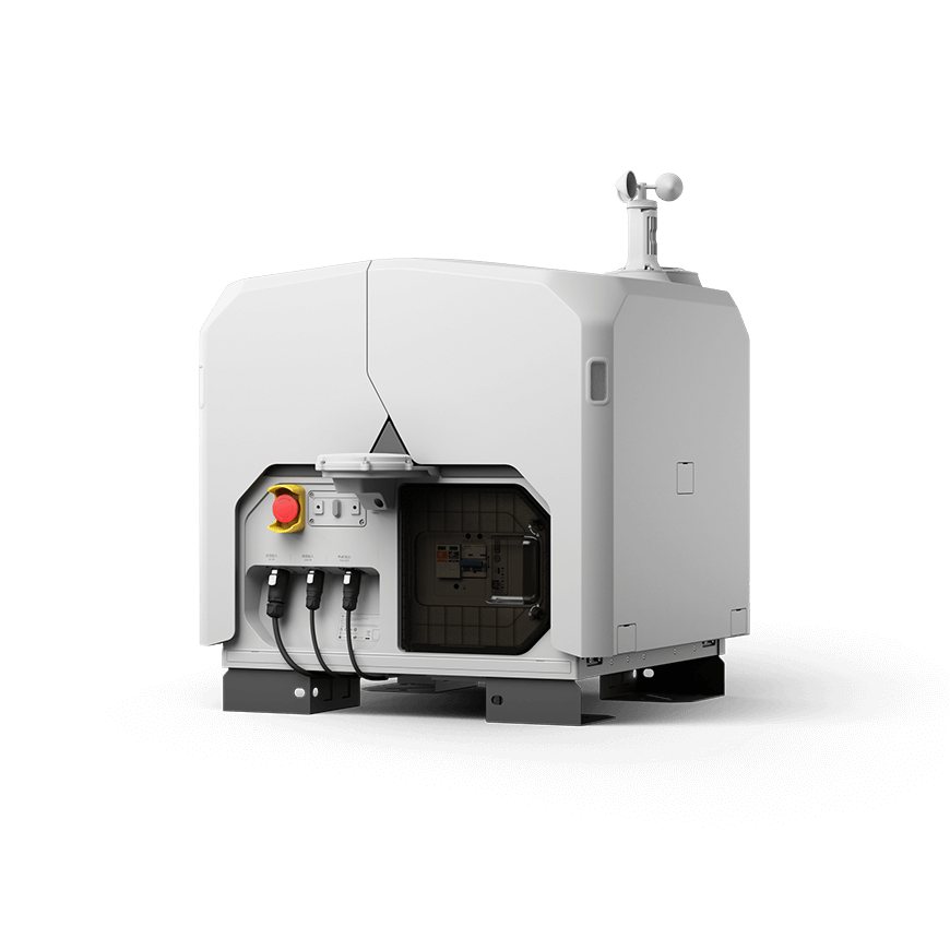
DJI Dock 2
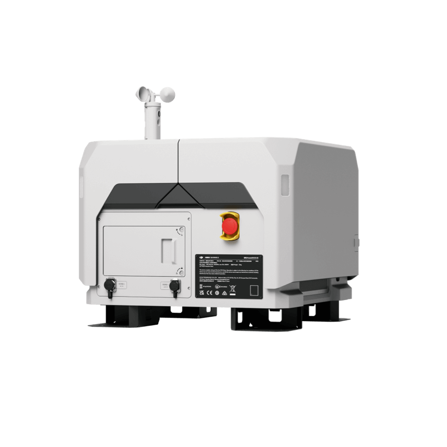
DJI Dock 3
DJI Matrice 400
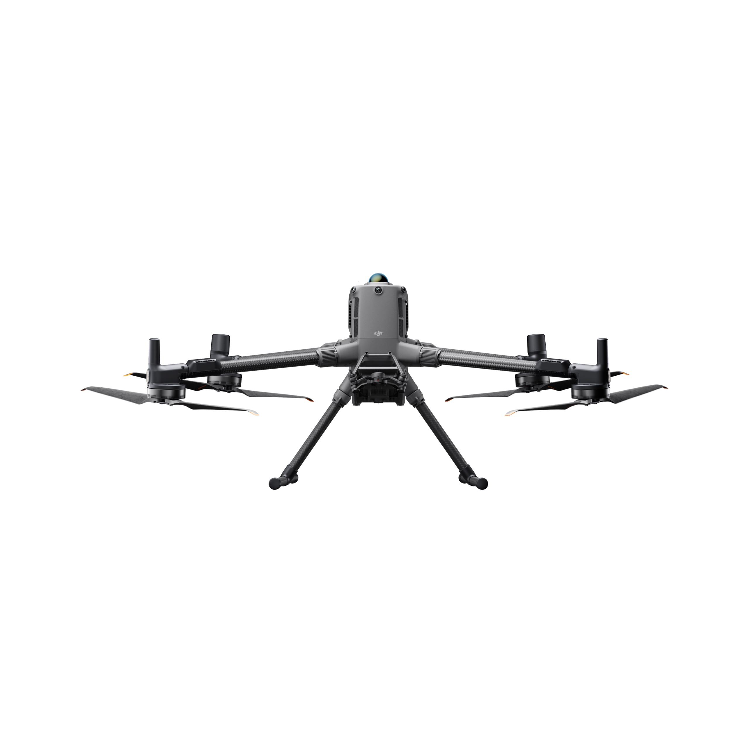
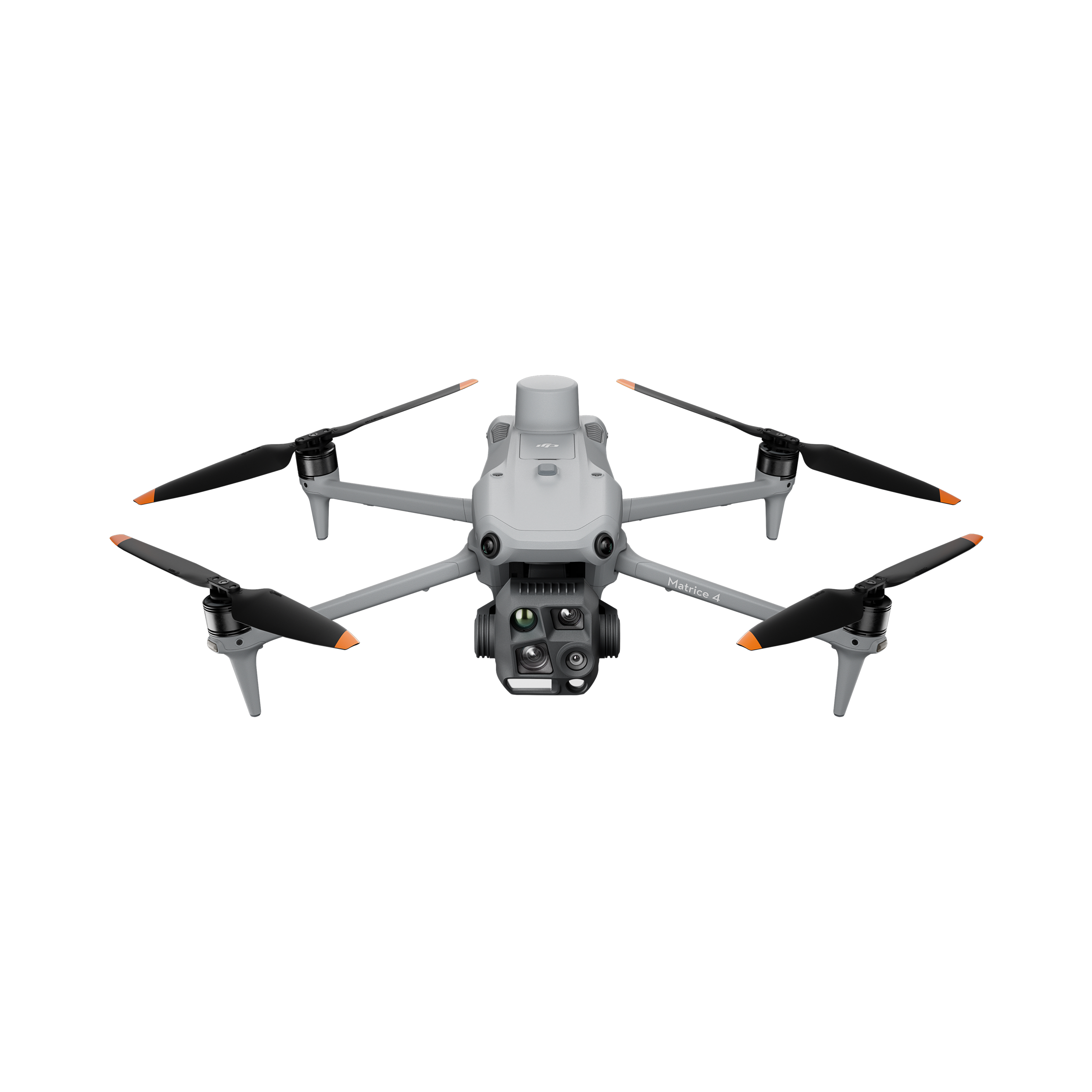
DJI Matrice 4 Series
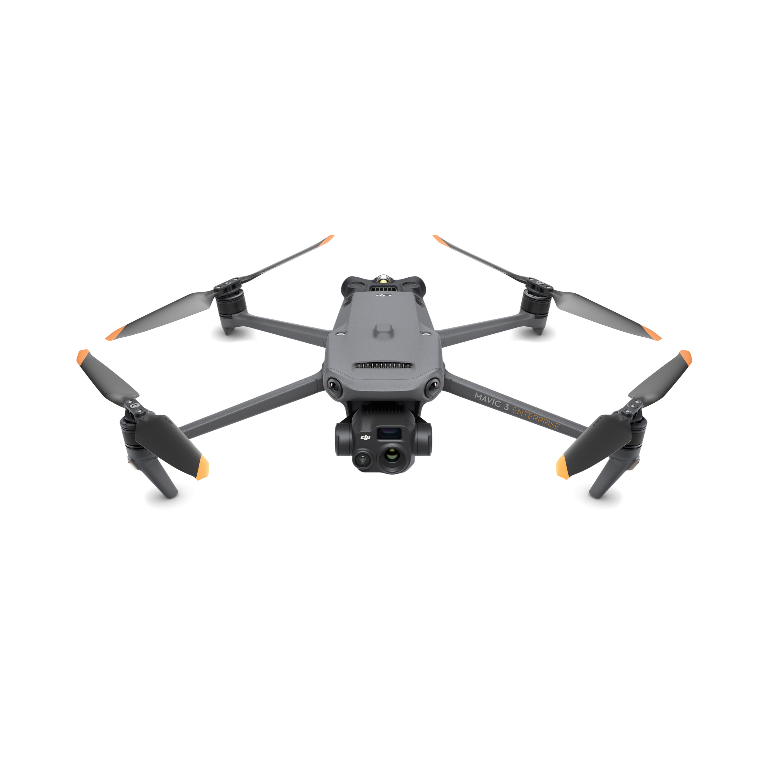
DJI Mavic 3 Enterprise Series
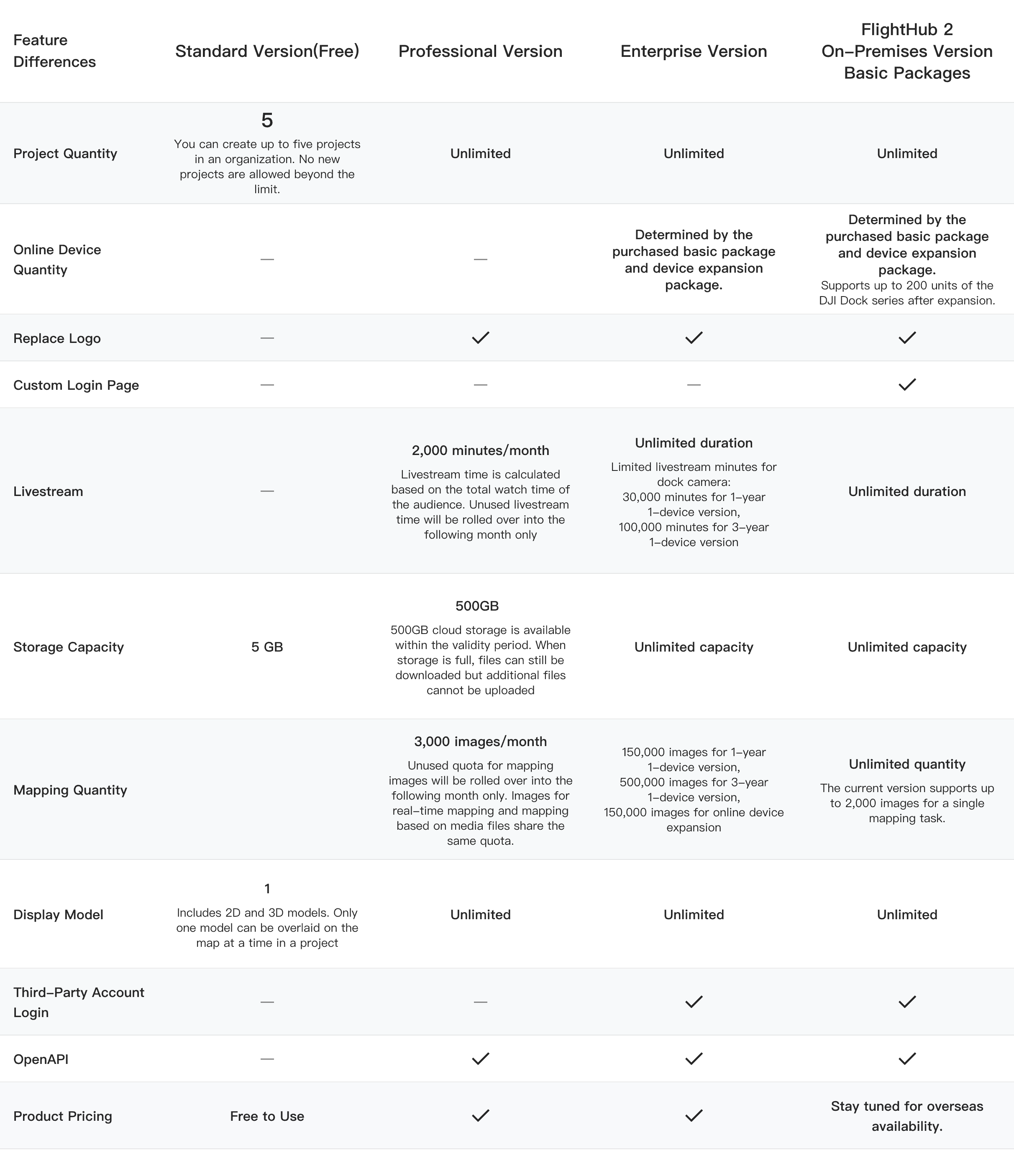
Compare differences between plans