
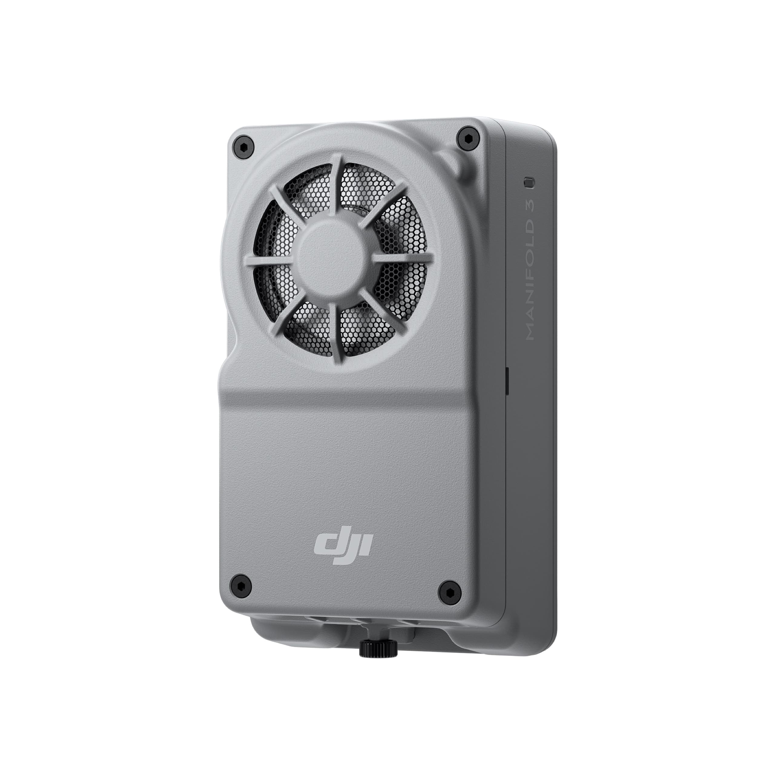
DJI Manifold 3
Manifold 3 delivers exceptional computing power of up to 100 TOPS in a lightweight 120 g design. When integrated with the Matrice 400 and Matrice 4 Series, it provides powerful processing for flight, gimbal, and camera systems, enhancing efficiency across sectors such as energy inspection, public safety, and infrastructure monitoring. With its developer-friendly environment, Manifold 3 empowers creators to build high-performance AI and automation applications for diverse real-world scenarios.
Manifold 3 – High-Performance Computing Power in the Sky
Igniting a New Era of Aerial Intelligence
The Manifold 3 delivers exceptional computing performance of up to 100 TOPS, packed into a compact body weighing only about 120 g. When integrated with the Matrice 400 or Matrice 4 Series, it provides robust processing capabilities for flight, gimbal, and camera systems—maximizing operational efficiency across diverse applications, from renewable energy inspection to public safety.
With its developer-friendly environment, Manifold 3 empowers developers to create high-performance, intelligent applications for a wide range of real-world missions.
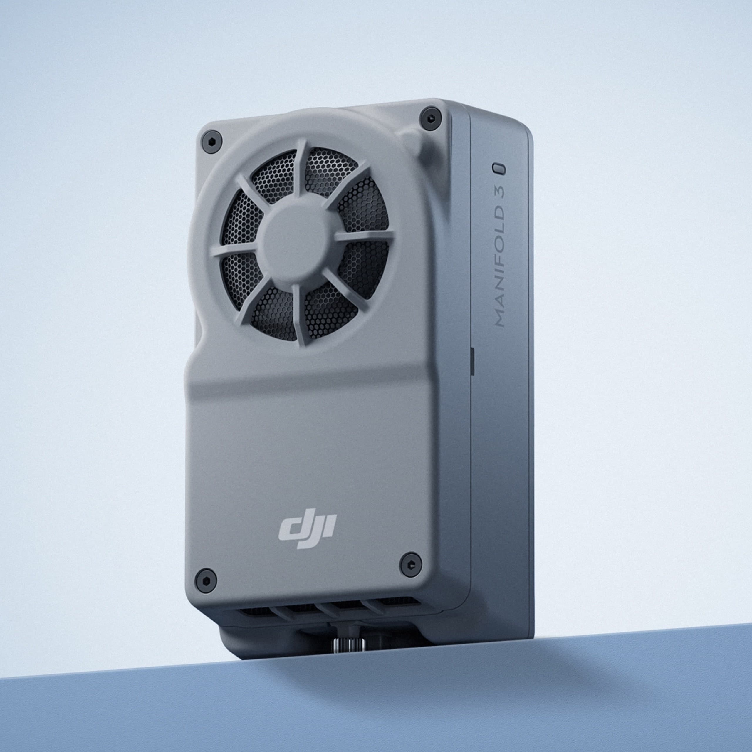
Powerful Performance – Compact Design
Equipped with up to 100 TOPS of computing power, Manifold 3 leverages GPU and DLA components to accelerate complex algorithmic models. Its lightweight design ensures minimal impact on flight endurance, striking the perfect balance between processing power and flight efficiency.
Built for Harsh Environments
With an IP55 rating, Manifold 3 maintains reliable performance in extreme conditions, operating smoothly within a temperature range of -20°C to 50°C. Its advanced thermal management allows continuous 25 W operation even in environments up to 40°C, ensuring stability and endurance during demanding missions.
Smart 3D Exploration – Automated Modeling Made Easy
When paired with the Matrice 4E, Manifold 3 activates Smart 3D Explore, enabling real-time mapping and autonomous flight path planning.
During flight, it generates a rough 3D model on-site and transmits it instantly to the remote controller, allowing users to create accurate mapping routes that match the object’s structure. With just a single operation, operators can efficiently complete precise measurement and modeling of complex structures.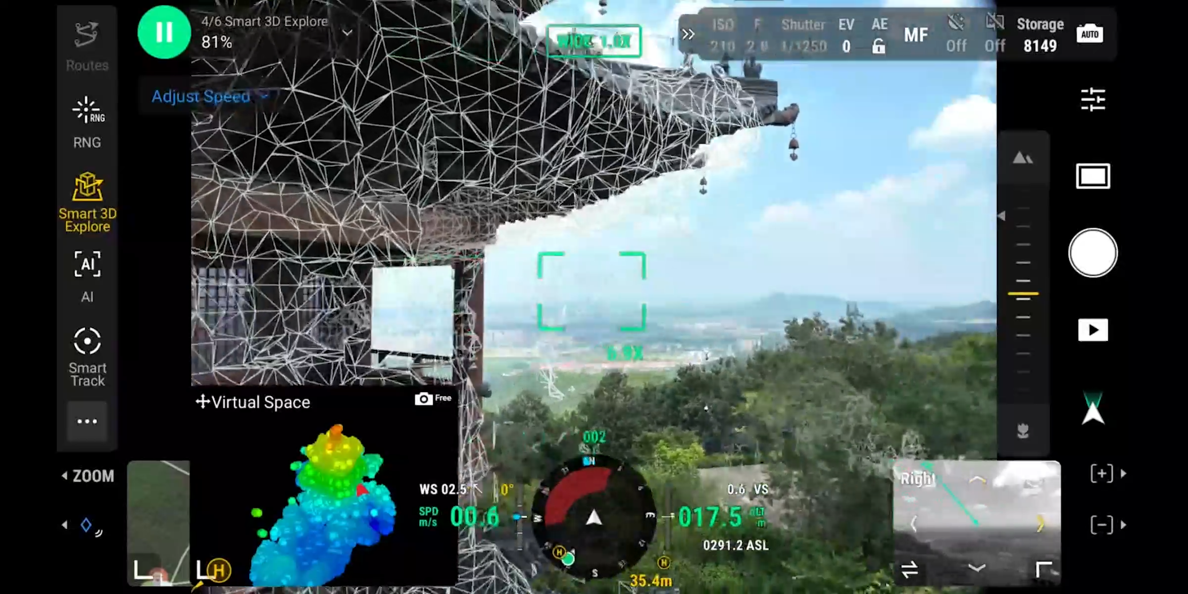
Open Platform – Flexibility for Developers
Manifold 3 is compatible with PSDK V3, allowing seamless access to various drone sensor data. With built-in hardware decoding, it enables faster video stream processing and enhances payload and flight control performance.
Developers can install and update third-party applications directly through DJI Pilot 2, just like installing apps on a smartphone—no command-line tools or complicated dependencies required.
In addition, PSDK supports onboard 4G networking, reducing latency and enabling developers to access LiDAR point cloud data and overlay AR visuals in DJI Pilot 2, unlocking new application possibilities for complex missions.
Expanded Connectivity – Optimized Customization
The USB 3.0 Type-C port on Manifold 3 supports Power Delivery (PD) and allows connection to external devices such as USB drives, NICs, or sensors, providing enhanced expandability to meet mission-specific needs.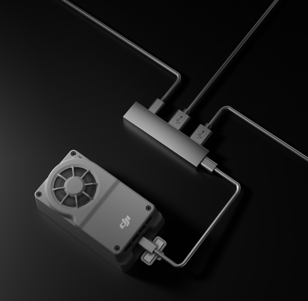
An Open Platform for Smart Solutions
Manifold 3 serves as an open computing platform, enabling developers to harness its full processing power together with the PSDK toolkit to build end-to-end automation solutions—from data acquisition to mission execution—enhancing efficiency across a variety of industrial operations.
Application Scenarios
Renewable Energy
Manifold 3 enables efficient image processing and analysis for inspecting wind turbines, solar panels, and renewable energy infrastructure, helping detect anomalies quickly and optimize system performance.
Public Safety
Enhances real-time imaging and data processing for surveillance, search and rescue, and emergency response, improving situational awareness and operational safety.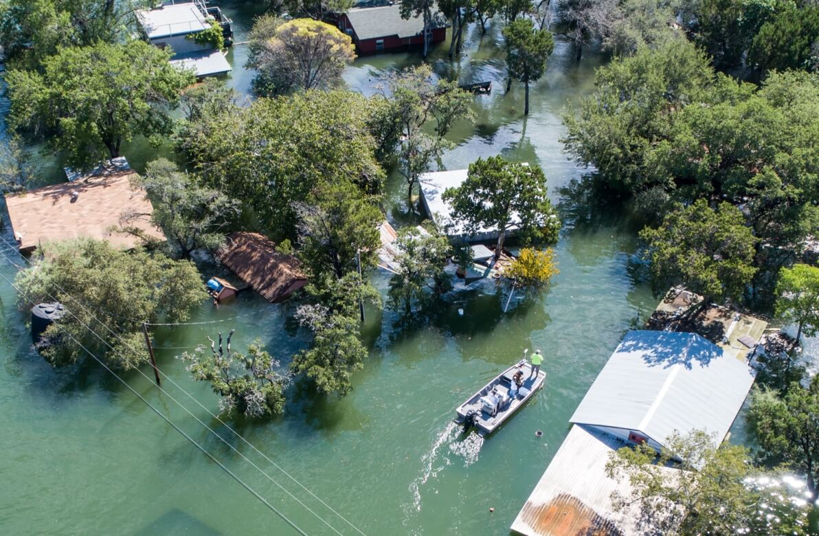
Water Conservation
Used in monitoring reservoirs, levees, and irrigation systems to detect leaks or erosion, supporting maintenance planning and disaster prevention efforts.
Forestry
Analyzes forest coverage, monitors fire risks, and supports ecological management with accurate 3D modeling and spatial data for sustainable conservation.
Building Facade Inspection
Captures and reconstructs detailed exterior models of buildings, aiding in structural assessments, maintenance planning, and ensuring urban infrastructure safety.