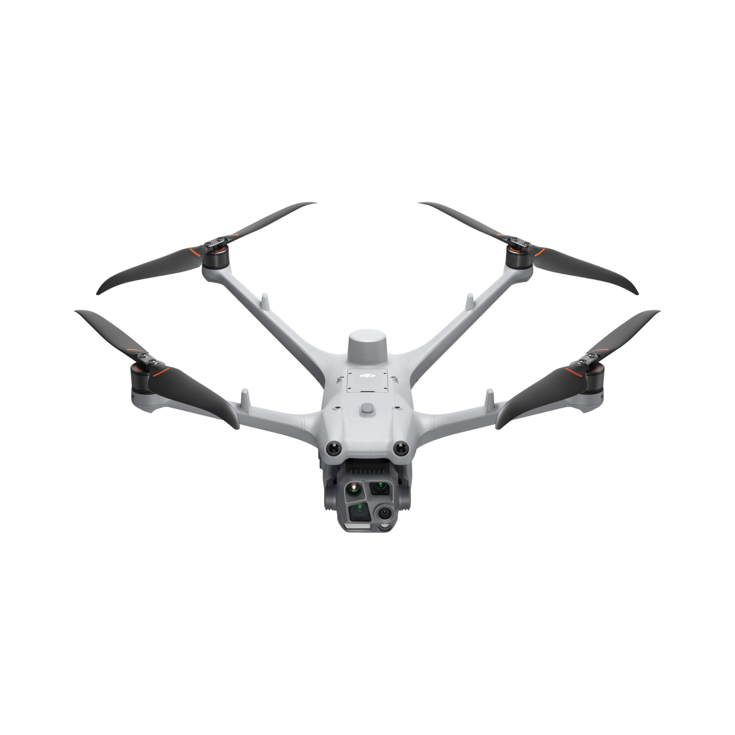
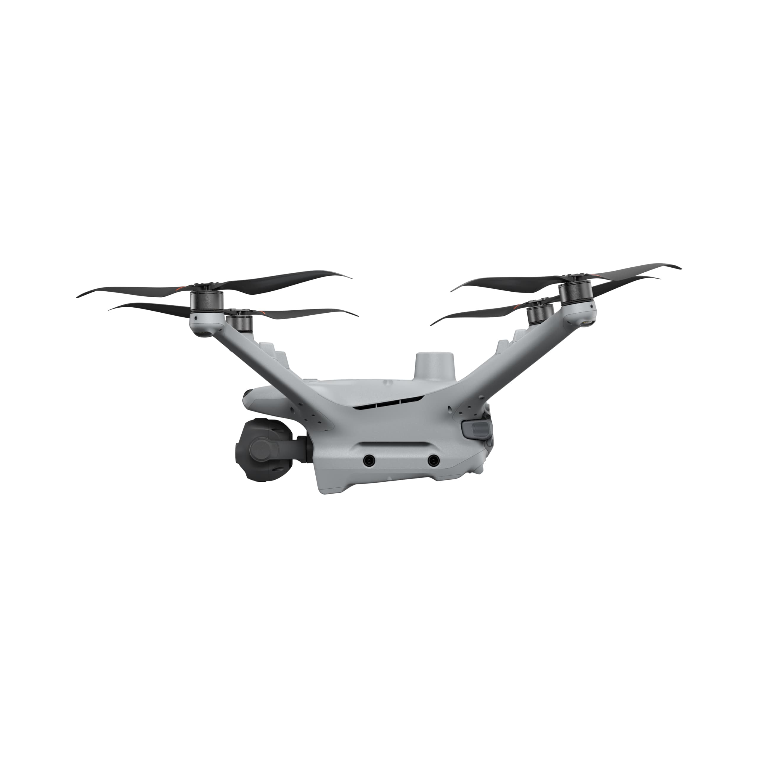
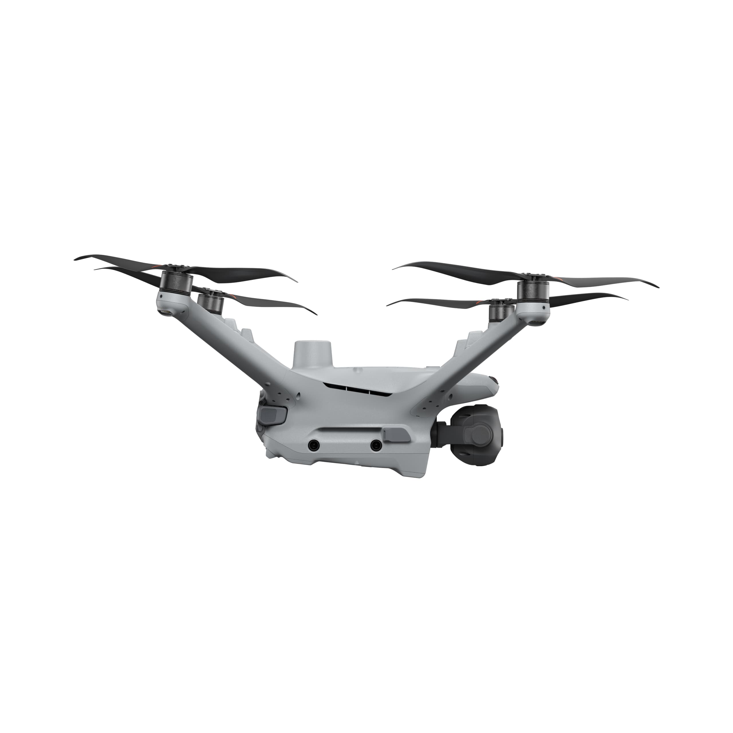
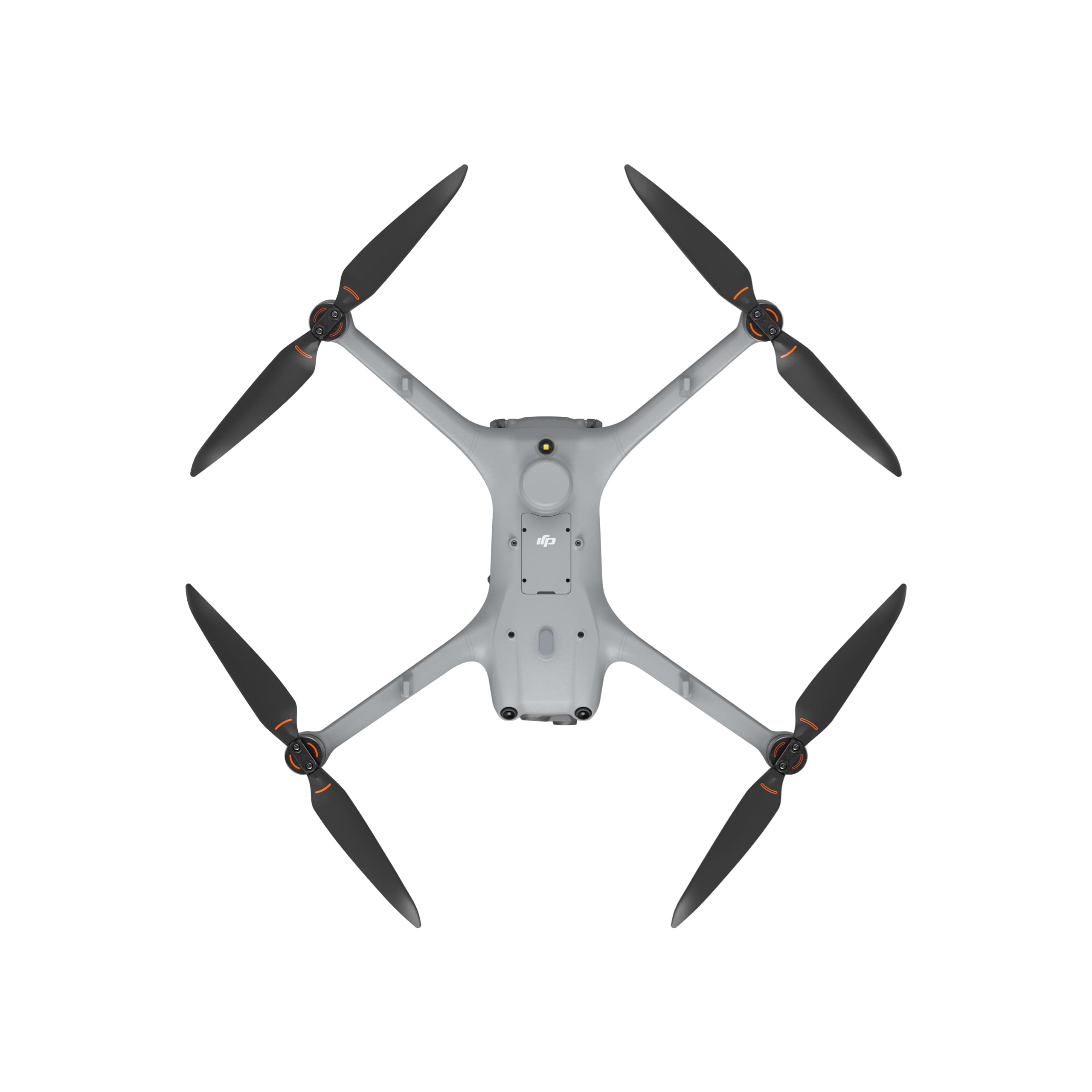
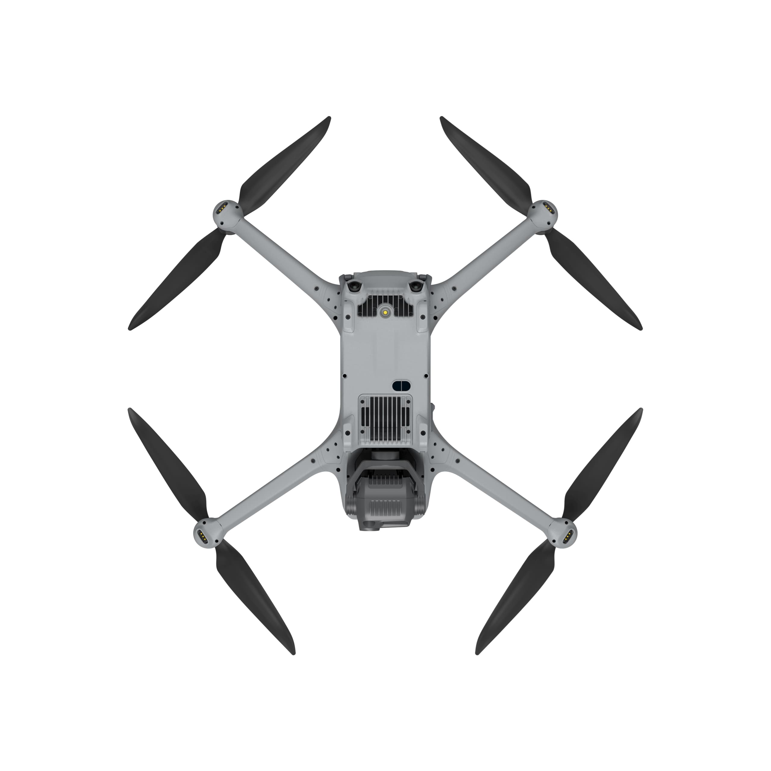
DJI Matrice 4TD
The DJI Matrice 4TD is a new-generation high-performance drone, specifically designed for the DJI Dock 3. It delivers extended flight time and supports autonomous operations when paired with the DJI RC Plus 2 Enterprise. Equipped with a versatile four-camera system—including a wide-angle camera, medium telephoto camera, long-range telephoto camera, thermal camera and a Laser Range Finder (LRF)—the Matrice 4D is especially optimized for high-precision mapping, detailed surface inspection, and large-scale infrastructure monitoring.
Select Version
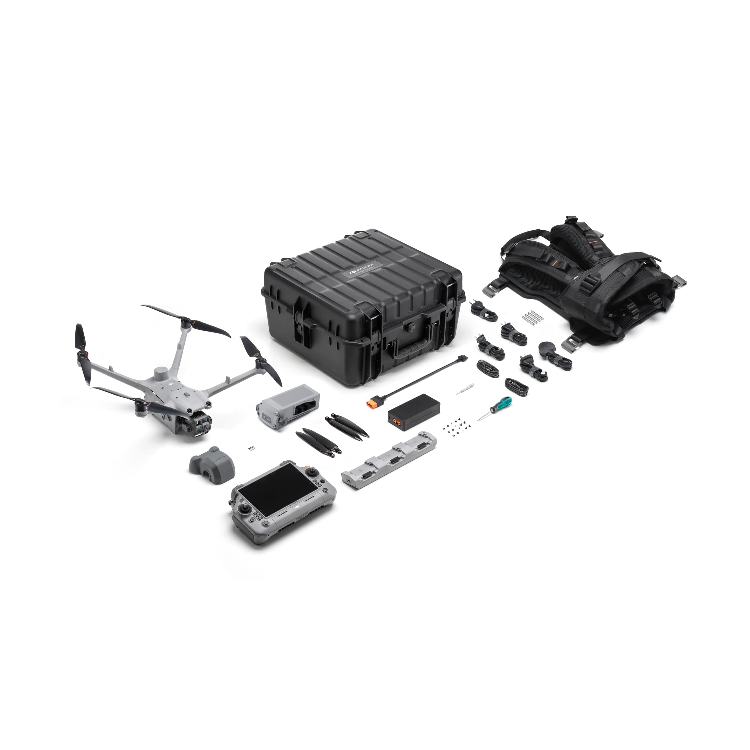
DJI Matrice 4TD Worry-Free Flagship Combo
The New Power of Performance and Accuracy
The DJI Matrice 4TD represents the next generation of professional drones in the Matrice Series, engineered specifically for the DJI Dock 3 — DJI’s next-level automated operation platform.
Built for endurance, precision, and reliability, the Matrice 4D features an extended flight time, robust construction, and an advanced multi-sensor camera system. It delivers exceptional performance for terrain surveying, mapping, infrastructure inspection, emergency response, and public safety missions.
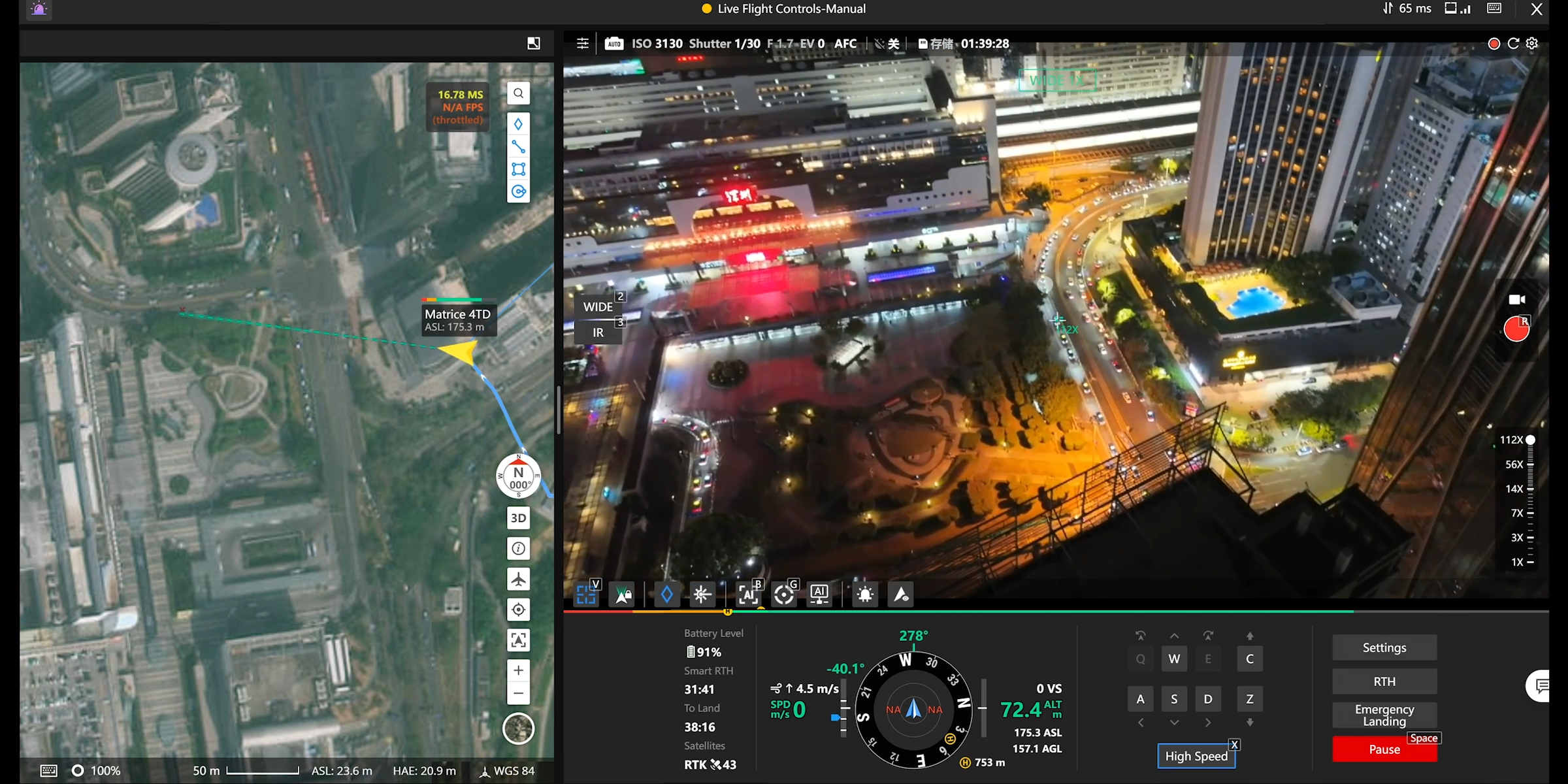
The Matrice 4TD can operate independently or in combination with the DJI RC Plus 2 Enterprise controller, enabling flexible deployment with or without a dock station.
Extended Flight and Stable Operation in Any Environment
The flight system of the Matrice 4TD has been fully upgraded, achieving up to 54 minutes of forward flight time and 47 minutes of hover time under standard conditions.
With superior energy efficiency, the drone maintains up to 18 minutes of stable operation within a 10 km radius, supporting extended missions with consistent performance.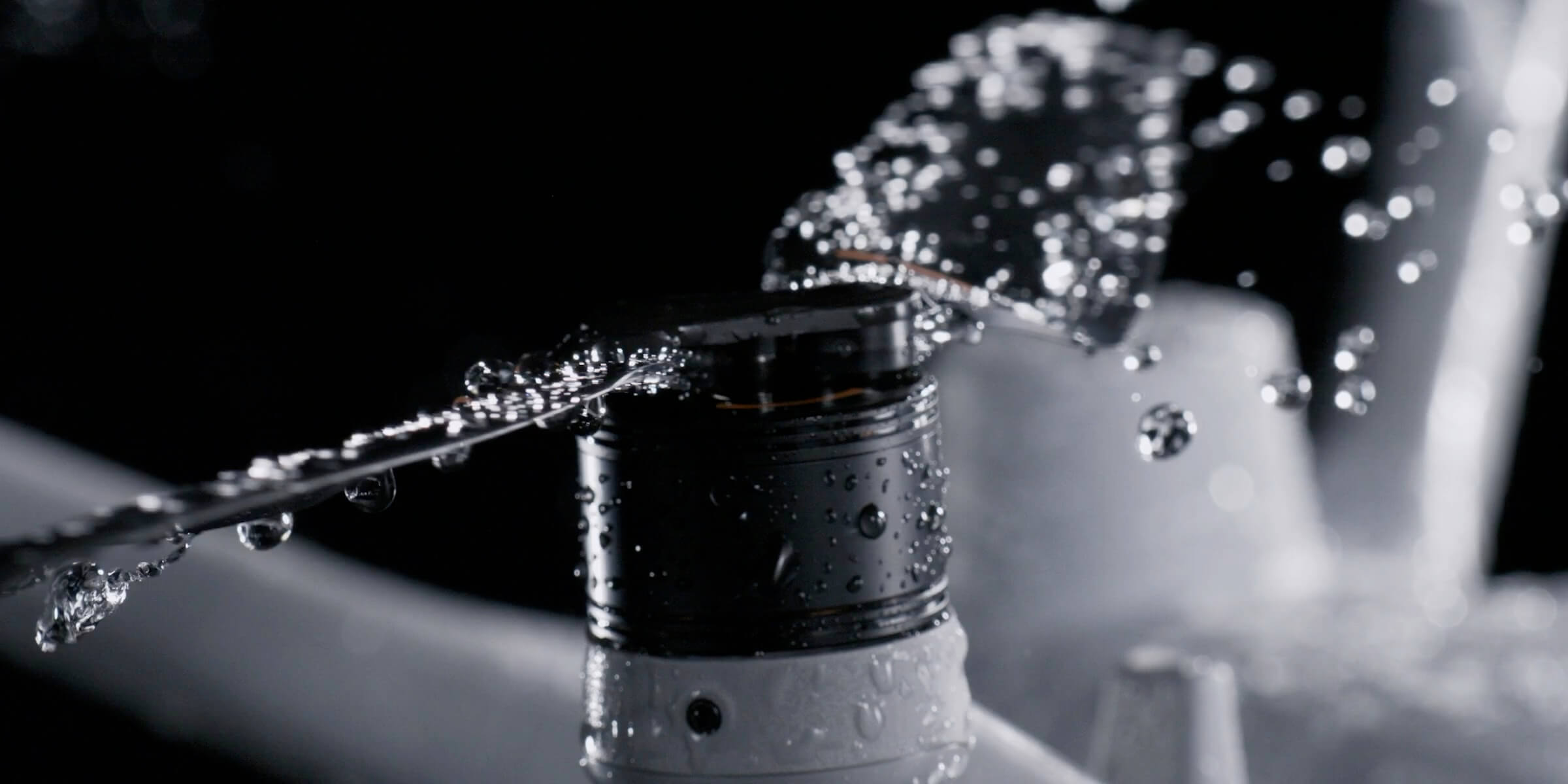
Moreover, the Matrice 4TD boasts an IP55 protection rating, offering resistance to dust, rain, and harsh environmental factors such as strong winds, humidity, fog, or industrial pollution — ensuring safe and reliable operation in all conditions.
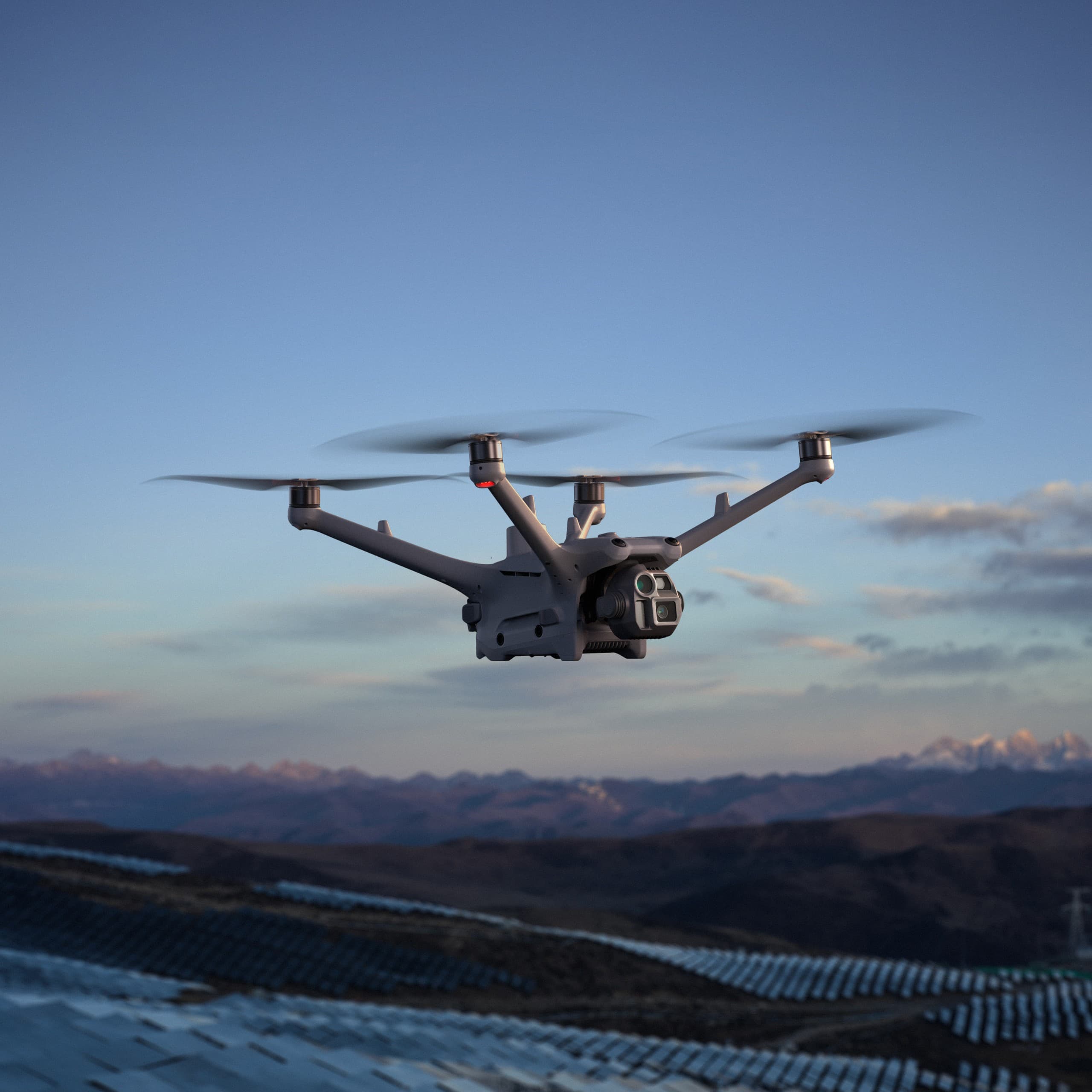
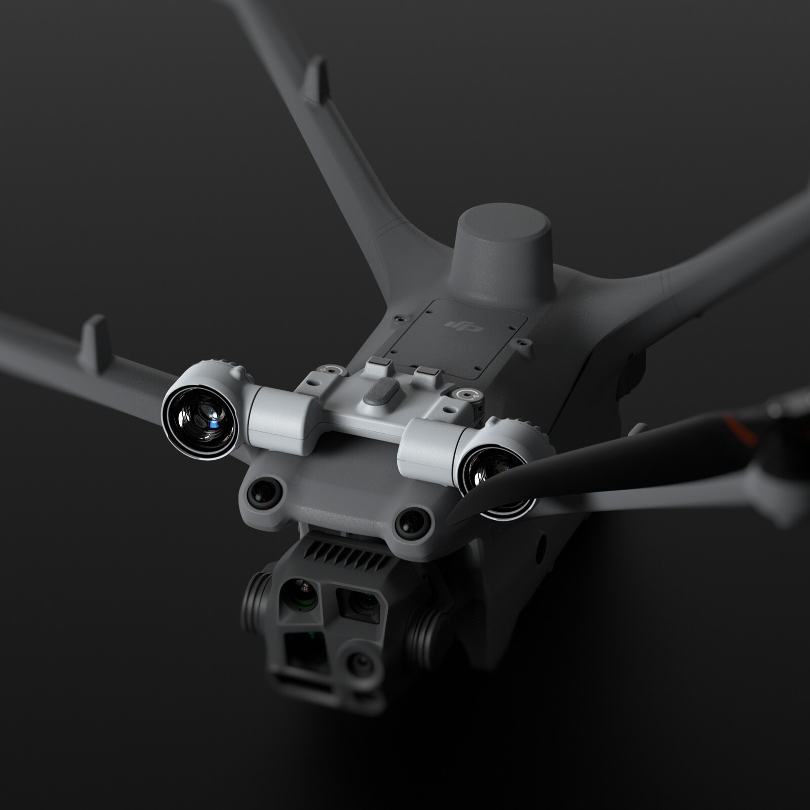
3. Multi-Sensor Camera System – Optimized for Every Task
Equipped with a versatile multi-camera setup, the Matrice 4TD provides exceptional image detail and measurement precision across diverse applications.

Wide-Angle Camera
1/1.3-inch CMOS sensor
48 MP effective pixels
f/1.7 aperture
24 mm format equivalent focal length
Medium Tele Camera
1/1.3-inch CMOS sensor
48 MP effective pixels
f/2.8 aperture
70 mm format equivalent focal length
Tele Camera
1/1.5-inch CMOS sensor
48 MP effective pixels
f/2.8 aperture
168 mm format equivalent focal length
Laser Range Finder
Direct measurement range: 1800 m (1 Hz)
Oblique incidence range (1:5 ratio): 600 m (1 Hz)
Blind zone: 1 m
Range accuracy: ± (0.2 + 0.0015 × D) meters
(D = target distance in meters)
NIR Auxiliary Light
6° field of view
100 m illumination distance
Infrared Thermal Camera
640 × 512 resolution
f/1.0 aperture
53 mm format equivalent focal length
Uncooled VOx microbolometer sensor
Supports UHR (Ultra High Resolution) infrared imaging mode
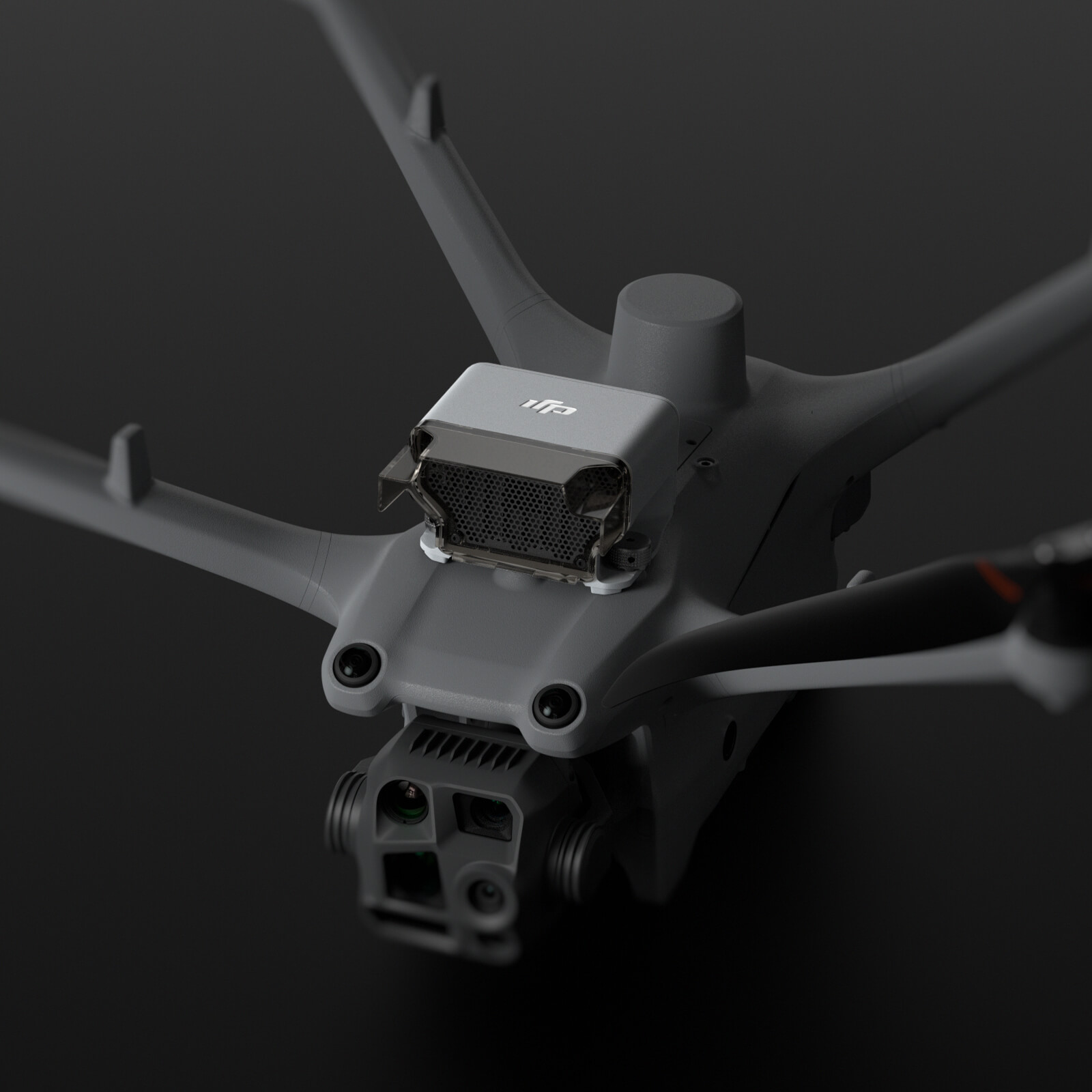
Precision Obstacle Avoidance and Safe Flight Operations
The Matrice 4TD integrates a rotating LiDAR sensor combined with millimeter-wave radar technology, providing ultra-precise obstacle detection — capable of identifying objects as thin as 12 mm, such as cables and power lines.
This system ensures accurate flight paths and real-time avoidance even in low-light or complex environments, maintaining operational safety around substations, factories, and dense urban areas.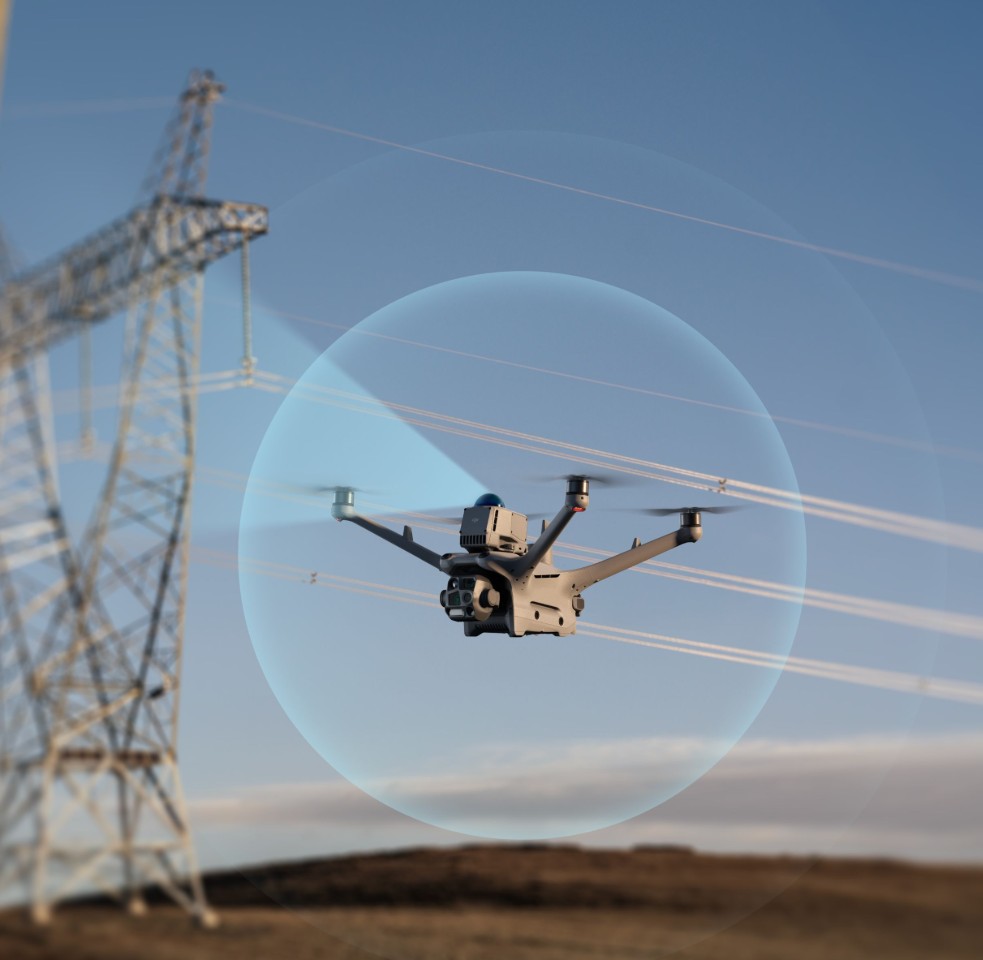
Key Advantages:
Detects thin obstacles down to 12 mm
Performs accurate localization in low-light conditions
Safe operation across complex industrial or residential zones
Seamless Airborne Relay for Extended Range
One of Matrice 4TD’s most advanced capabilities is its airborne relay transmission feature.
When paired with DJI RC Plus 2 Enterprise, one drone can ascend to act as a relay node, extending communication range for another drone operating at a lower altitude or in obstructed areas.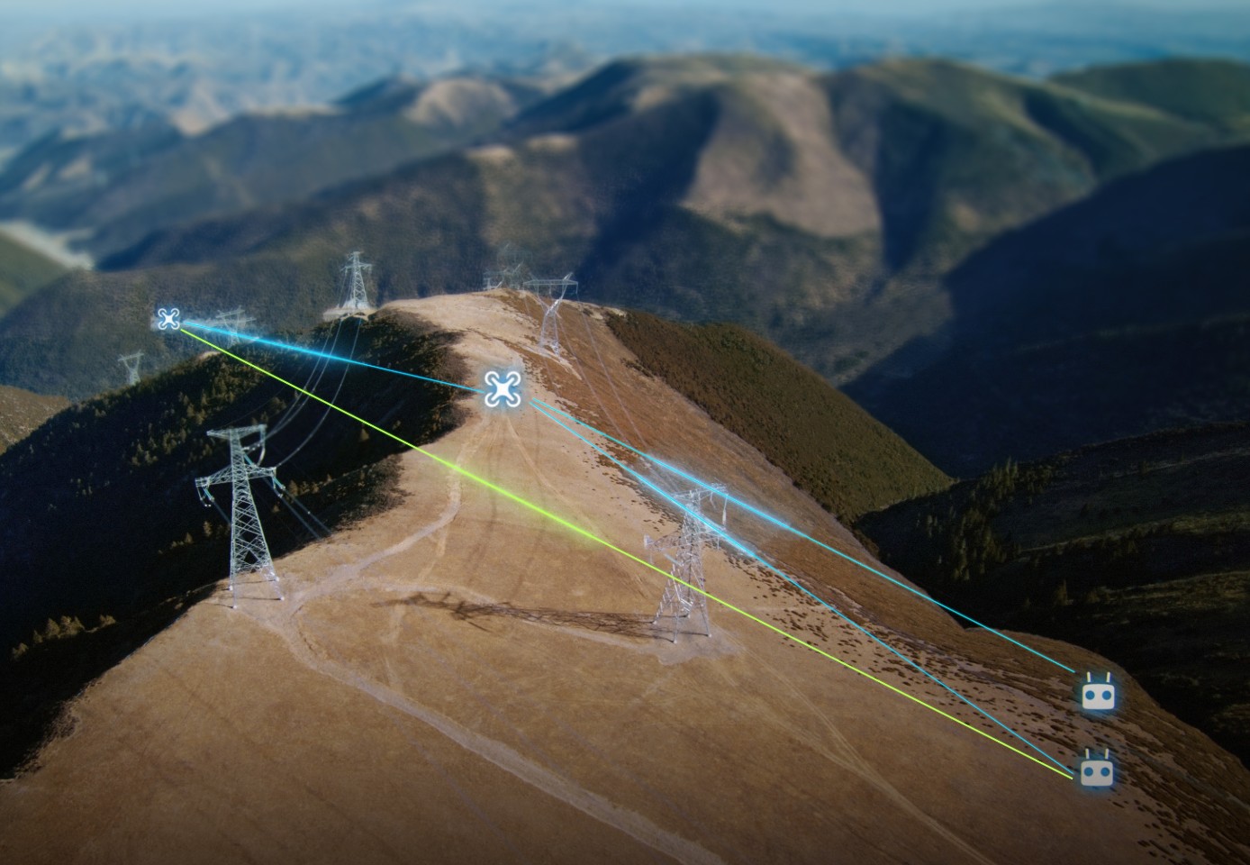
Ideal Applications:
Search and Rescue (SAR) missions in mountainous or network-restricted zones
Powerline or pipeline infrastructure inspections
Field operations in GPS- or 4G-limited environments
Exceptional Low-Light Imaging
Matrice 4TD’s high-sensitivity imaging sensors and Night Scene Mode allow operators to capture clear, detailed visuals even in extremely low-light conditions.
The Full-Color Night Vision mode delivers realistic colors at night, enabling continuous 24/7 operation.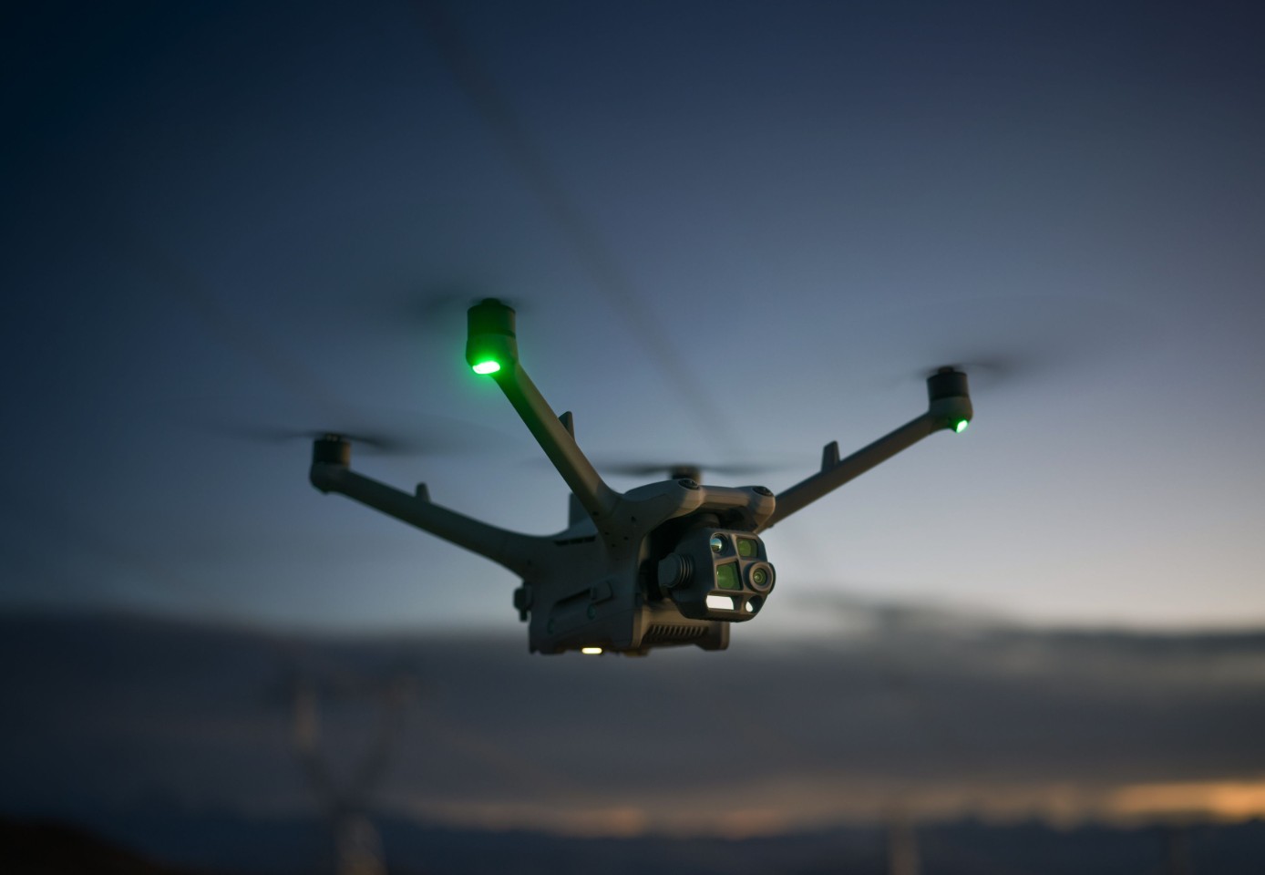
Additionally, the drone supports NIR auxiliary illumination, enhancing visibility in foggy or dark areas — ideal for night surveillance, search and rescue, or security patrols.
Enhanced Efficiency with Intelligent Features
When used with DJI Pilot 2, the Matrice 4D introduces a suite of intelligent automation tools:
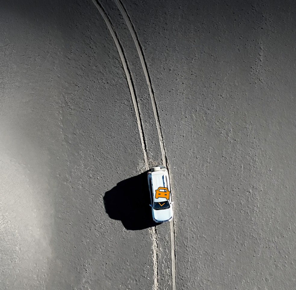
Vehicle and Vessel Detection for area monitoring
Laser Range Finder-based point marking directly on live maps
Linear and Area-based Surveying for topographical accuracy
Intelligent Change Detection for periodic environmental or structural analysis
Smart Track for automatic target following with precise auto-zoom
These AI-powered functions reduce manual workload, increase mission efficiency, and ensure faster field data acquisition.
Advanced Accessory Ecosystem
DJI offers a complete ecosystem of expandable accessories to adapt the Matrice 4TD for specialized use cases:
Gimbal-Following Spotlight – synchronized illumination for nighttime operations
Real-time Voice Speaker – broadcast real-time commands or warnings
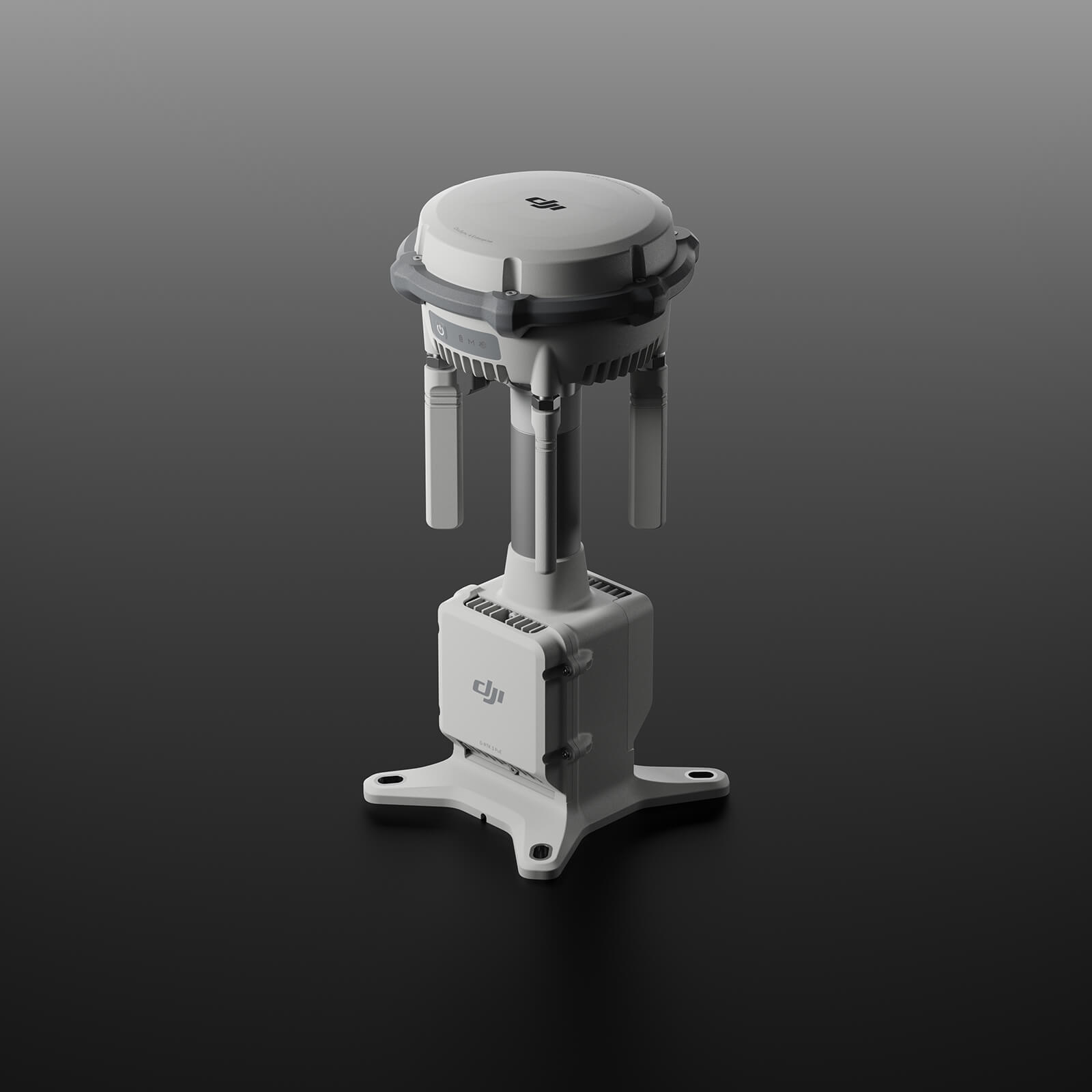
D-RTK 3 Relay – enhances positional accuracy
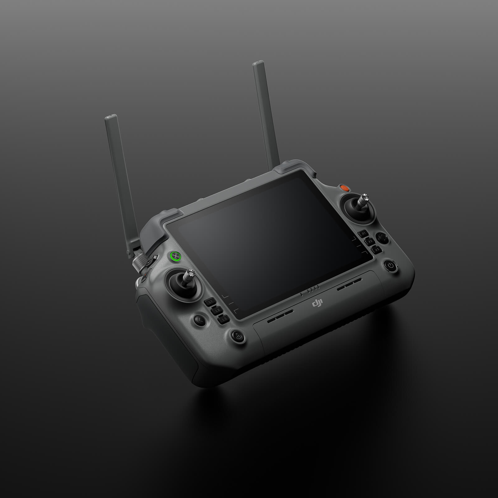
DJI RC Plus 2 Enterprise Controller – high-brightness screen with multi-channel video transmission
These upgrades empower professionals to customize the Matrice 4D for specific mission requirements, ensuring maximum operational efficiency and adaptability.
9. High-Precision Mapping Solutions
The Matrice 4TD is engineered for professional aerial surveying and mapping, featuring:
5-directional oblique photography and 3-directional orthophoto capture
Real-time terrain following
Smart 3D Capture flight paths with automatic terrain simulation
This combination delivers highly detailed, accurate 3D models ideal for urban planning, land surveying, and infrastructure analysis.
Intelligent Flight and Control
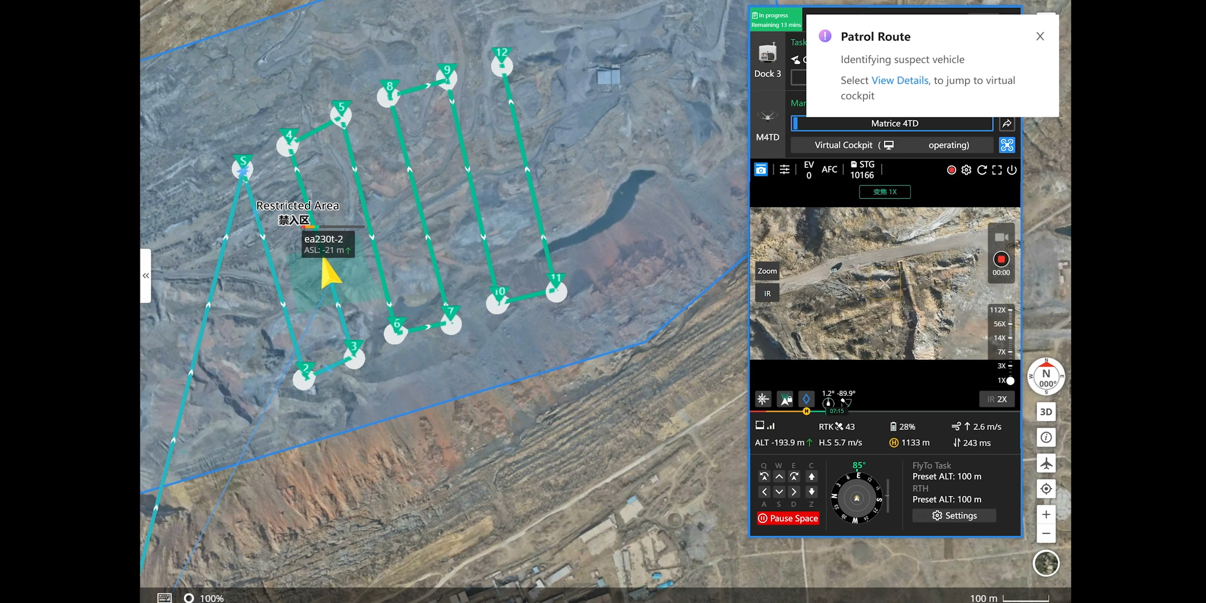
Automated Routes
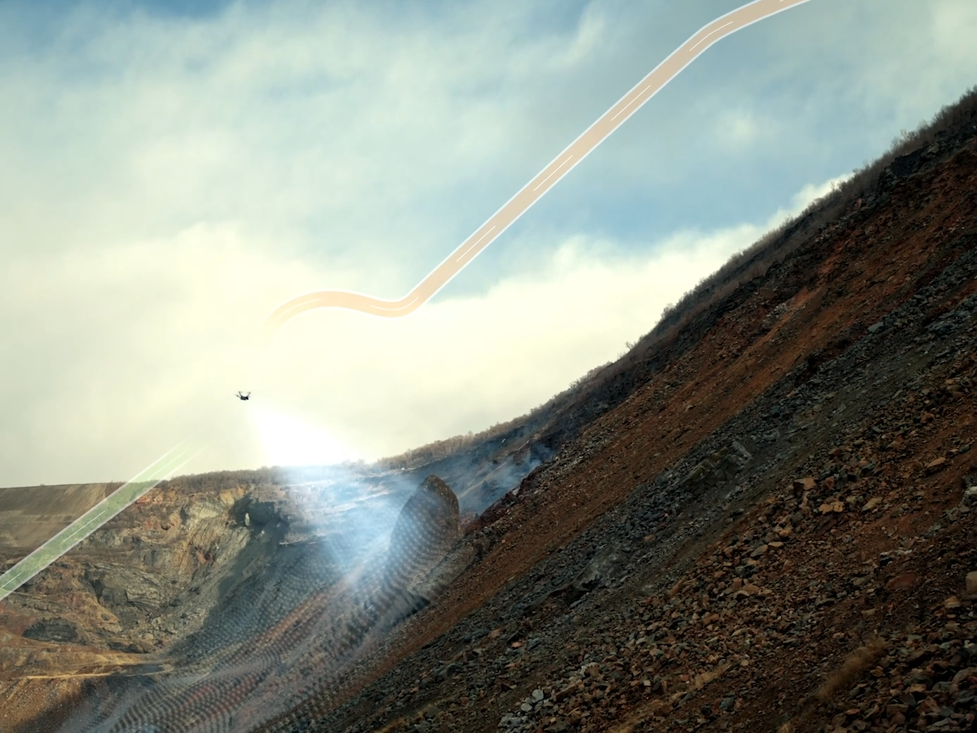
The next-generation automated flight system enhances efficiency across multiple industries such as public safety, infrastructure inspection, and environmental monitoring.
Once a route is configured, the drone can automatically detect and capture imagery or thermal anomalies (vehicles, vessels, heat sources) and send real-time alerts to operators — minimizing manual intervention while maximizing data accuracy.
Intelligent Change Detection
This feature enables the drone to analyze area changes over time, identifying environmental shifts, structural damage, or surface cracks.
It supports faster, data-driven decisions in environmental protection, infrastructure maintenance, and disaster response.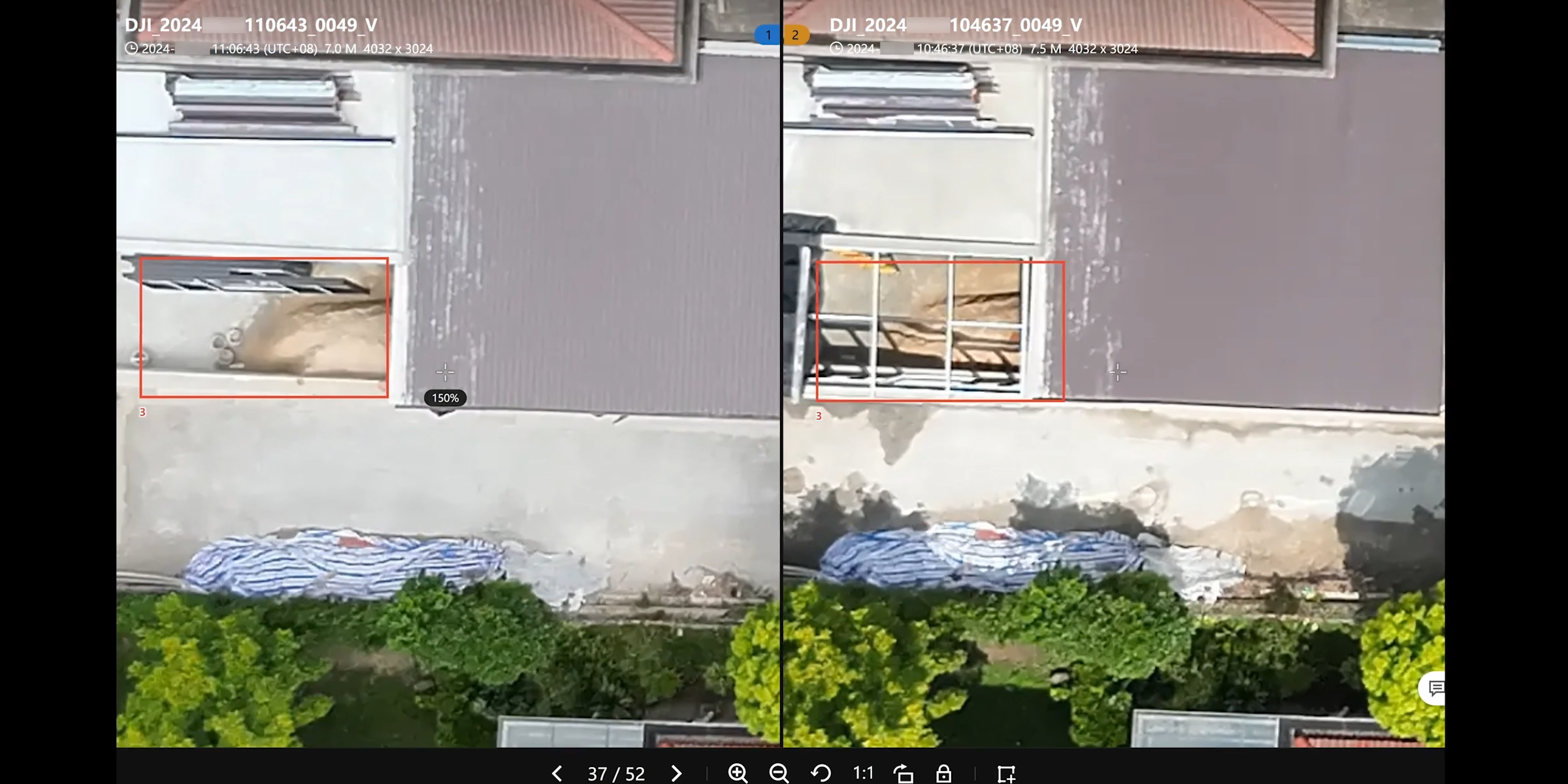
Smart Track
With powerful auto-zoom and subject tracking, the Matrice 4D can seamlessly follow moving targets such as vehicles or people, providing stable and detailed footage for surveillance or emergency missions.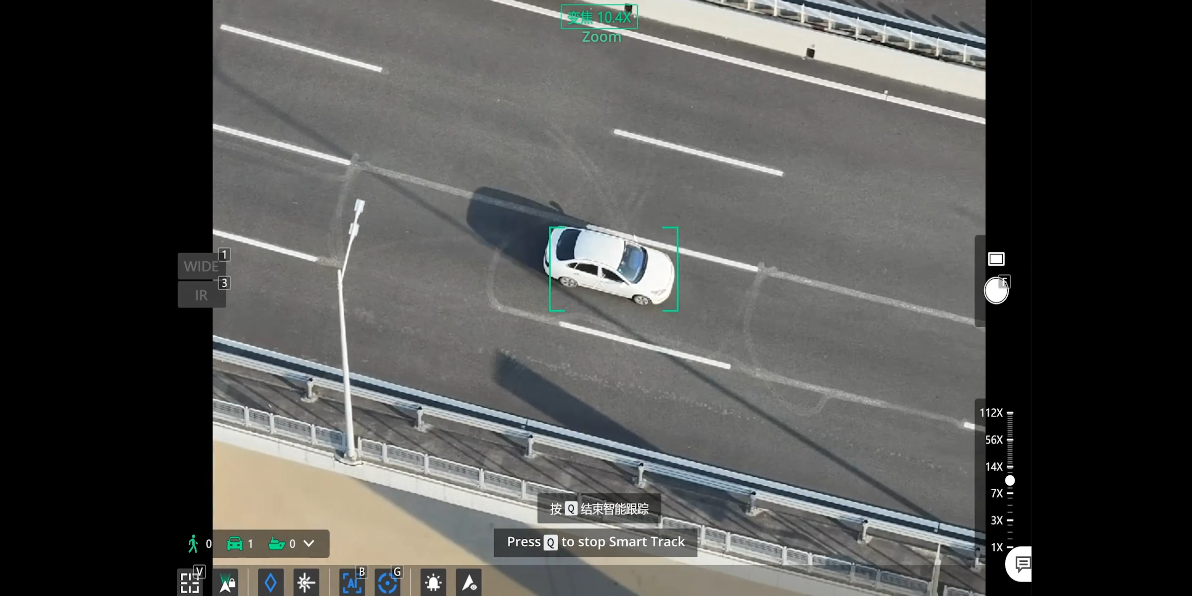
Virtual Cockpit
The enhanced Virtual Cockpit interface introduces the Mouselook feature, allowing operators to adjust the drone’s attitude and gimbal orientation with simple mouse movements.
This innovation enables rapid and precise framing — delivering a “point and see” experience for real-time monitoring and situational awareness.