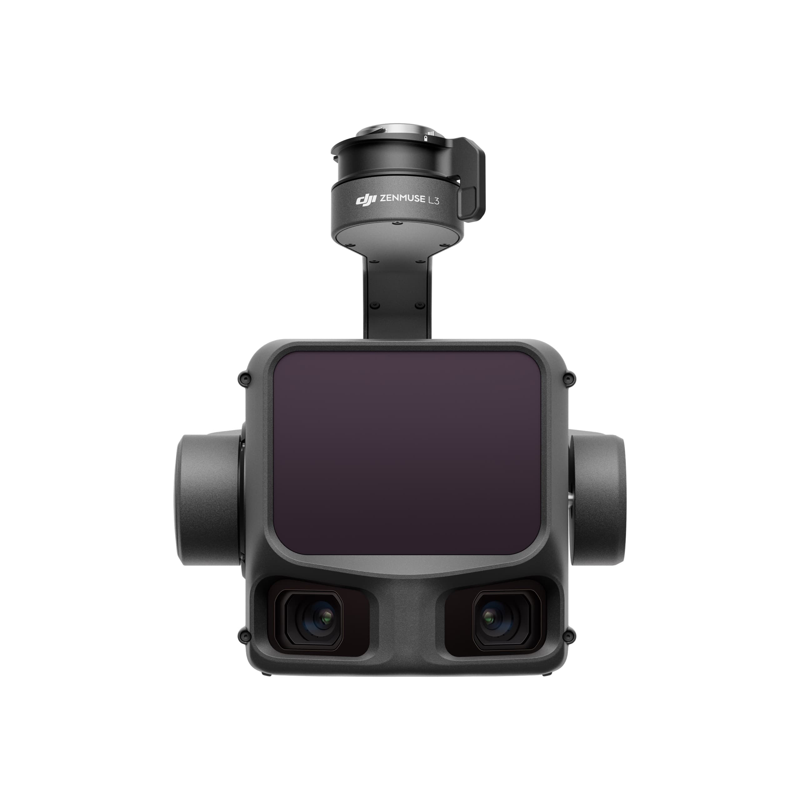
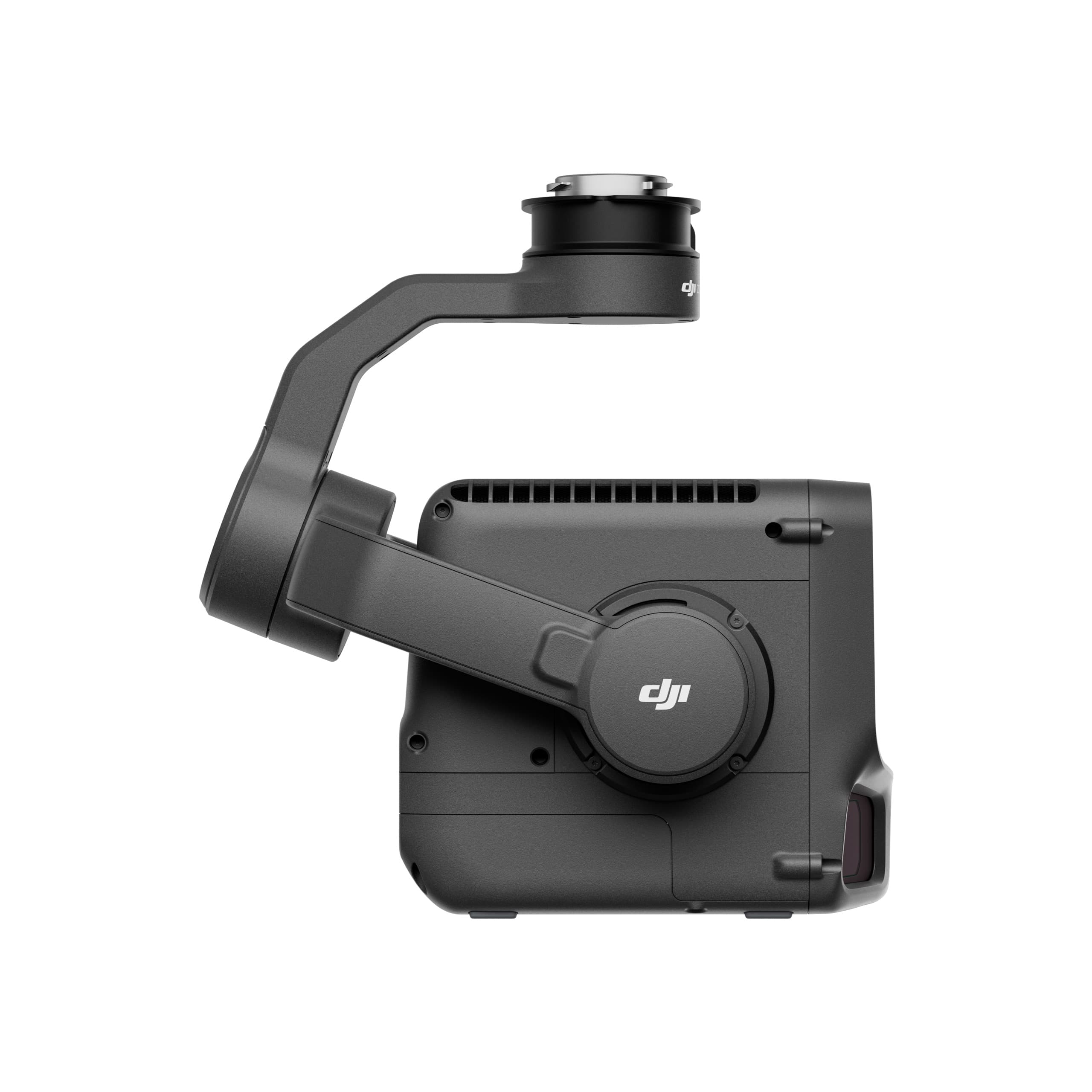
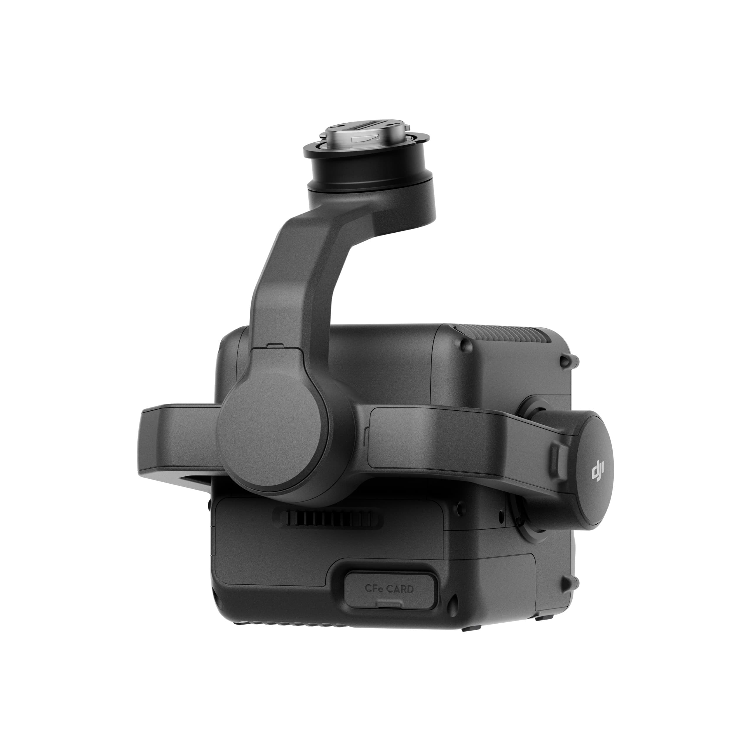
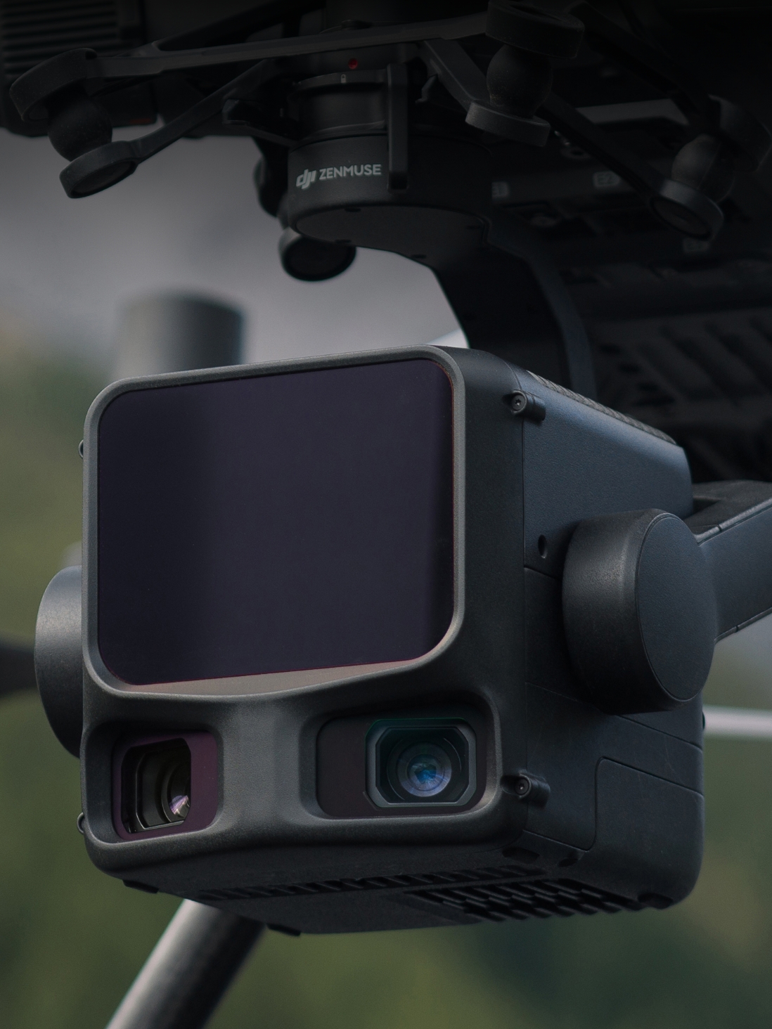
Zenmuse L3
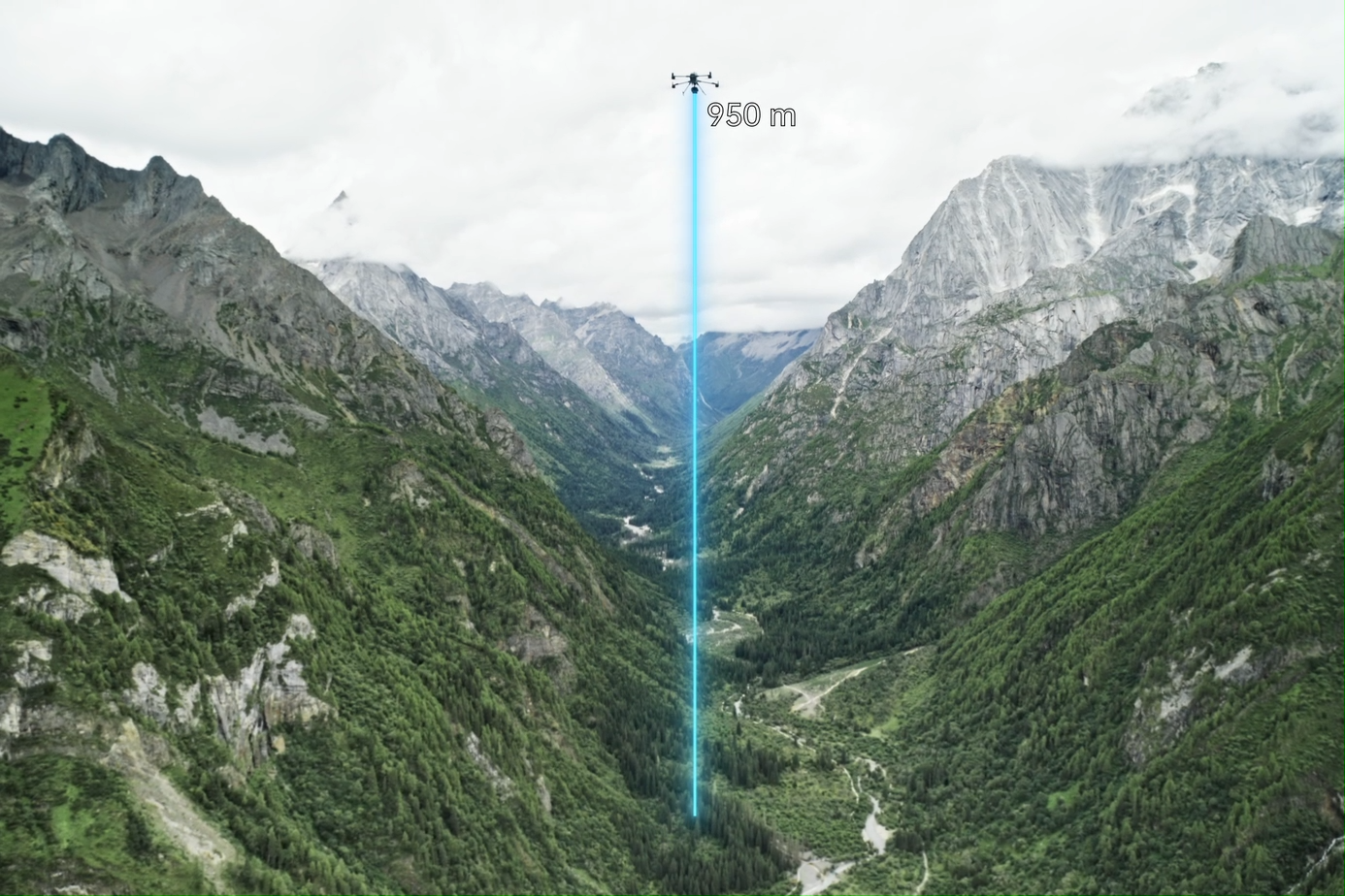
Zenmuse L3 is DJI’s next-generation aerial LiDAR system, featuring an exceptional ranging capability of up to 950 m, even on surfaces with only 10% reflectivity, paired with dual 100MP RGB cameras and a high-precision POS system. With a fully integrated hardware–software ecosystem, Zenmuse L3 enables large-scale geospatial data acquisition at remarkable speed—up to 100 km² per day.
ZENMUSE L3
Zenmuse L3 is DJI’s next-generation aerial LiDAR system, featuring an exceptional ranging capability of up to 950 m, even on surfaces with only 10% reflectivity, paired with dual 100MP RGB cameras and a high-precision POS system. With a fully integrated hardware–software ecosystem, Zenmuse L3 enables large-scale geospatial data acquisition at remarkable speed—up to 100 km² per day.
Hardware Performance – Redefining Excellence
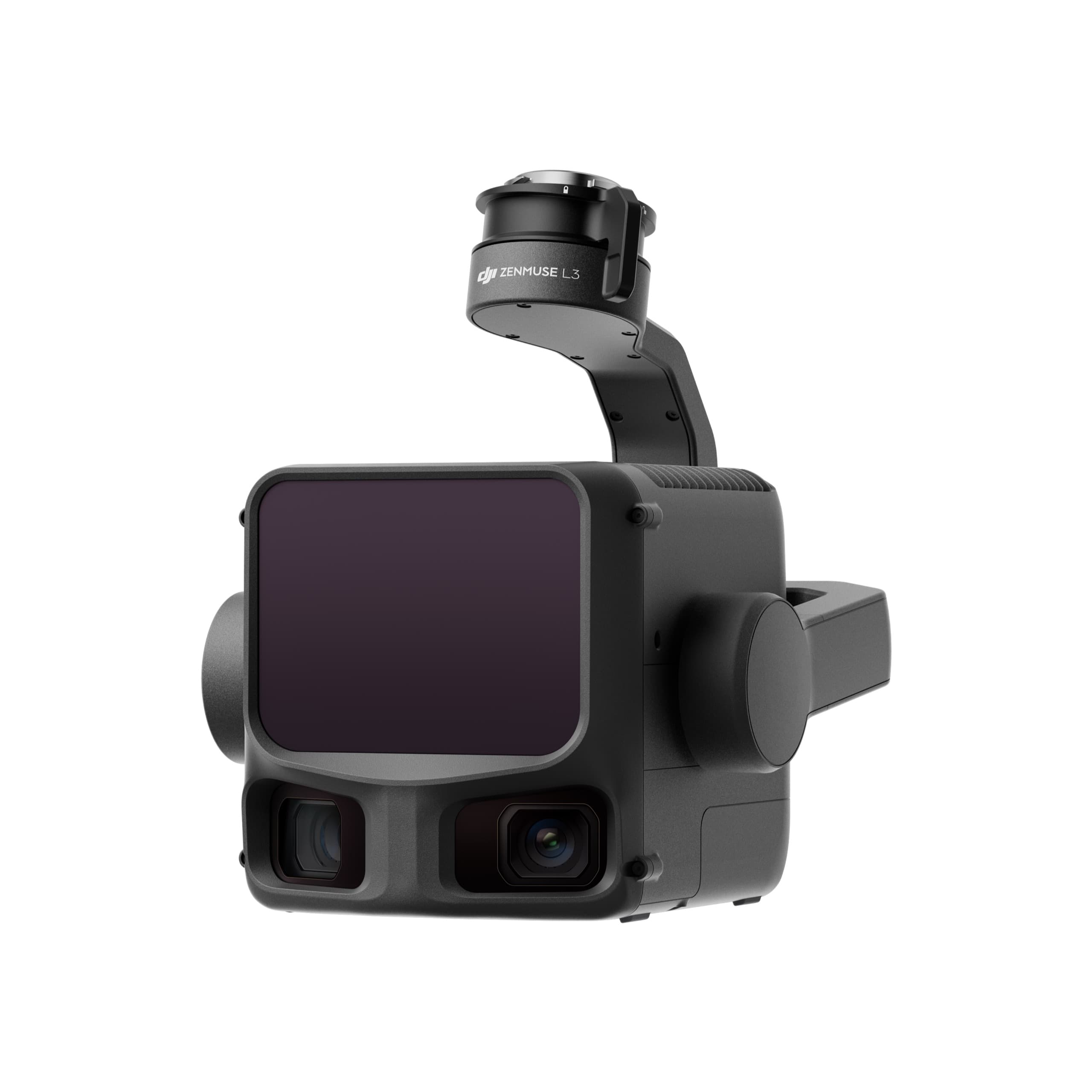
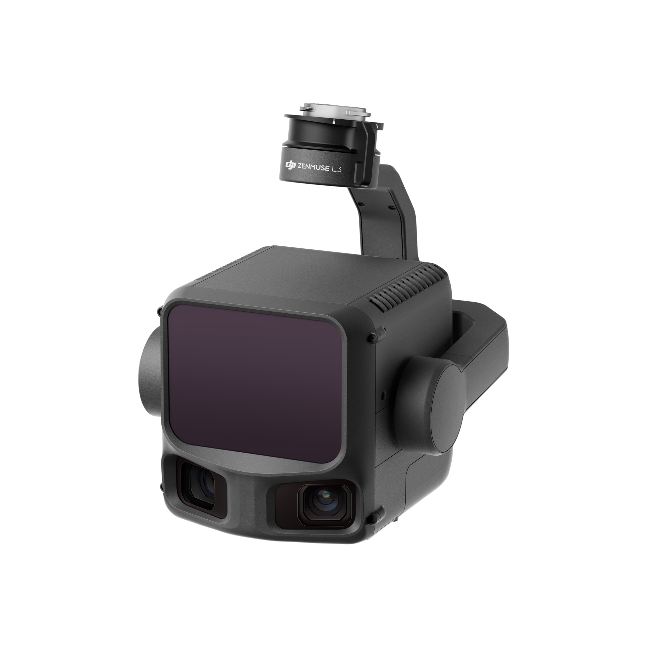
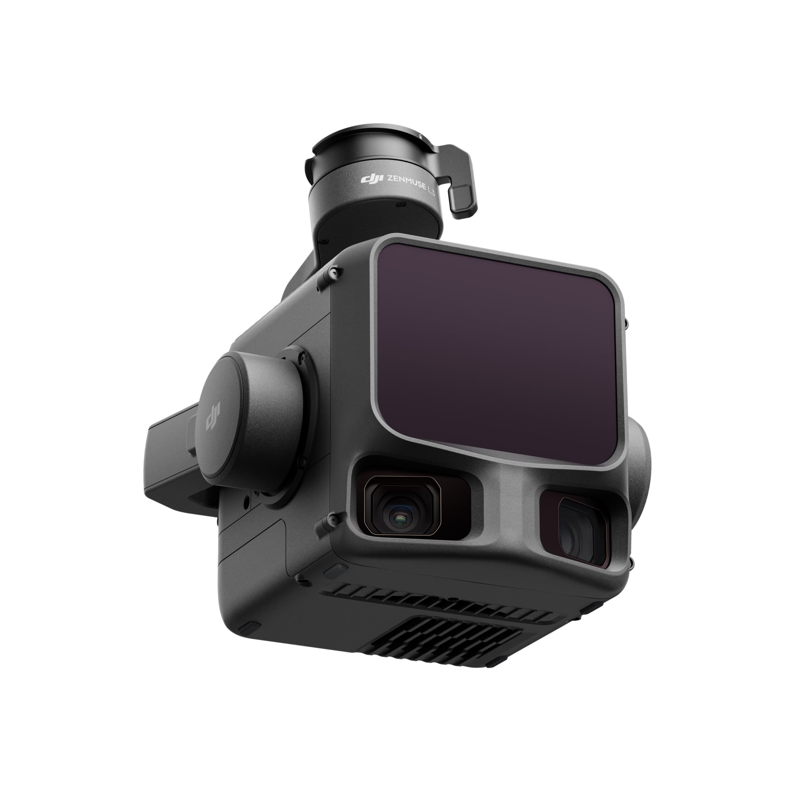
Zenmuse L3 integrates a long-range 1535 nm LiDAR, dual 100MP RGB cameras, a high-precision POS system, and a 3-axis gimbal into a compact device. Everything works together to deliver best-in-class performance.
1535 nm Long-Range LiDAR – Extended Range, Superior Coverage
950 m Ranging Distance
Optimized for flight altitudes of 300–500 m.
Performs reliably even under 100 klx strong ambient light
Measures well on surfaces with 10% reflectivity
Adjustable pulse rate for mission-optimized performance
→ Result: greater coverage per flight, significantly improving mapping efficiency.
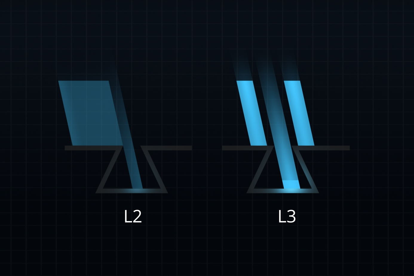
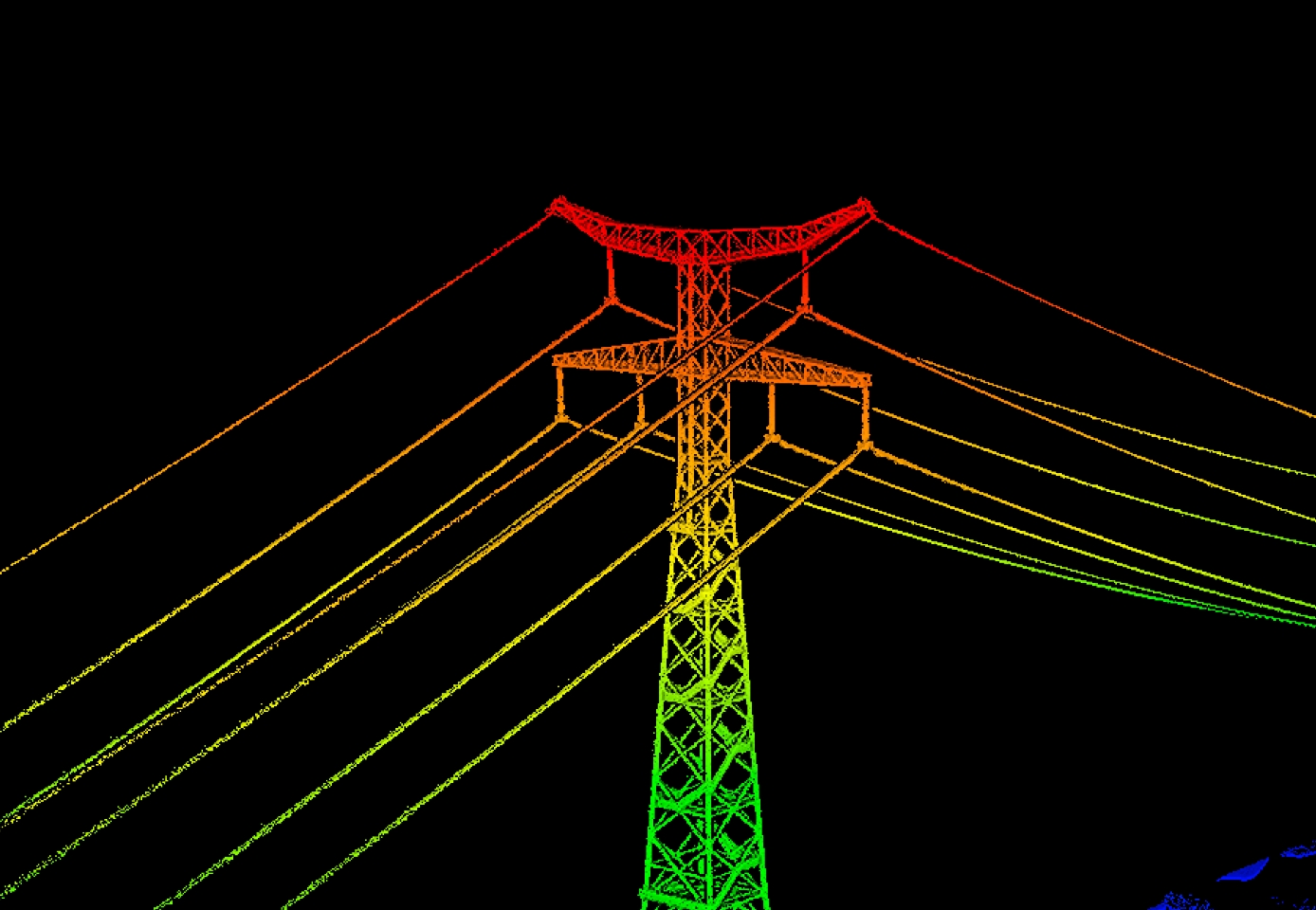
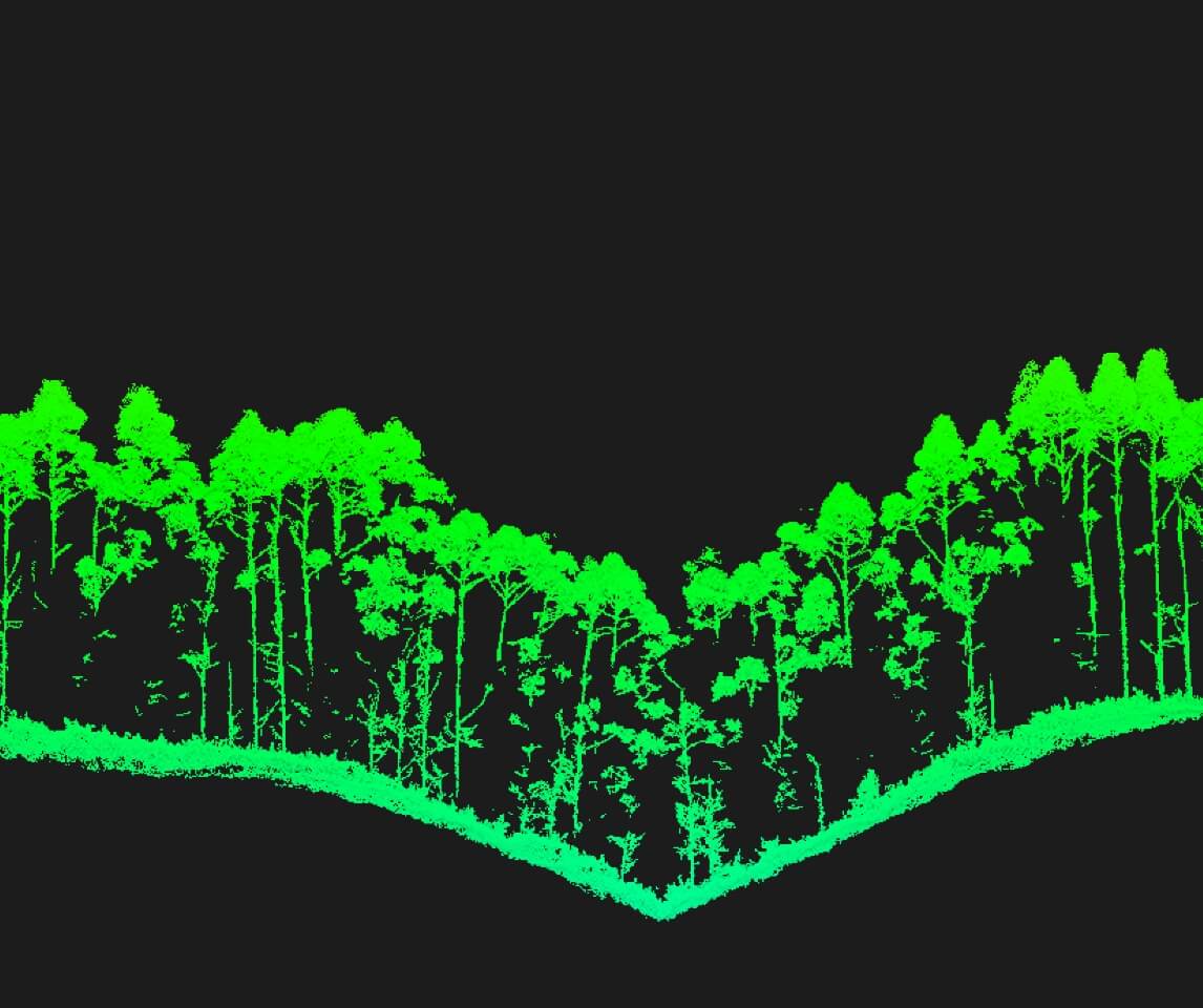
Small Laser Spot – High Energy
Beam divergence of only 0.25 mrad → scan area 1/5 the size of the L2
Captures tiny details such as power lines and thin branches
Strong penetration through vegetation, retrieving more ground points beneath canopy
High Pulse Rate – Up to 2 Million Pulses per Second, Supporting 16 Returns
→ Enables extremely detailed 3D reconstruction, ideal for high-precision terrain mapping and complex structural surveys.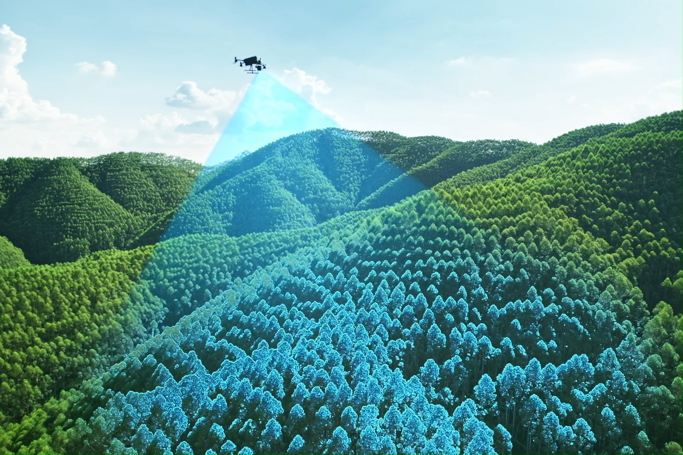
Three Flexible Scan Modes
Linear Mode
Uniform point distribution, optimized for high-precision topographic surveys.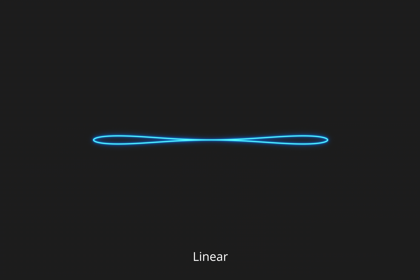
Star-Shaped Mode
Balances accuracy and penetration—ideal for forests and dense urban areas.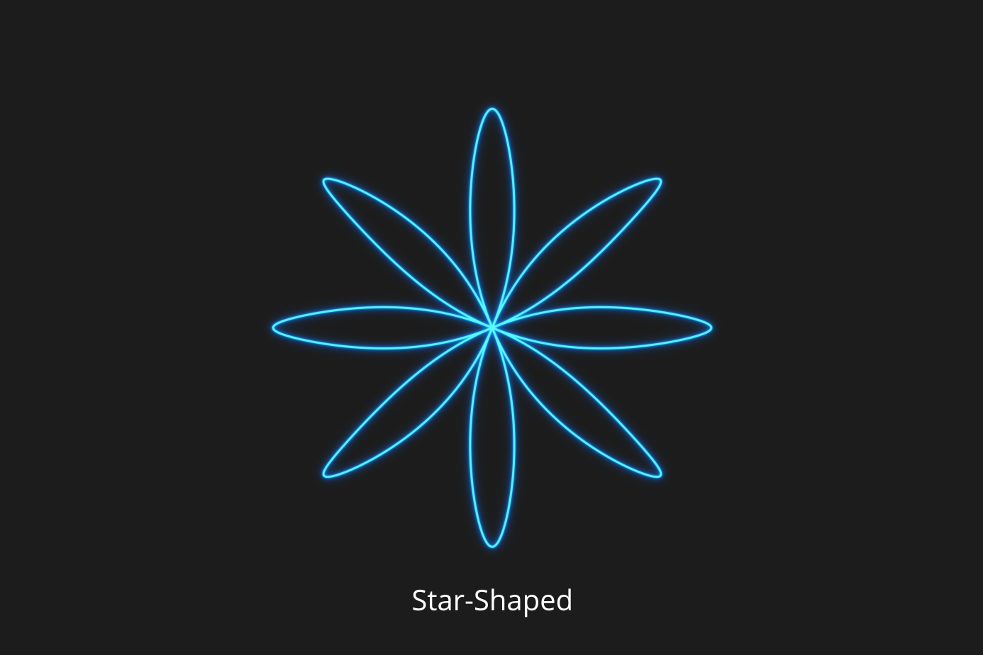
Non-Repetitive Mode
Multiple scan angles, wide coverage—perfect for power line inspections and complex structures.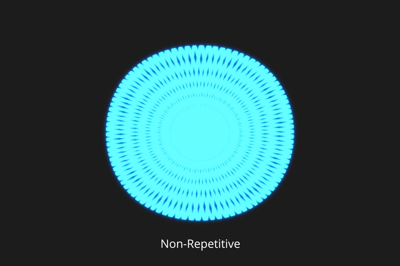
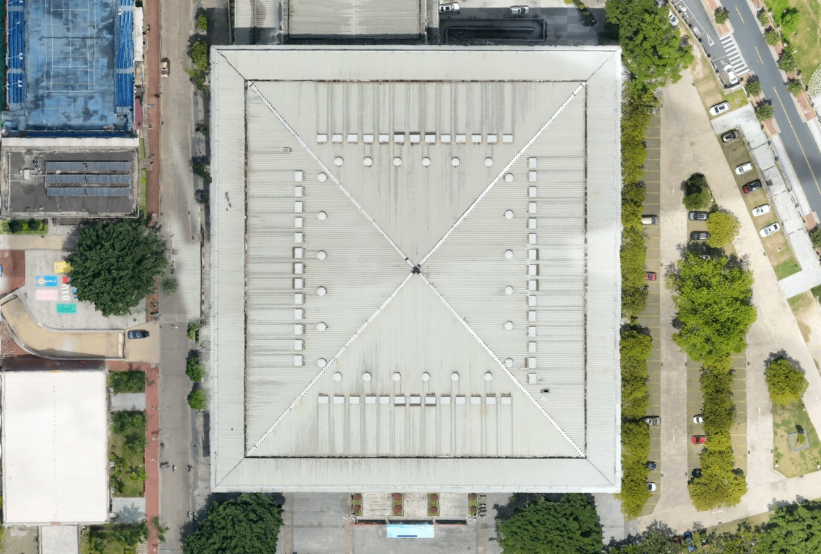
Dual 100MP RGB Cameras – Ultra-Wide, Ultra-Clear, Ultra-Efficient
4/3 CMOS sensors, mechanical shutter
Supports pixel binning → effective 25MP high-quality images in low light
107° ultra-wide FOV → very large area covered per capture
With only 20% LiDAR sidelap, a single mission generates complete DOM & DEM
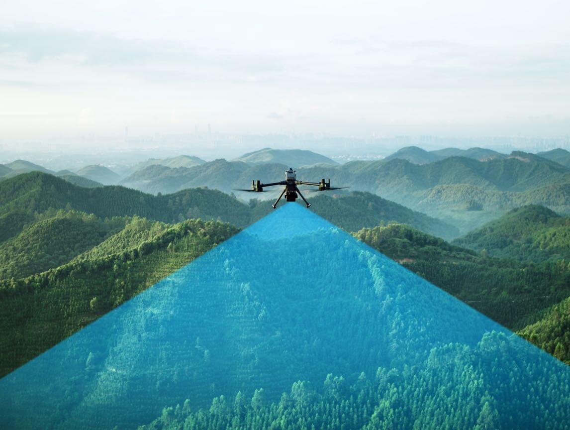
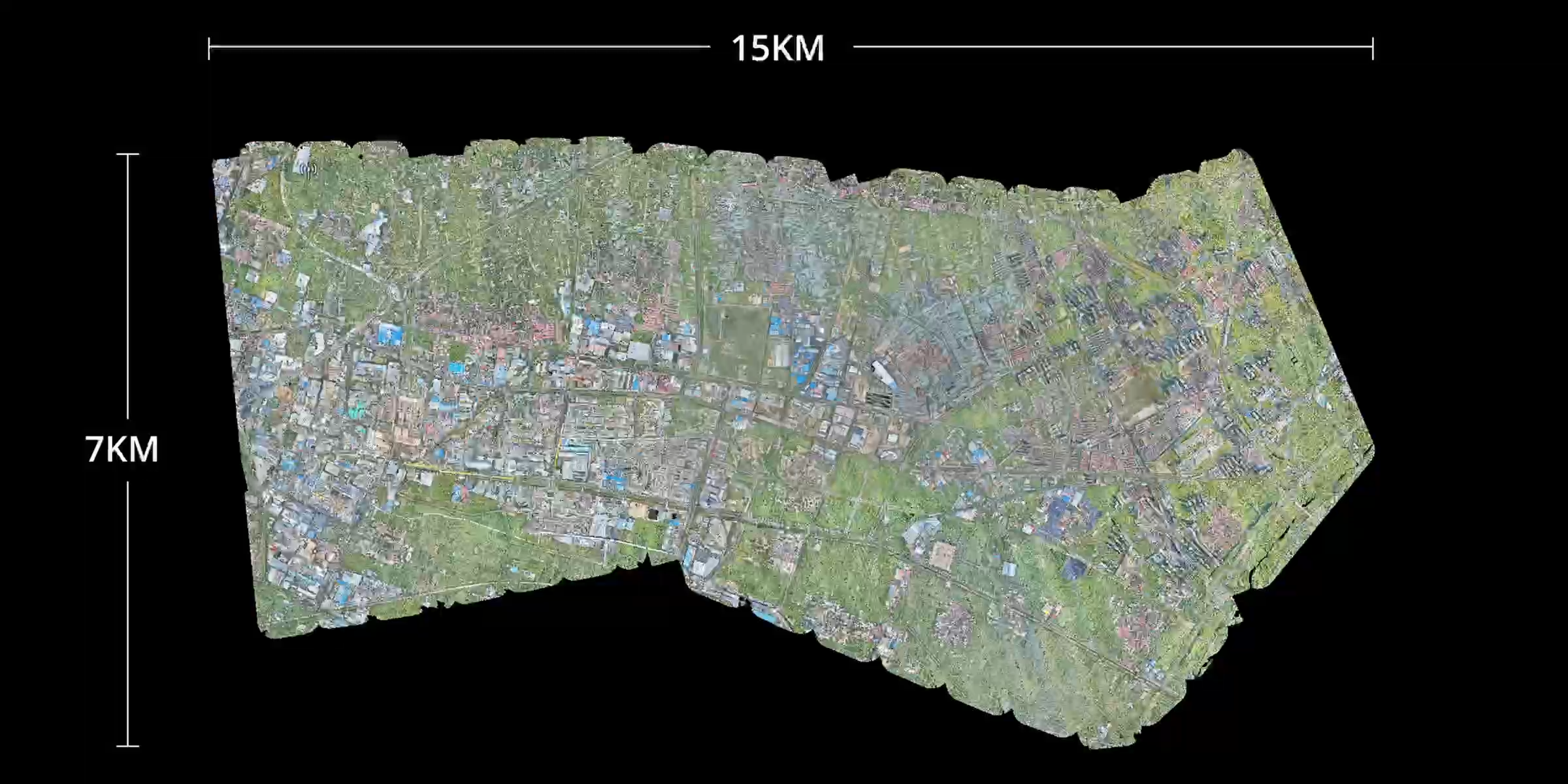
Maximum Efficiency
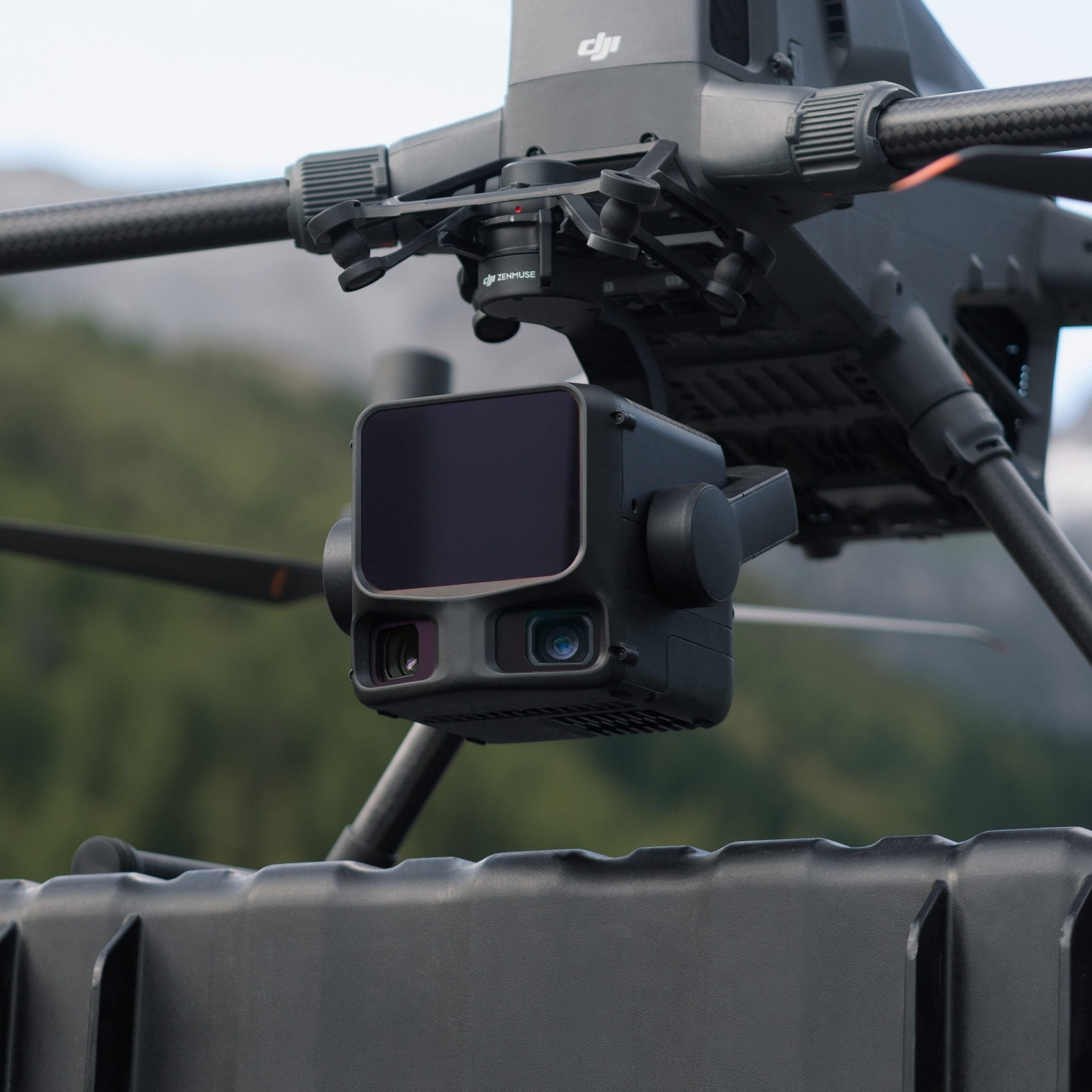
Combined with Matrice 400, each flight can cover up to 10 km², achieving 100 km² per day.
High Accuracy – Professional Survey-Grade
Next-Generation POS System
Heading accuracy: 0.02°
Pitch accuracy: 0.01° (post-processed, 1σ)
LiDAR range repeatability: 5 mm at 150 m
LiDAR Data Accuracy
Vertical error < 3 cm at 120 m
< 5 cm at 300 m
< 10 cm at 500 m
→ Meets 1:500 / 1:1000 / 1:2000 mapping standards.
Point clouds from L3 are over 2× thinner than L2, supporting advanced analysis.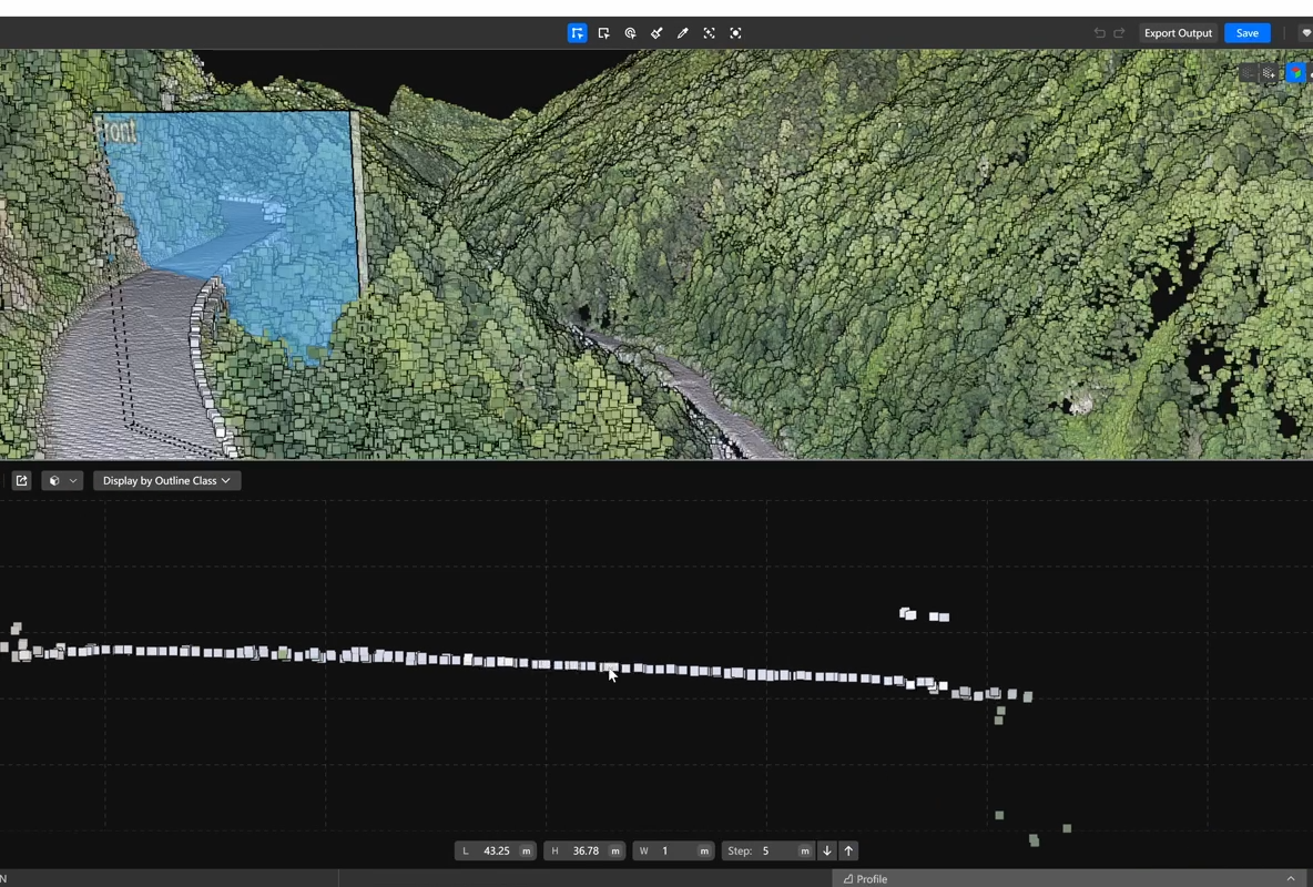
Photogrammetry Accuracy
GSD 3 cm at 300 m altitude
No GCPs required thanks to real-time synchronized positioning
Penetration Capability – More Accurate Ground Data
Thanks to the small laser spot and high pulse energy, L3:
Captures more ground points
Maintains high completeness under vegetation
Improves DEM accuracy and surface reconstruction
High Efficiency – Large-Scale Mapping Performance
Coverage up to 100 km² per day
With DJI Matrice 400:
10 km² per flight at 300 m altitude
Stable operation supports 100 km² per day
→ Ideal for large-area surveys and high-speed mapping tasks.
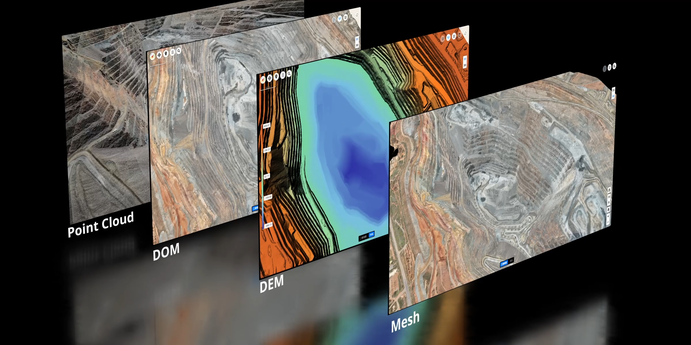
Multiple Data Types in a Single Flight
Zenmuse L3 simultaneously collects LiDAR and RGB data, enabling production of:
DEM (Digital Elevation Model)
DOM (Digital Orthophoto Map)
And various survey-grade datasets
A seamless workflow—from acquisition to processing to application—much simpler than multi-platform systems.
Intelligent Data Acquisition Experience
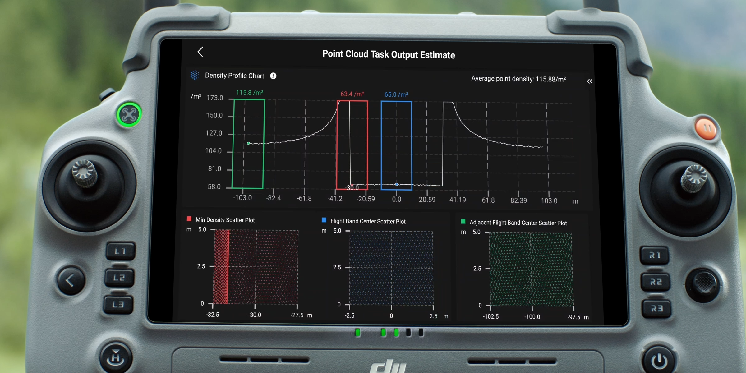
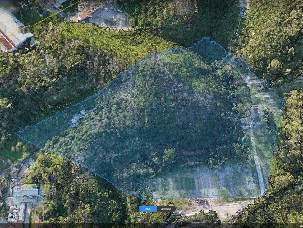
Point Cloud Preview
DJI Pilot 2 automatically recommends flight parameters based on the planned route.
Before takeoff, the system displays:
Point density chart
Point cloud distribution map
→ Helps evaluate expected data quality in advance.
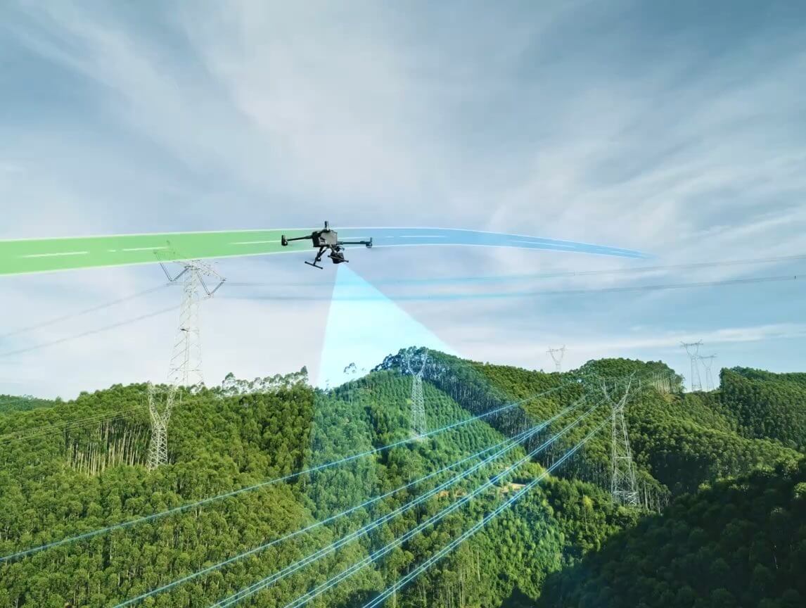
Power Line Follow – Optimized for Power Line Inspection
DJI Pilot 2 suggests optimal parameters for power line routes.
Users can preview point cloud distribution for each segment to ensure detailed capture of:
Lines
Towers
Suspended structures
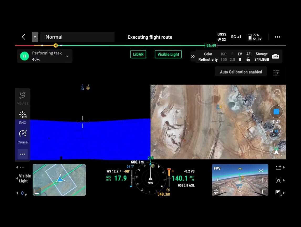
Flexible Split-Screen View
Pilot 2 supports side-by-side viewing of any two data sources:
Point Cloud
RGB
Vision Assist
Vision Assist provides a forward-facing view when the RGB camera is angled downward—reducing risk and improving safety.
Real-Time Point Cloud
Zenmuse L3 supports real-time SLAM point cloud, displaying live 2D and 3D models during flight.
Users can:
Track collection progress
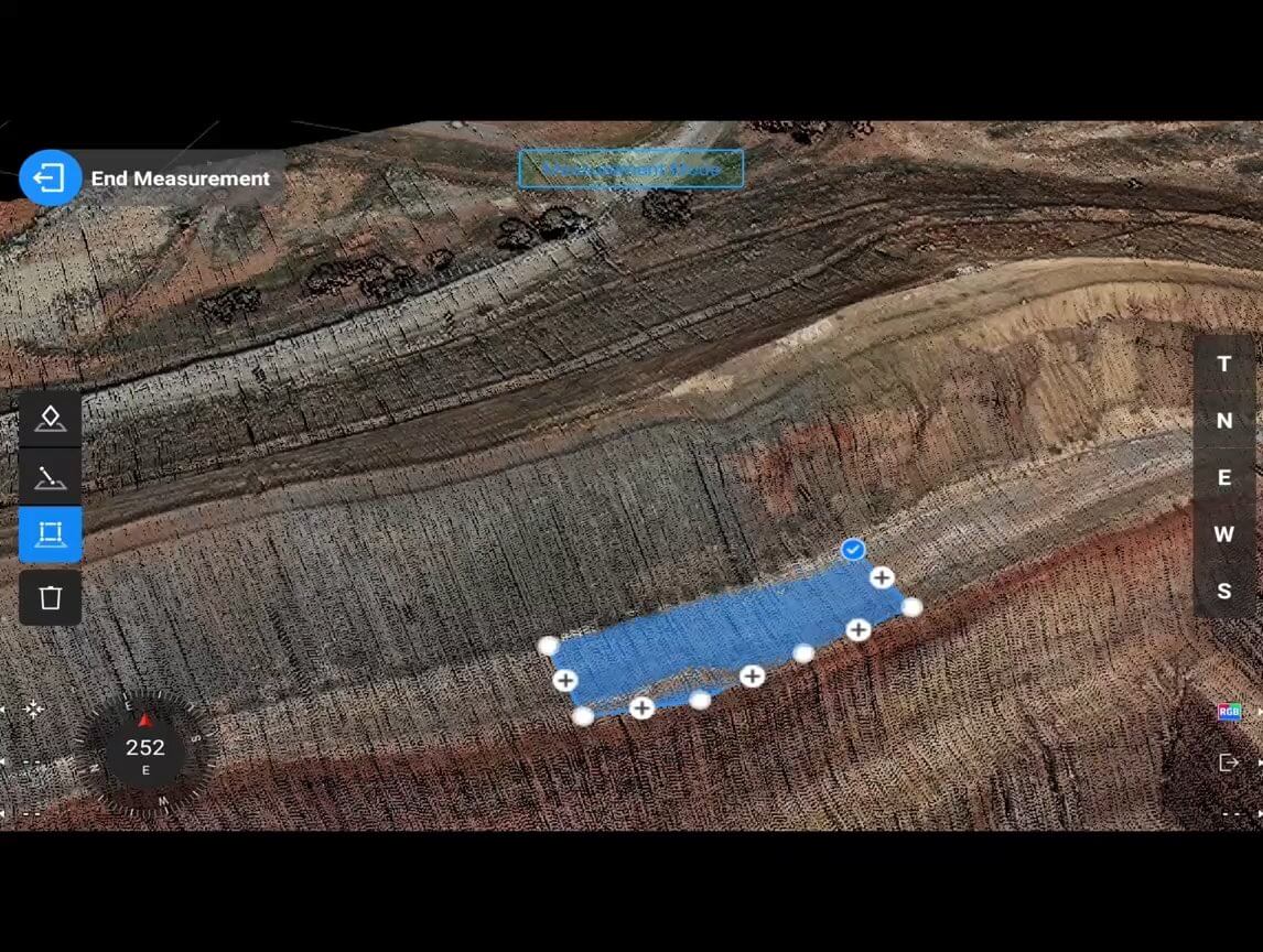
Measure directly in real time
Sync point cloud instantly to DJI FlightHub 2 for rapid response in emergencies or field missions
Cloud-Based Point Cloud Measurement
Compatible with FlightHub 2 for:
Real-time point cloud viewing & management
Detailed route planning
Marking & sharing key points
Measuring area, length, and volume directly on the cloud
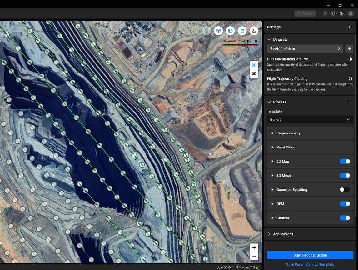
Data Processing – Fast, Accurate, Complete
Integrated PPK Processing
DJI Terra supports robust PPK, compatible with:
D-RTK 3 Mobile Station
Standard base station data
L3 achieves centimeter-level accuracy even without RTK signal or network connectivity.

LiDAR Gaussian Splatting & Fusion Modeling
DJI Terra supports:
LiDAR reconstruction using Gaussian Splatting
Fusion-based modeling
→ Produces smoother, more detailed, and more realistic 3D models.
Fusion-Based Modeling – RGB + LiDAR Unified
Using DJI Terra, users can deeply integrate LiDAR and RGB data to generate:
High-accuracy point cloud
Orthomosaic map
Full 3D mesh
Benefits:
More complete models
High detail in complex areas (bridges, substations, transportation structures)
Better color and geometry consistency
Suitable for energy, transportation, construction, and infrastructure industries.
Data Application
Smart Filter – Intelligent Semantic Classification
DJI Modify automatically identifies and separates:
Ground
Vegetation
Buildings
Power lines
Utility poles
Other objects
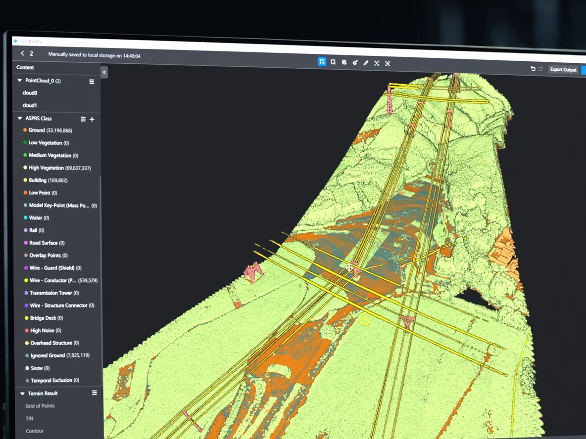
Users can refine results with Quick Selection and Structure Selection for high-efficiency processing.
Profile Tool – Detailed Cross-Section Analysis
DJI Modify allows flexible selection of point cloud cross-sections to:
Analyze terrain changes
Measure construction features
View elevation, slope, and structure
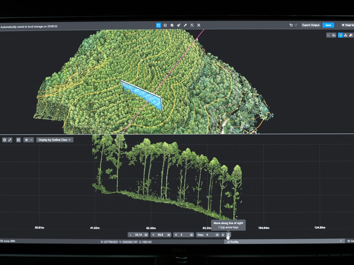
Essential for engineering surveys, planning, and advanced terrain analysis.
Comprehensive Output Capabilities
Together with DJI Modify, Zenmuse L3 produces:
Semantic point cloud
DEM
TIN
Point grid
Contour lines
Multiple visual layers
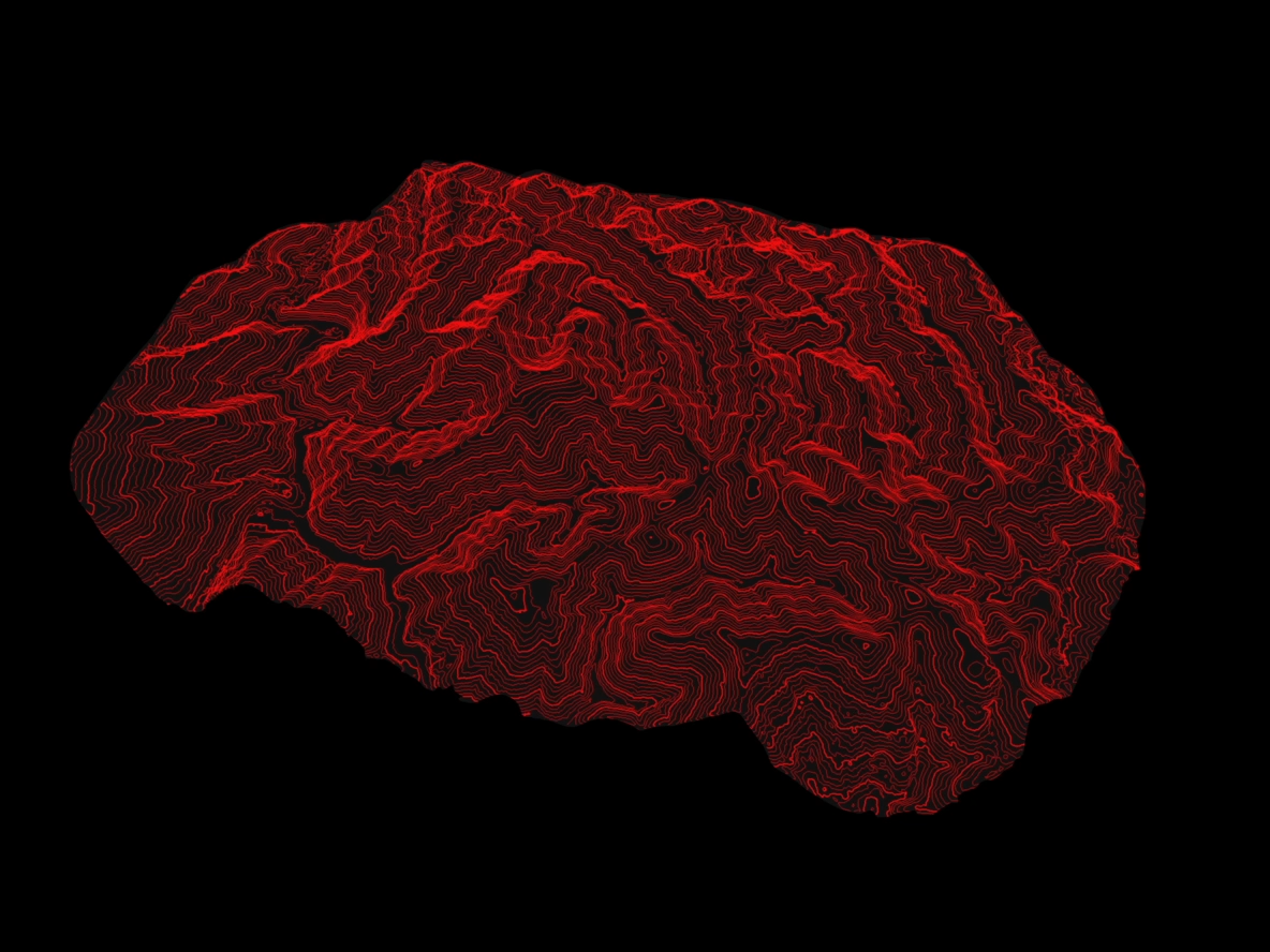
Perfect for CAD, GIS, surveying, construction, and engineering design workflows.
Data Security
Supports CFexpress™ card encryption, preventing unauthorized access
Matrice 400 offers:
One-tap log deletion
AES-256 encrypted video transmission
→ Ensures sensitive data is always protected.


