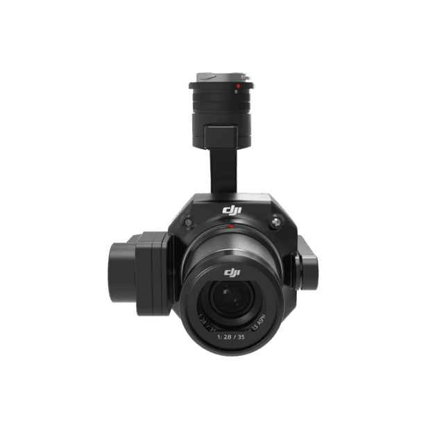
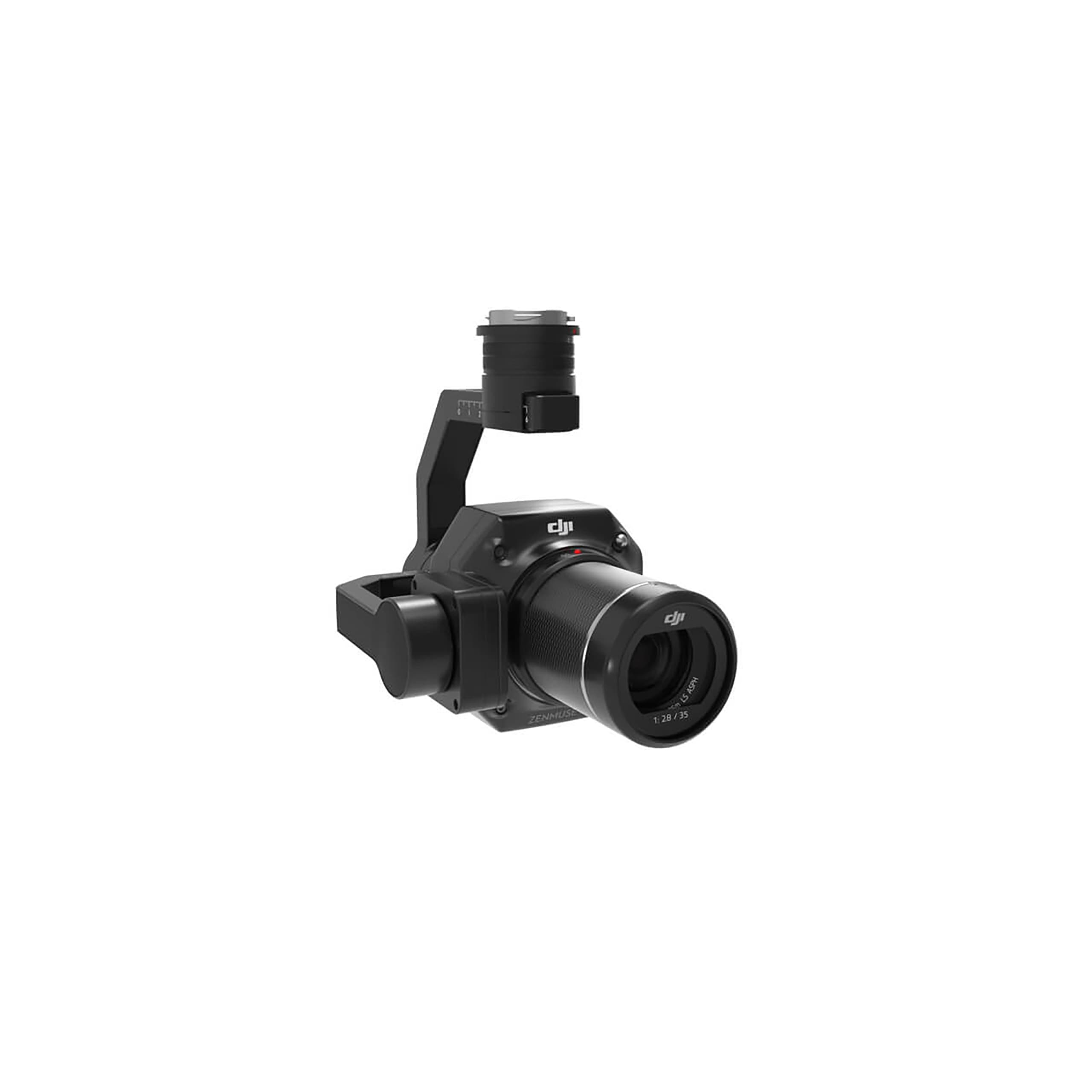
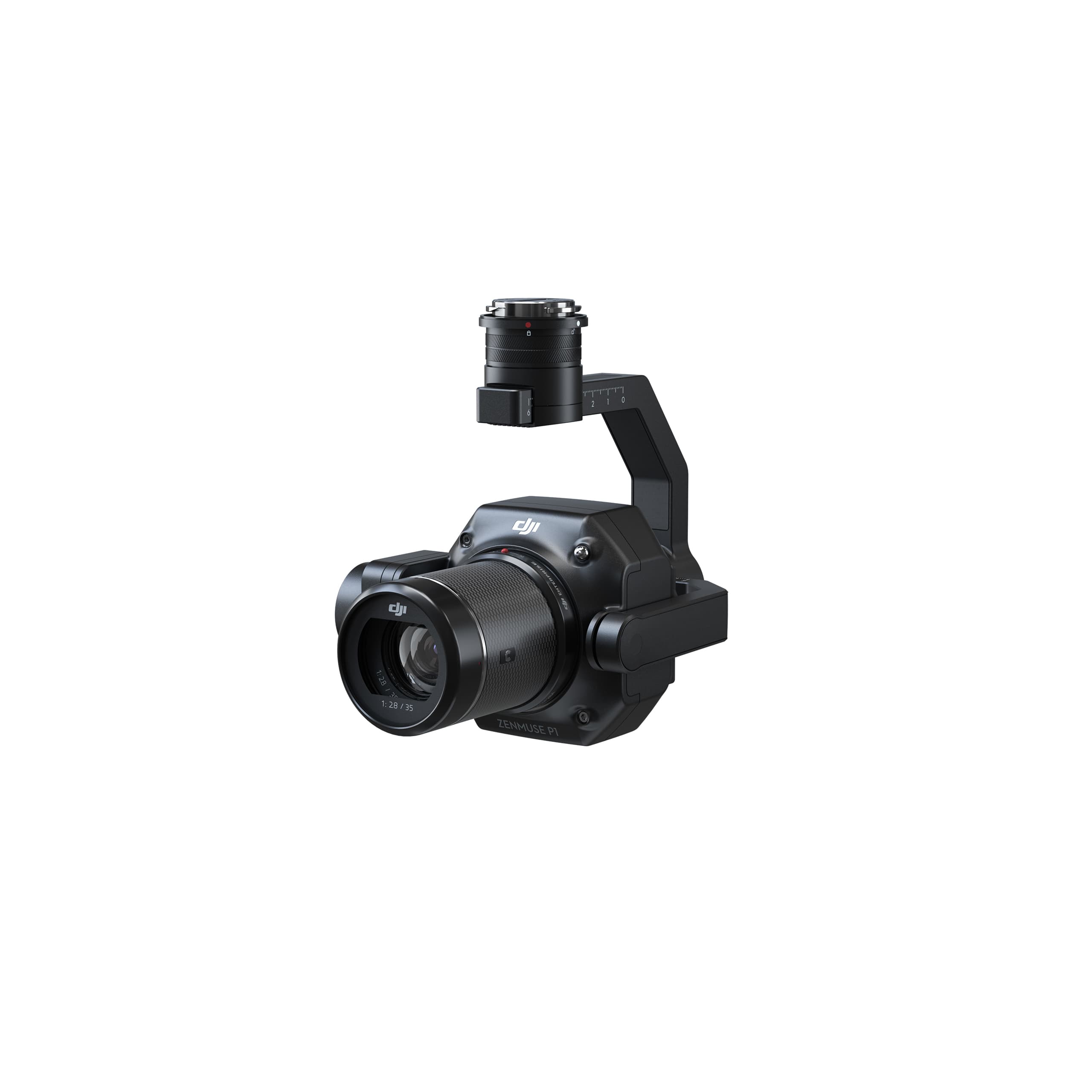
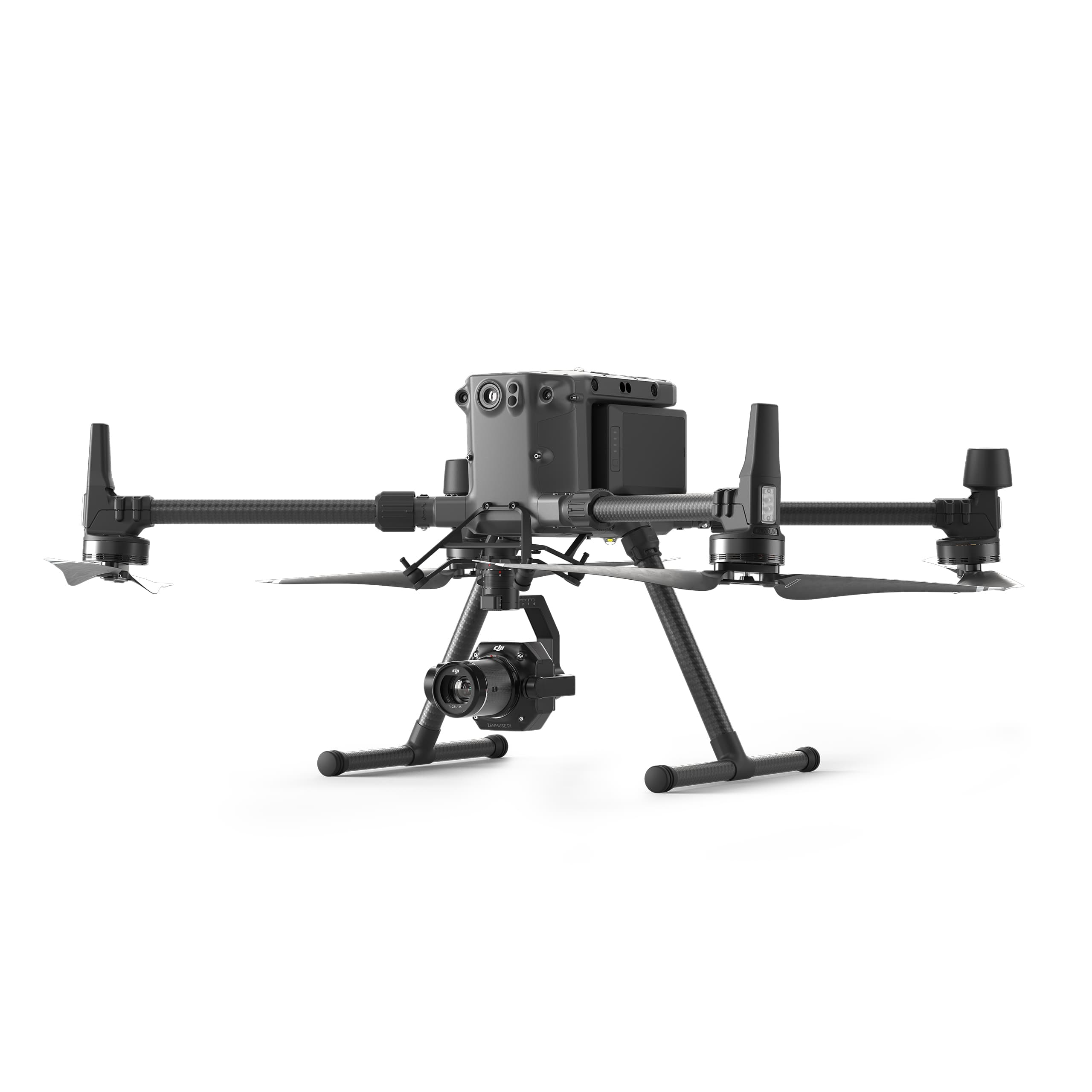
Zenmuse P1
The Zenmuse P1 integrates a full-frame sensor with interchangeable fixed-focus lenses on a 3-axis stabilized gimbal. Designed for photogrammetry flight missions, it takes efficiency and accuracy to a whole new level.
DJI Zenmuse P1 – The Professional Full-Frame Aerial Photography Solution
45 MP Full-Frame Sensor – Exceptional Detail and Clarity
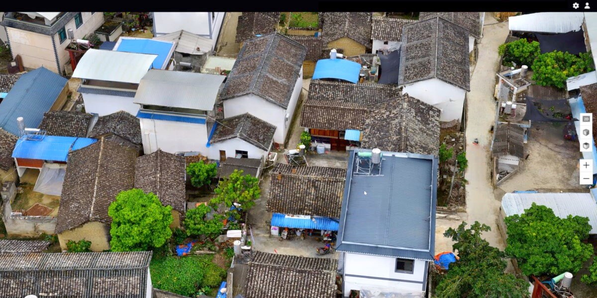
The Zenmuse P1 features a 45-megapixel full-frame sensor that delivers stunning image quality and exceptional detail, making it ideal for precision mapping and 3D modeling.
With large 4.4 μm pixels, the camera performs brilliantly even in low-light environments.
It supports interchangeable DJI DL lenses (24 mm, 35 mm, and 50 mm), allowing operators to choose the optimal focal length for each specific mission.
3-Axis Gimbal with Smart Oblique Capture
Equipped with a stabilized 3-axis gimbal, the Zenmuse P1 ensures sharp, stable imagery even during high-speed or windy flight conditions.
Its Smart Oblique Capture function automatically adjusts camera angles to efficiently cover the entire survey area — reducing flight lines while ensuring complete and accurate 3D data collection.
Global Mechanical Shutter – Fast and Precise
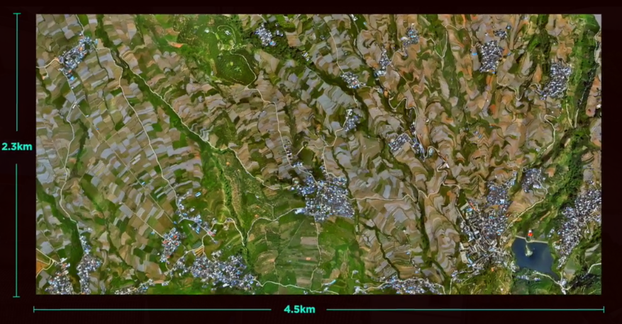
The P1’s global mechanical shutter operates at speeds up to 1/2000 s, eliminating rolling shutter distortion. It can capture an image every 0.7 seconds, providing dense, consistent image datasets for each mission.
With this capability, the Zenmuse P1 can cover up to 3 km² in a single flight, greatly improving efficiency and reducing operational costs for large-scale surveys.
Absolute Time Synchronization – TimeSync 2.0
DJI’s TimeSync 2.0 system precisely synchronizes the camera, gimbal, flight controller, and RTK module down to the microsecond level.
This ensures every image is accurately geotagged, enabling the creation of highly precise maps and 3D models with minimal positional error.
Smart Data Management
The Zenmuse P1 makes data organization simple and reliable.
- All mission data — including images, GNSS coordinates, and TimeStamps.MRK files — are automatically linked to the mission name and time.
- Captured data are stored in a centralized folder for easy access and processing.
- Each image contains complete camera intrinsic and extrinsic parameters, as well as RTK status information, ensuring data integrity and consistency throughout post-processing.
Fieldwork Report – Instant On-Site Data Verification
Immediately after flight, users can review an automatic Fieldwork Report to verify data quality.
The report summarizes the number of captured images, positional data, RTK status, and accuracy — ensuring all required information has been collected before leaving the site.
A Mission Mode for Every Scenario
The Zenmuse P1 supports specialized mission modes tailored to various professional applications:
2D Orthomosaic Mission – Capture high-accuracy orthophotos with wide area coverage.
3D Oblique Mission – Acquire multi-angle imagery for realistic 3D reconstruction.
Detailed Modeling Mission – Collect ultra-high-resolution imagery of vertical or slanted surfaces for detailed modeling, geological studies, heritage documentation, hydraulic engineering, and more.
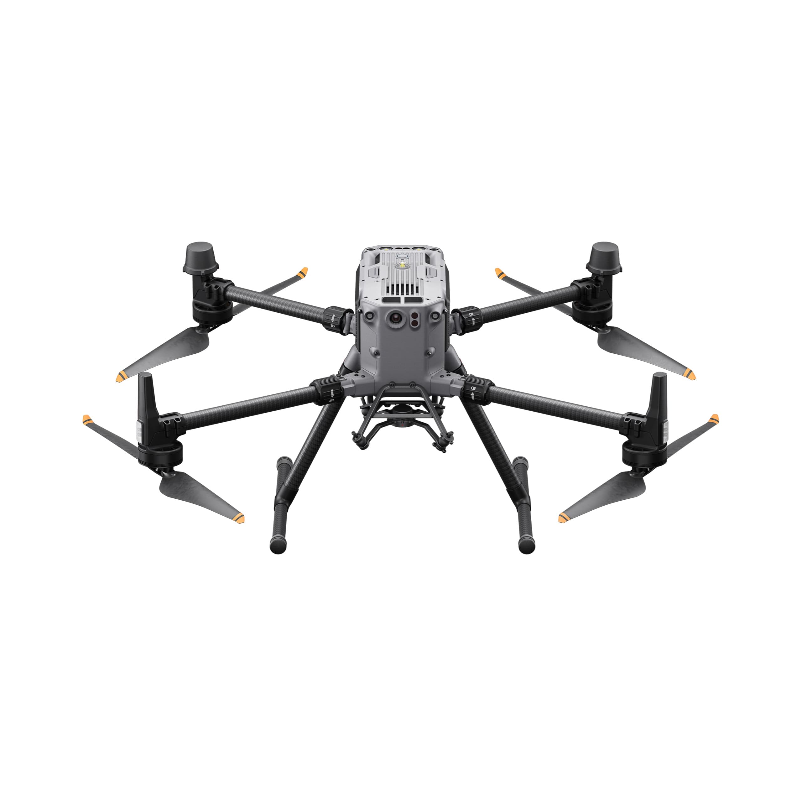
A Complete Aerial Surveying Solution
When paired with the Matrice 300 RTK or Matrice 350 RTK, the Zenmuse P1 becomes a powerful, high-precision geospatial data collection system.
Seamless integration with DJI Terra allows users to process imagery, generate maps and 3D models, and produce professional reports — streamlining the entire workflow from flight to final output.