Additional Response
Diversify your response scope for Hazmat, water rescue, and other unexpected emergencies with multipurpose aerial support.
Disadvantages
Advantages
Solution
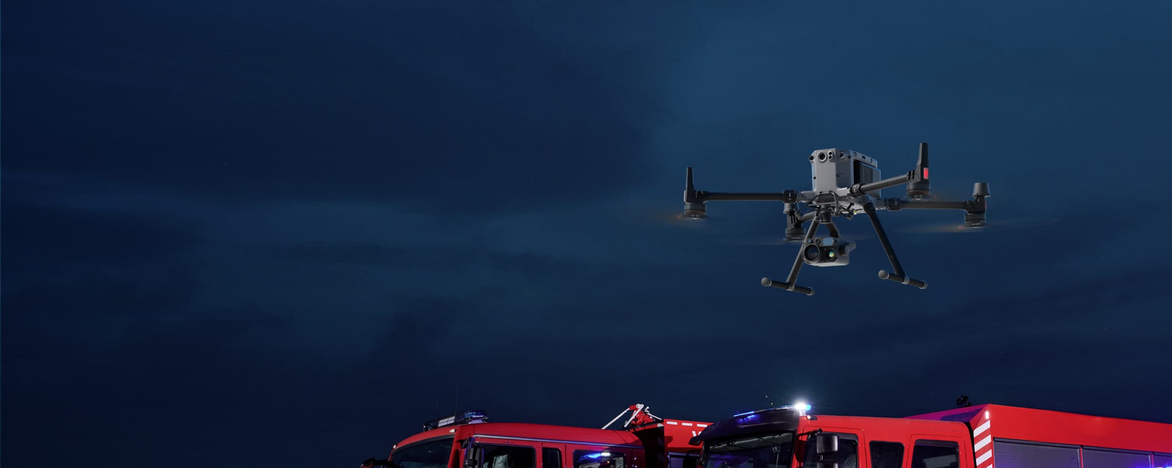
Hazmat Response
The Matrice 350 RTK, equipped with the Zenmuse H30T, brings enhanced thermal capabilities to Hazmat response. Expand the M350 RTK's capabilities with a third-party payload for gas detection sensing.
Reliable multipurpose drone platform easily adapts to the mission needs.
Powerful Infrared Sensor with 1280 × 1024 resolution provides superb thermal imagery.
Robust and reliable, IP54 graded, allows you to fly when is most needed.
Laser range finder to get accurate coordinates of objects up to 3,000 meters range.
Enhanced full-color or black-white night vision to easily identify risks.
Drone Platform
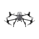
The upgraded flagship drone platform, Matrice 350 RTK, sets a new benchmark for the industry. This next-generation drone platform features an all-new video transmission system and control experience, a more efficient battery system, enhanced safety features, and powerful expansion and payload capabilities. It is fully equipped to bring creative power to any aerial operation.
Xem thêm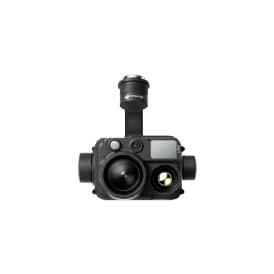

Workflow

Brush Clearance and Inspection
The Mavic 3T offers unparalleled portability and performance for scanning large areas with ease. Its small airframe is convenient to carry on patrol vehicles, and with visual and thermal cameras equipped, it's the ideal solution for identifying wildfire risks.
Compact and lightweight design, less than 1kg and easy to carry in the response vehicle.
Fast and easy deployment, get airborne in around 30 seconds.
640 × 512 thermal radiometric sensor for accurate temperature readings.
Thermal palettes and temperature measurement tools for easy data interpretation.
Automated mapping missions for quick 2D and 3D model data collection.