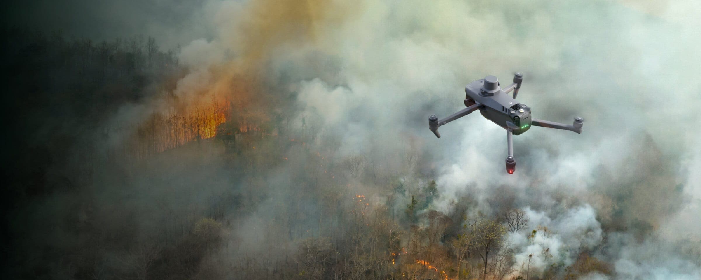
Wildfires
Enhance wildfire response by providing critical aerial information. Identify hotspots more accurately and improve responders' safety while aiding in the strategic deployment of resources.
Disadvantages
The rapid expansion and unpredictability of wildfires complicate ground crews' ability to evaluate the situation in real time and make accurate decisions.
Firefighters face significant risks due to their limited knowledge of the situation.
A lack of information makes it difficult for incident commanders to effectively deploy resources and track the effectiveness of mitigation efforts.
Advantages
Gain real-time aerial insights, enabling firefighters to make informed, strategic decisions amidst the chaos of wildfires.
Enhance personnel safety with advanced situational awareness, thereby reducing firefighters' exposure to hidden dangers.
Collect critical data to optimize resource allocation and monitor the impact of firefighting strategies in real time.
Solution

Portable and Rapid Response
The Mavic 3T offers unparalleled portability for quick reconstruction missions. Easy to carry on fire response vehicles and equipped with visual and thermal cameras, it's the ideal solution for initial risk evaluations.
Compact and lightweight design, less than 1kg and easy to carry in the response vehicle.
Fast and easy deployment, get airborne in around 30 seconds.
640 × 512 thermal radiometric sensor for accurate temperature readings.
Thermal palettes and temperature measurement tools for easy data interpretation.
Drone Platform
Workflow
Mission Execution:
- Fly manually over the affected area looking for hotspots. Switch between infrared and visual views to evaluate the situation. - Use the Link Zoom feature to zoom in simultaneously with thermal and visual sensor. - Select a suitable infrared palette and gain mode for the conditions at hand. - Use orbit flights to perform 360 circular flights around the structure, facilitating the risk evaluation.
Post Mission Documentation:
- Map the affected areas for post-incident reports and reforestation efforts.

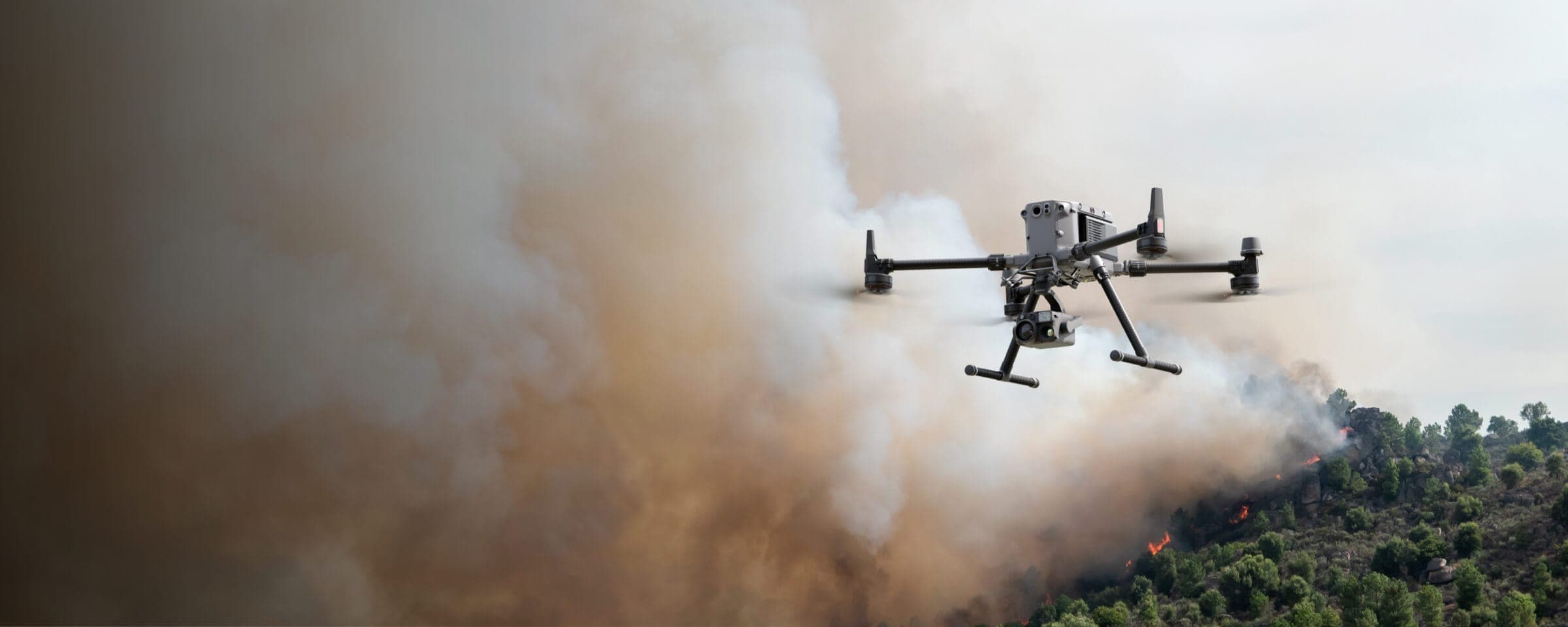
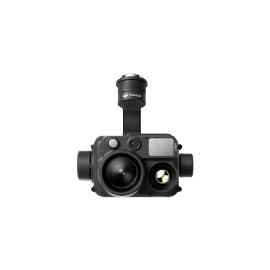
High Performance Fire Response
The Matrice 350 RTK, equipped with the Zenmuse H30T, brings enhanced thermal capabilities to fire response. Using the new H30T Night Scene mode, fire brigades can now gain valuable insights during low-light operations
Reliable multipurpose drone platform easily adapts to the mission needs.
Powerful infrared sensor with 1280 × 1024 resolution provides superb thermal imagery.
Robust and reliable, IP54 graded, allows you to fly when is most needed.
Laser range finder to get accurate coordinates of objects up to 3,000 meters.
Enhanced full-color or black-white night vision to easily identify risks.
Drone Platform

The upgraded flagship drone platform, Matrice 350 RTK, sets a new benchmark for the industry. This next-generation drone platform features an all-new video transmission system and control experience, a more efficient battery system, enhanced safety features, and powerful expansion and payload capabilities. It is fully equipped to bring creative power to any aerial operation.
Xem thêmWorkflow
Mission Execution:
Mission Execution: - Fly manually over the affected area looking for hotspots. Switch between infrared and visual views to evaluate the situation. - Use the Link Zoom feature to zoom in simultaneously with thermal and visual sensors. - Select a suitable infrared palette and gain mode for the conditions at hand. - Install the IR Density Filter to increase the measurement range of the thermal sensor. - Get the coordinates of hotspots using the laser range finder and the Pin Point function. - Share the coordinates with ground teams through the DJI Pilot 2 QR code or DJI FlightHub 2.
Post Mission Documentation:
- Collect the videos and photos captured during the mission through DJI FlightHub 2 or download from the payload SD card to be used as supporting documentation for post-disaster analysis.


