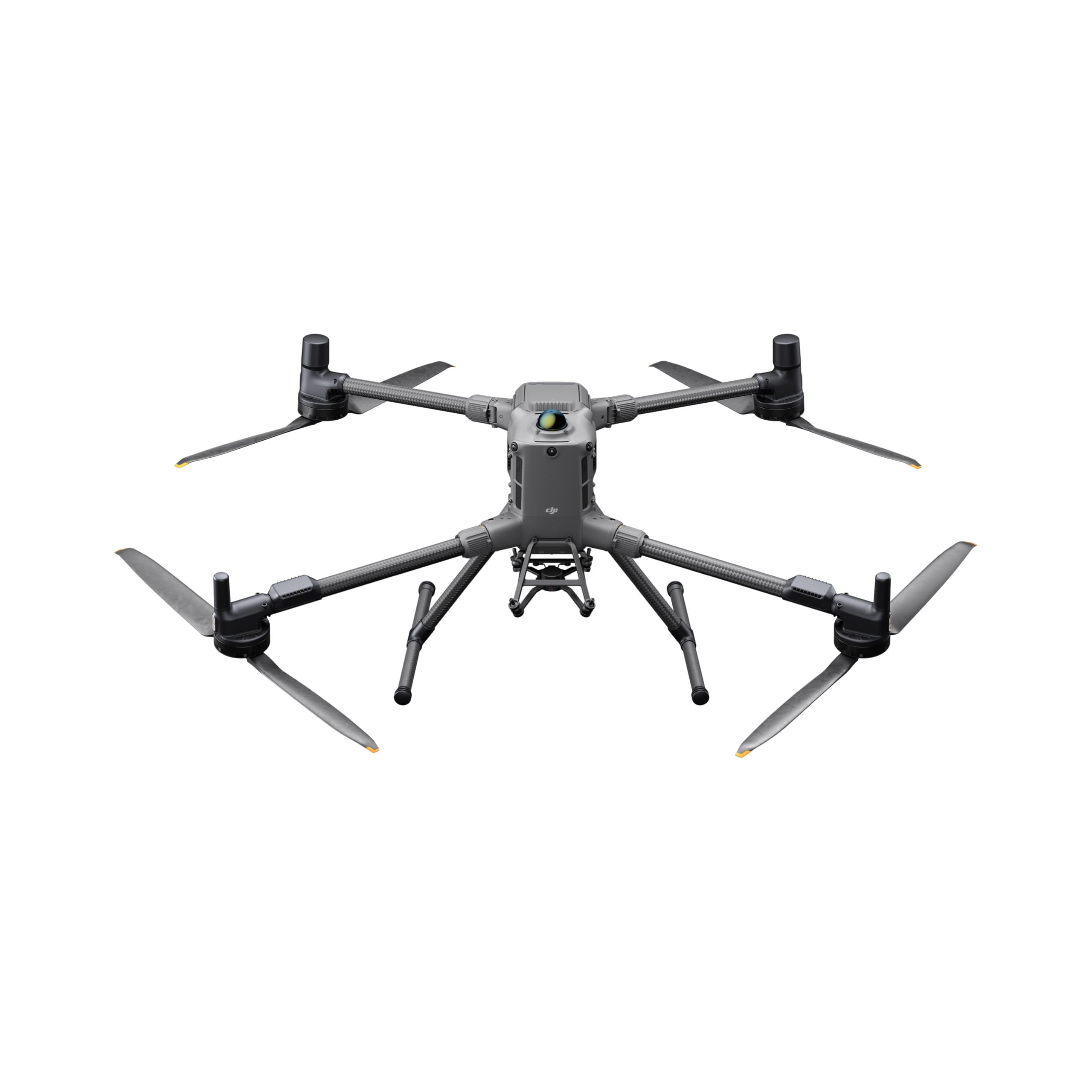
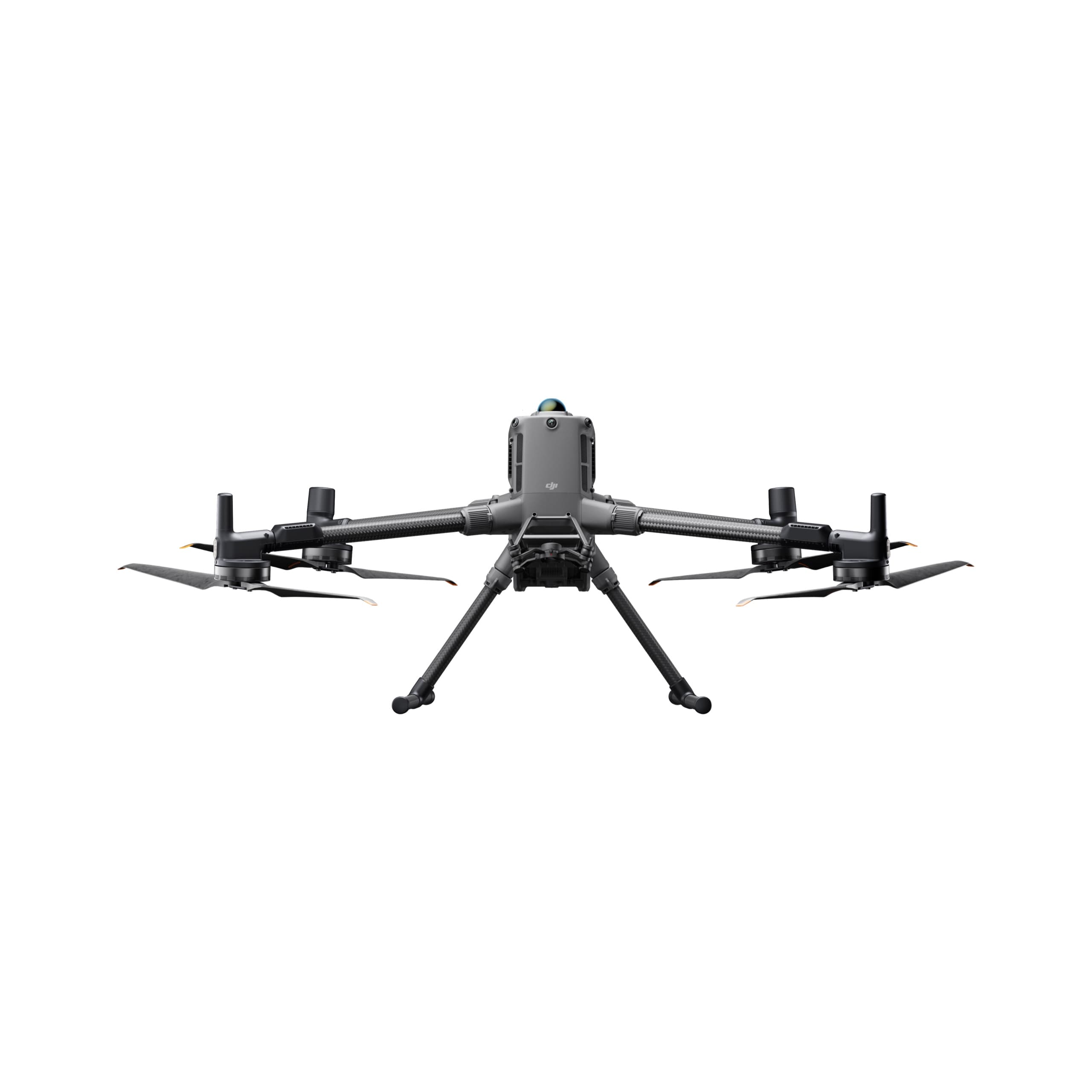
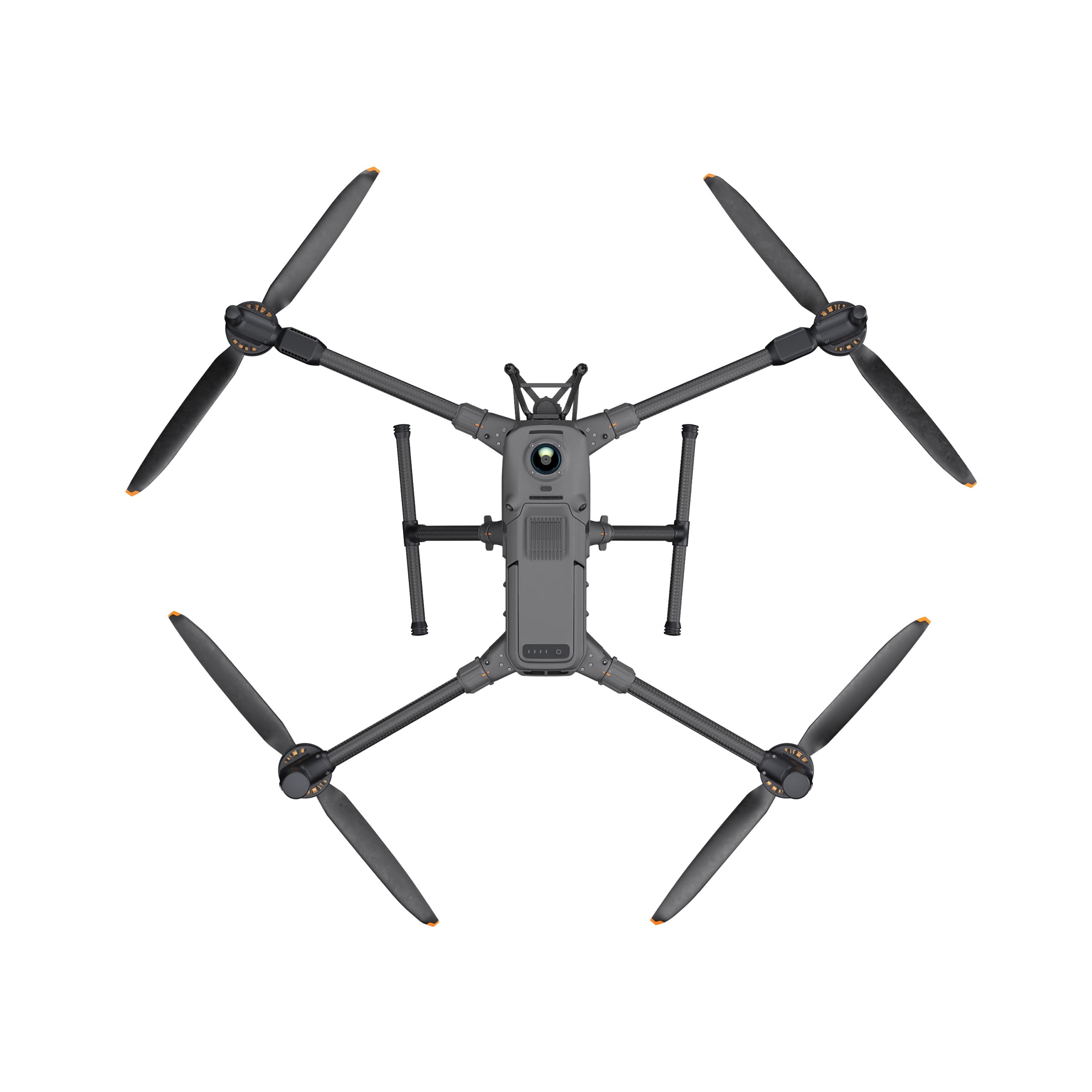
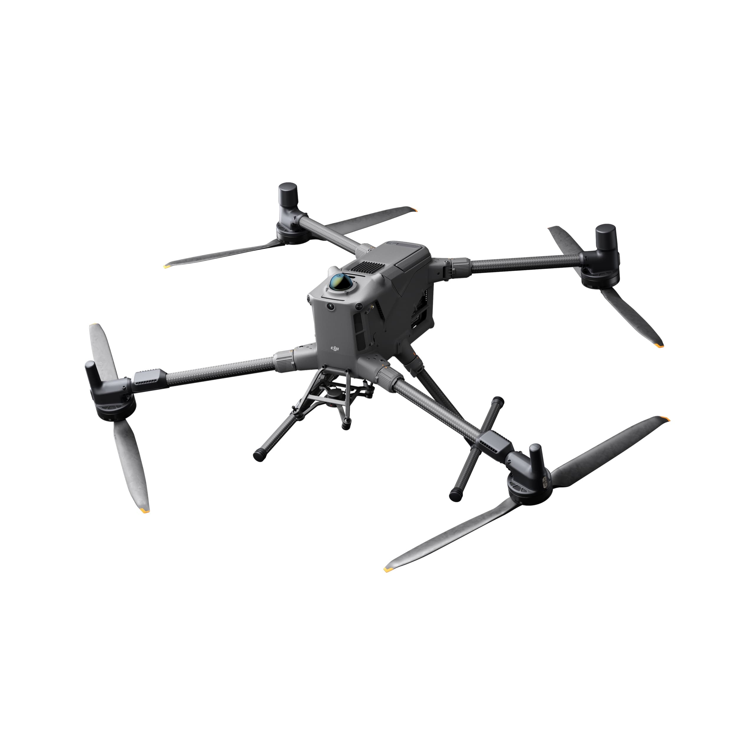
DJI Matrice 400
The upgraded flagship drone platform, Matrice 350 RTK, sets a new benchmark for the industry. This next-generation drone platform features an all-new video transmission system and control experience, a more efficient battery system, enhanced safety features, and powerful expansion and payload capabilities. It is fully equipped to bring creative power to any aerial operation.
Select Version
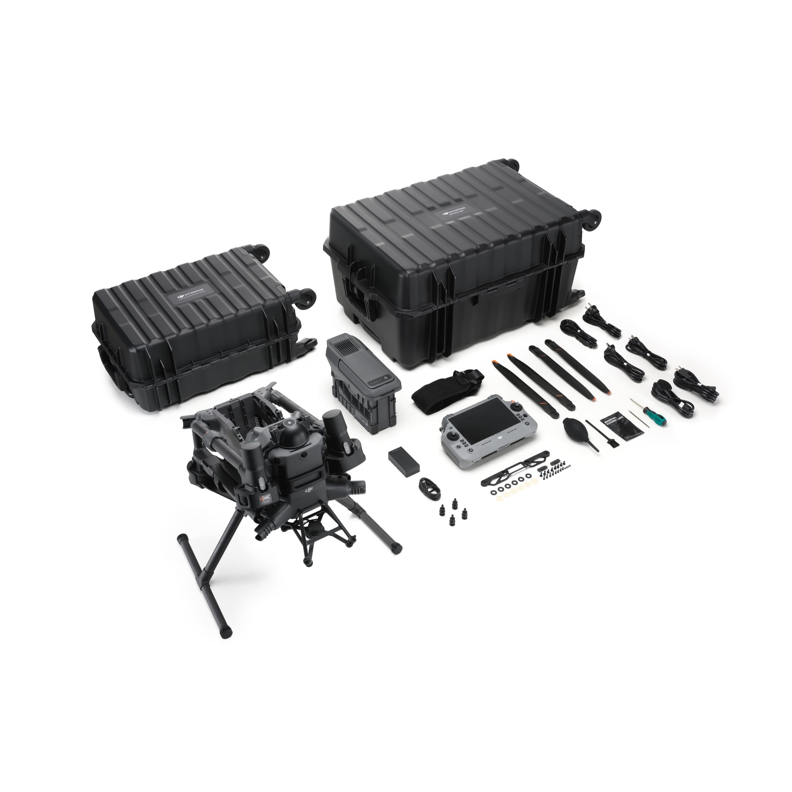
DJI Matrice 400 Worry-Free Plus Combo
DJI MATRICE 400
A Long-Endurance Industrial Drone Platform – High-Voltage Power Line–Grade Obstacle Sensing
The DJI Matrice 400 is a next-generation enterprise drone engineered for demanding missions such as search and rescue, infrastructure inspection, surveying and mapping, public safety, AEC, and power grid inspection. With extended flight endurance, strong payload capacity, power line–level obstacle sensing, enhanced video transmission, and a suite of intelligent automation features, the Matrice 400 becomes an optimal aerial platform for all field operations.
Industry-Leading Flight Performance
The Matrice 400 delivers up to 59 minutes of forward-flight time and 53 minutes of hovering time, ideal for long-duration operations such as:
Search and rescue
Wildfire inspection
Large-area surveying and mapping
Multi-phase construction monitoring
The aircraft can avoid large obstacles—such as buildings and complex terrain—at flight speeds up to 25 m/s, ensuring both efficiency and safety during missions.
Powerful Payload Capacity – Flexible for Multiple Applications
The Matrice 400 supports a maximum payload capacity of 6 kg and is compatible with multiple gimbal configurations:
Single downward gimbal
Dual downward gimbals
One additional upward gimbal
Up to 7 payloads operating simultaneously

The aircraft integrates four E-Port V2 interfaces for easy mounting of:
Optical zoom cameras
Thermal cameras
LiDAR sensors
Spotlights
Loudspeakers
Manifold computing units
Third-party payloads
This versatility enables the Matrice 400 to excel in:
Power line and substation inspection
Construction surveying and mapping
Public safety and city surveillance
Search and rescue
Energy and oil & gas emergency handling
Robust Payload Ecosystem
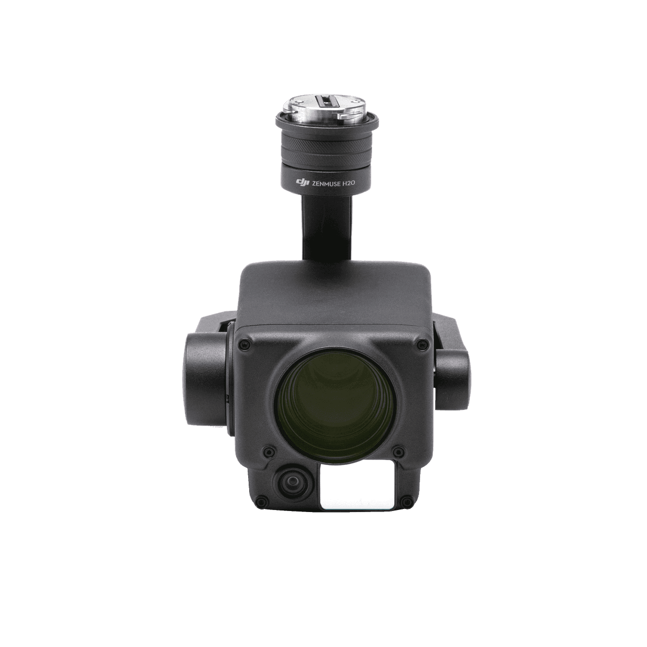
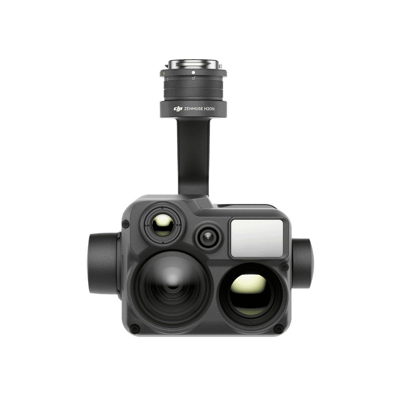
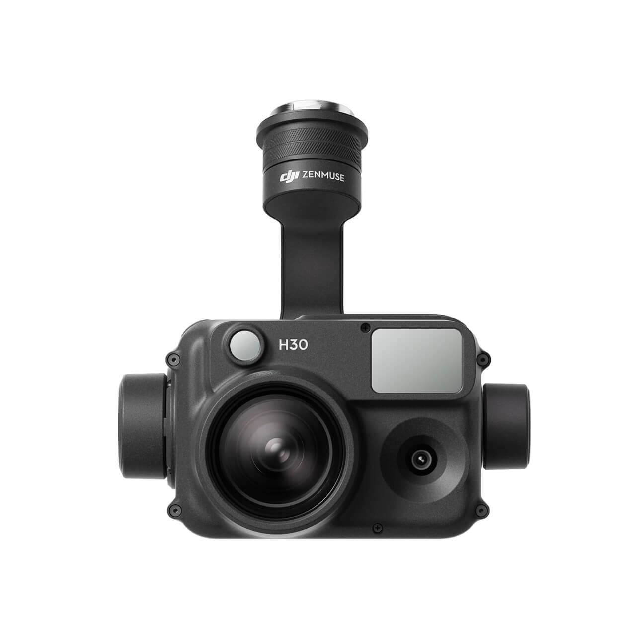
Zenmuse H30 Series
A multi-sensor system featuring a wide-angle camera, zoom camera, thermal camera, laser rangefinder, and IR auxiliary light. Combined with intelligent algorithms, it delivers high-accuracy day and night imaging.
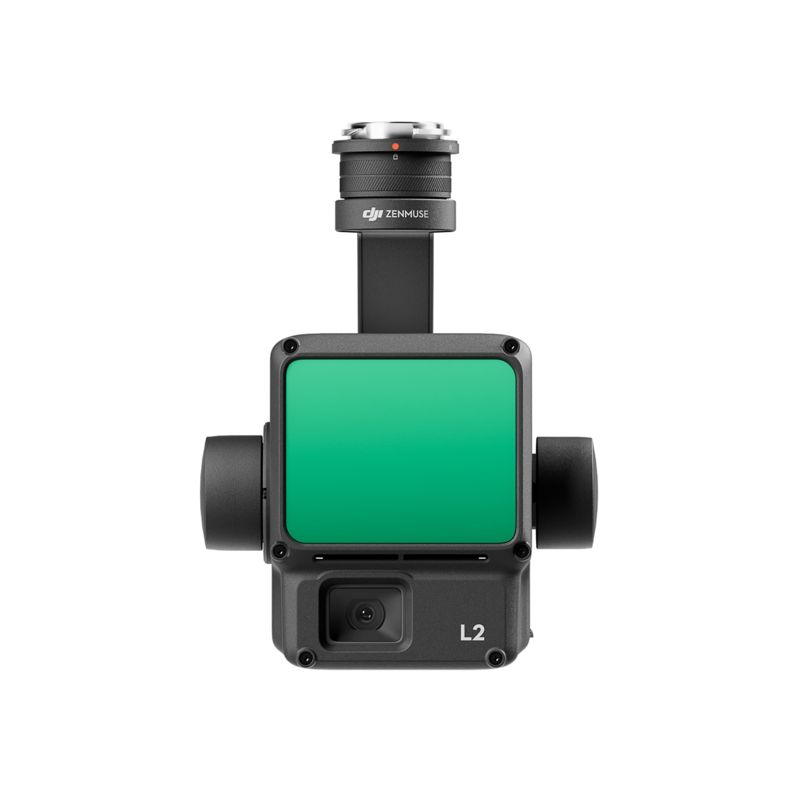
Zenmuse L3
Equipped with a 1535 nm LiDAR module, dual 100 MP cameras, and precision positioning for accelerated geospatial data acquisition.
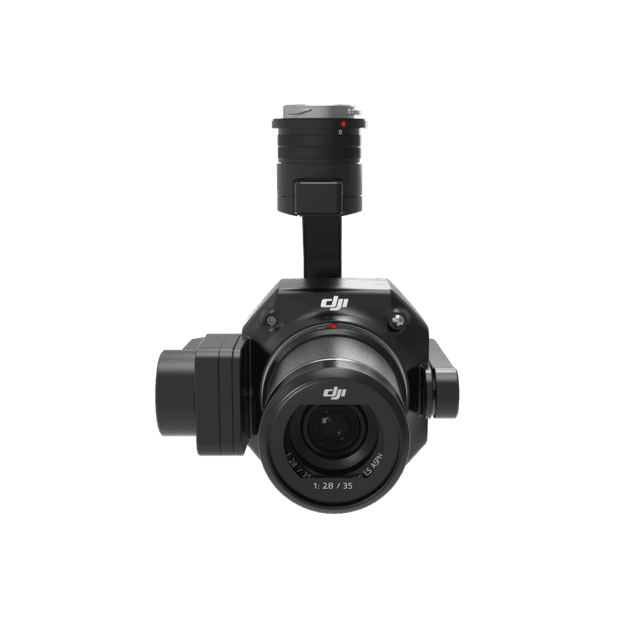
Zenmuse P1
A full-frame sensor with interchangeable fixed lenses mounted on a 3-axis gimbal—ideal for high-precision aerial photogrammetry missions.
Zenmuse S1
A powerful LEP spotlight offering long-range illumination, suitable for nighttime rescue, security operations, and low-light inspections.
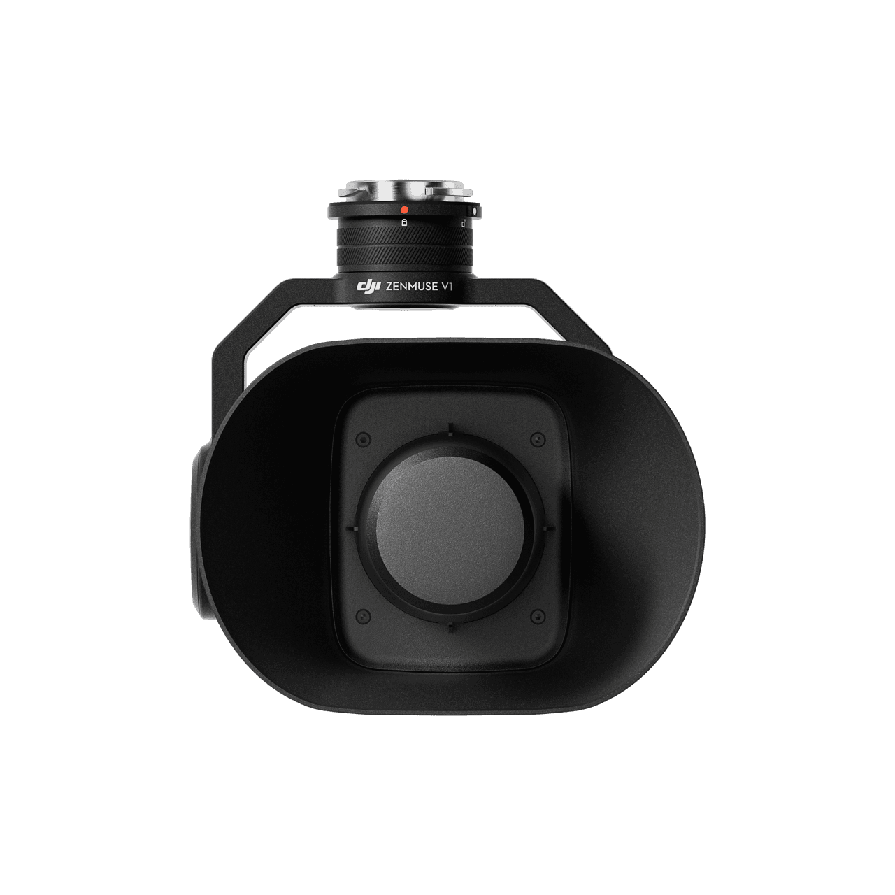
Zenmuse V1
A high-output loudspeaker providing wide diffusion and long-range coverage for aerial broadcasting.
Manifold 3
A compact yet powerful onboard computer delivering real-time AI processing and on-site data analysis.
Safe – Stable – Reliable
Ready for Harsh Environments
The Matrice 400 features IP55-rated dust and rain resistance, operating reliably in temperatures from -20°C to 50°C, making it suitable for hot, humid, icy, or dusty environments.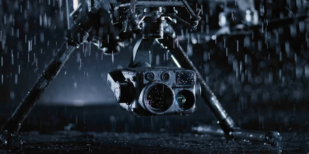
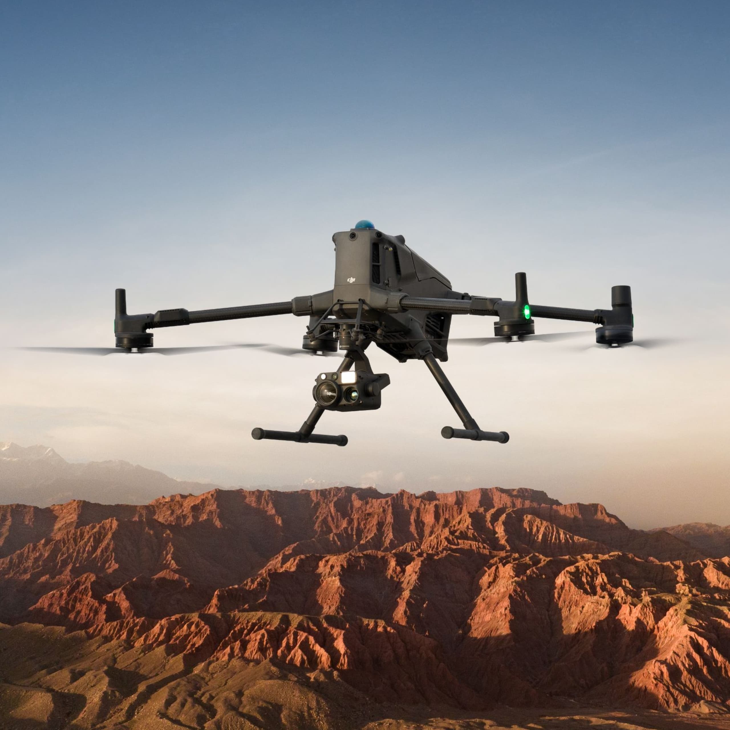
High-Voltage Power Line–Grade Obstacle Avoidance
Integrated sensors include:
Rotating LiDAR
mmWave radar
Low-light color fisheye cameras
These enable detection of even extremely small obstacles such as power lines in complex terrain, mountainous environments, rain, fog, or low-light conditions—making it exceptionally reliable for power grid inspection, substation checks, and large-scale infrastructure tasks.
Stable Long-Range Video Transmission
The O4 Enterprise transmission system provides:
High-resolution video streaming
Multi-antenna support on both the aircraft and remote controller
Strong stability even in high-interference environments
The aircraft supports Sub-2G frequency bands and can automatically switch carriers when using a USB Cellular Dongle, ensuring stable connectivity in both urban and remote regions.
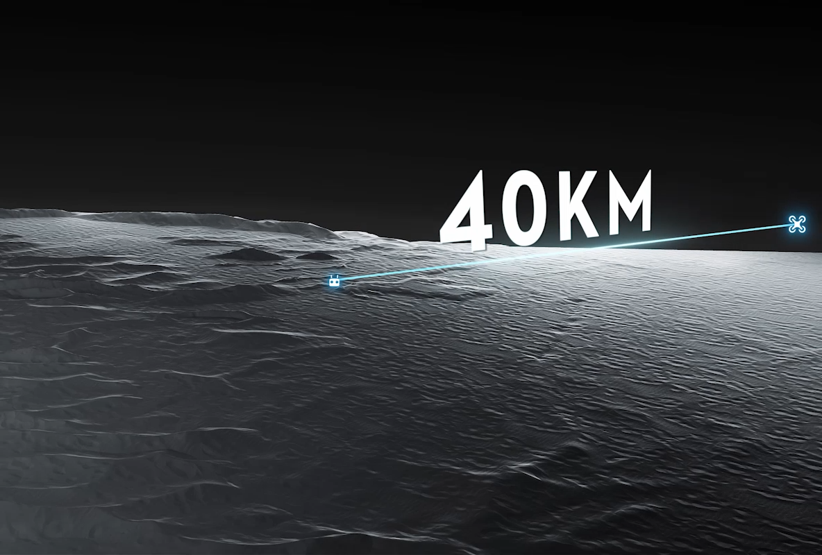
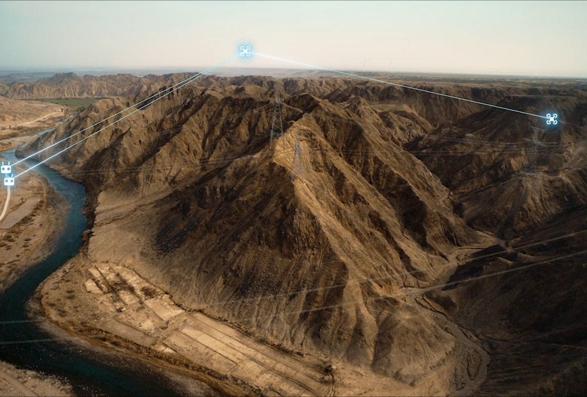
Aerial Relay Transmission
One Matrice 400 can hover at altitude as a relay node, extending video transmission range for another Matrice 400 operating farther away. This is extremely useful for:
Mountainous search and rescue
Wide-area scanning
Operations in rugged terrain
Unified Positioning and Navigation
Multiple sensors work together to enable stable flight close to surfaces such as wind turbines and high-rise glass façades.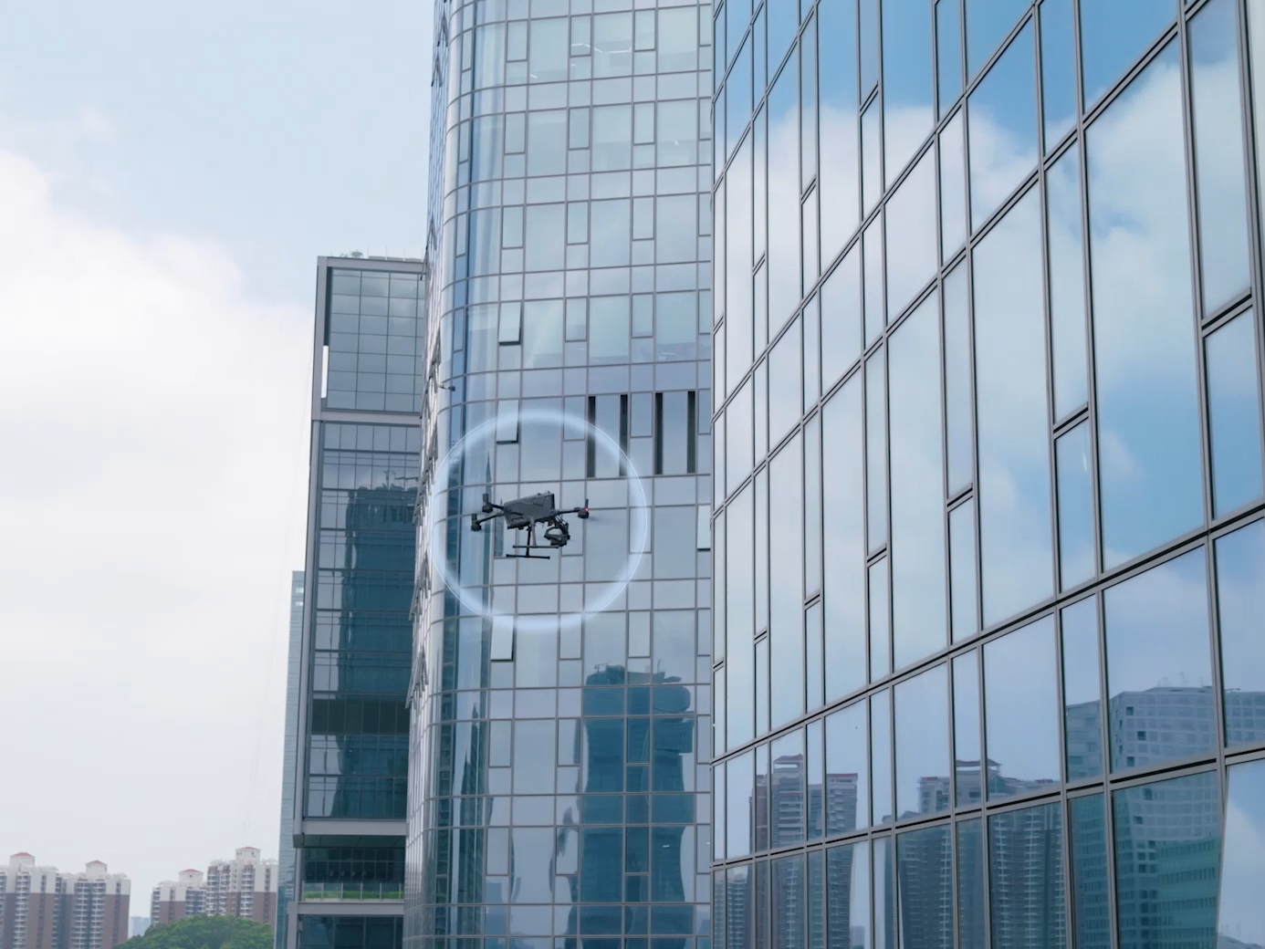
Enhanced Environmental Awareness
Multi-directional sensing provides clearer situational awareness, especially in low-light environments.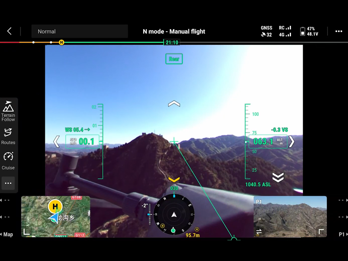
Smarter & More Efficient
Smart Detection
By combining thermal and visual imaging, the system can detect people, vehicles, vessels, and other objects during search or surveillance missions. It also supports high-resolution grid photography and intelligent tracking.
Smart AR Projection
Power Line AR
During power grid inspections, the obstacle sensing system automatically detects frontal wires and displays easily recognizable AR lines on the remote controller screen, giving operators instant environmental clarity and ensuring safer flight.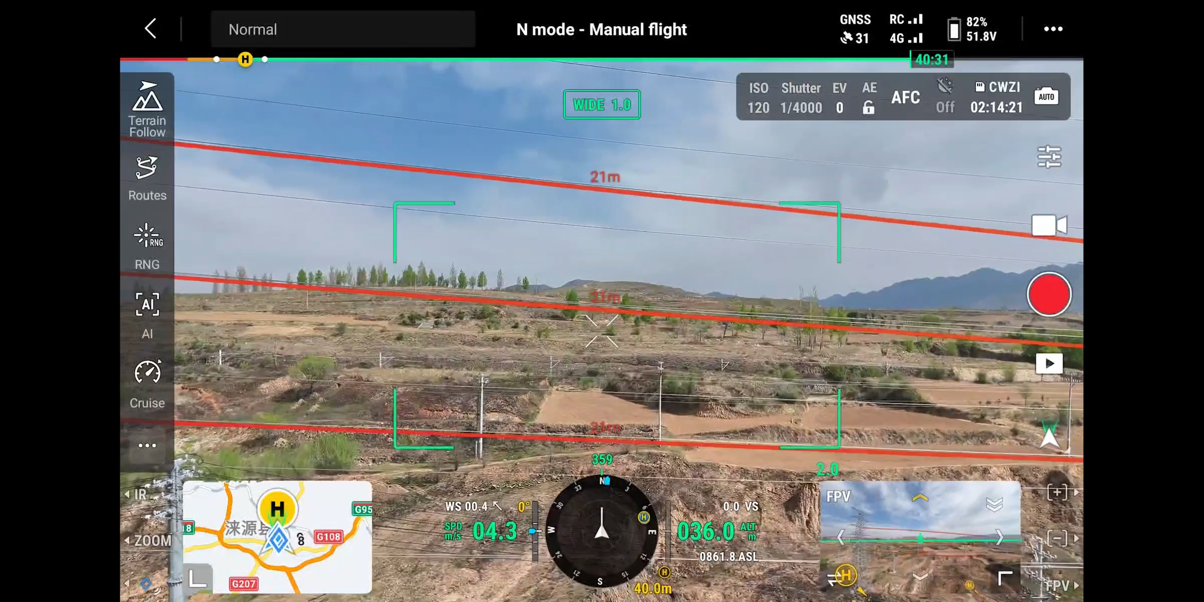
Map View AR
During day or night operations in urban environments, the controller can display real-time building names, landmarks, and highlight major roads for intuitive navigation.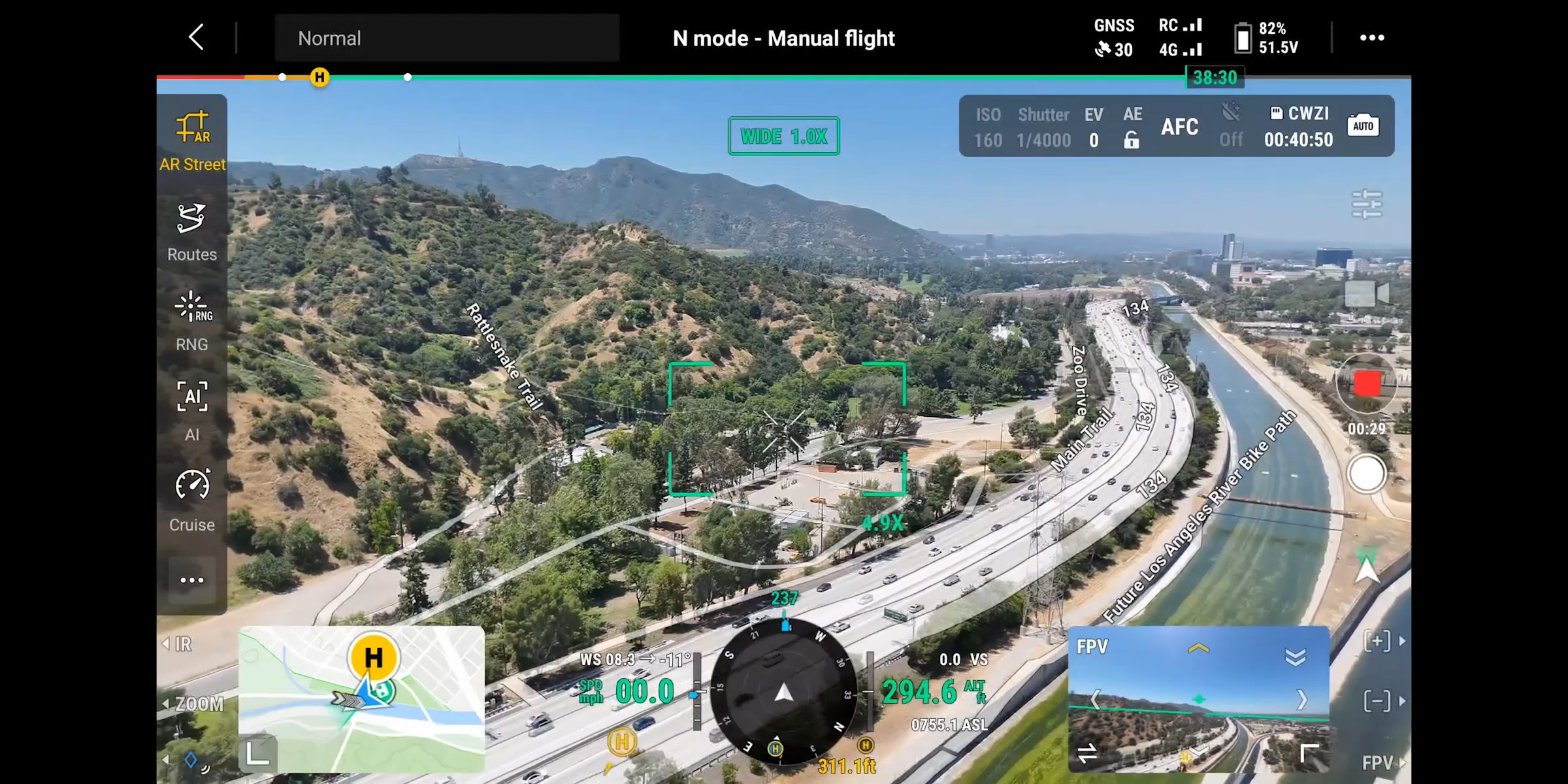
AR Flight Waypoint
The aircraft provides real-time route previews during RTH, obstacle avoidance, and FlyTo operations. When landing, AR Aircraft Shadow assists pilots in confirming precise touchdown points.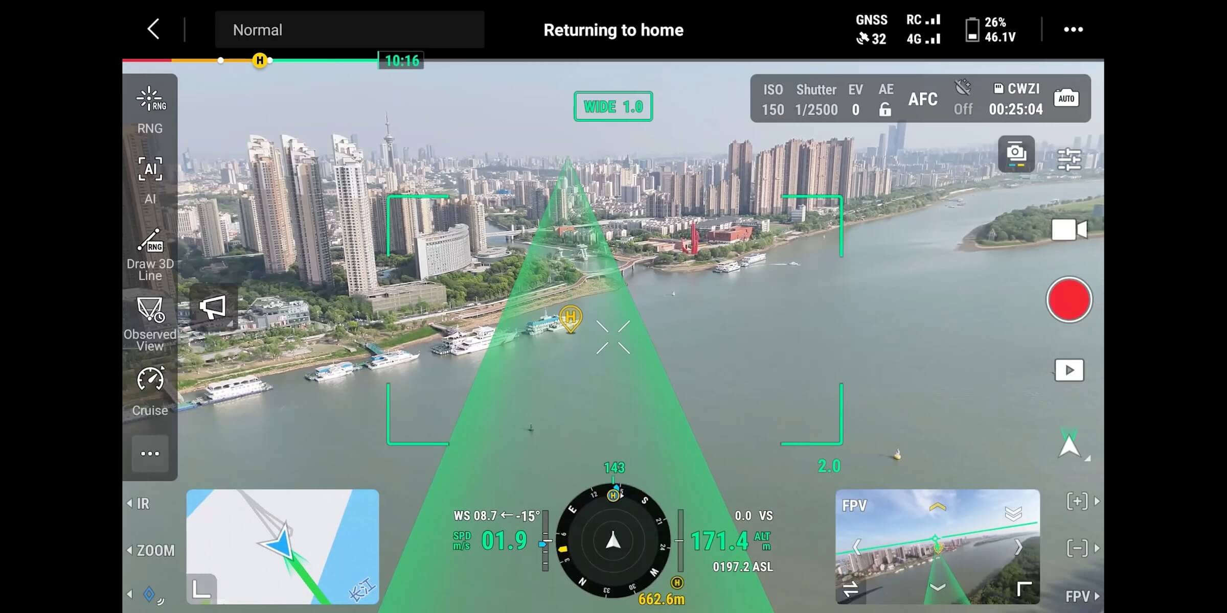
Live Annotations
Without 3D modeling, operators can mark points to determine target locations, draw lines to measure distances between multiple points, and outline polygons to calculate area.
All measurements can sync directly with DJI FlightHub 2, improving team workflow and coordination.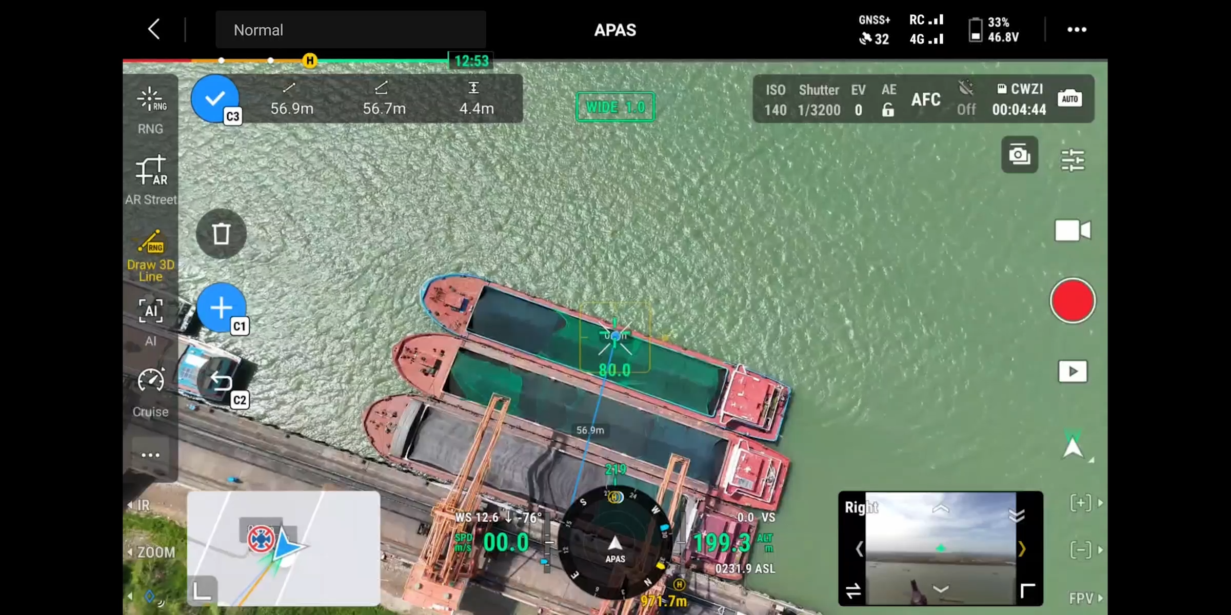
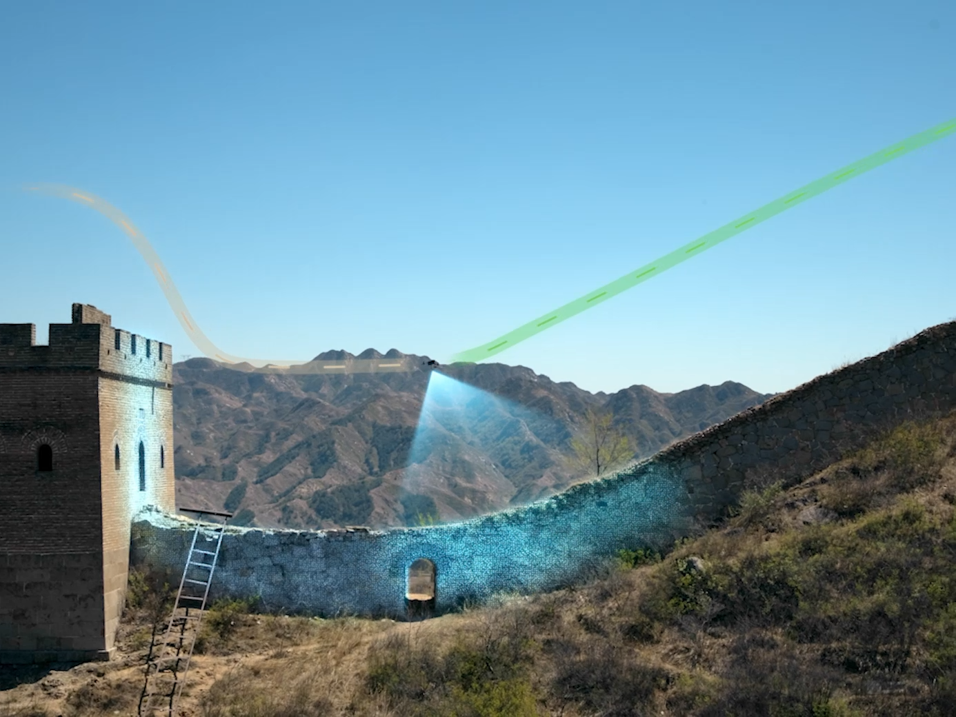
Real-Time Terrain Follow
The drone automatically adjusts altitude based on terrain during both manual and automated flight, maintaining consistent ground distance—critical for:
Wide-area search and rescue
Mapping missions requiring uniform GSD
Infrastructure inspection in complex terrain
Ship Takeoff & Landing
The Matrice 400 can:
Take off from stationary vessels
Land on moving ship decks
Recognize and lock onto landing zones using deck features
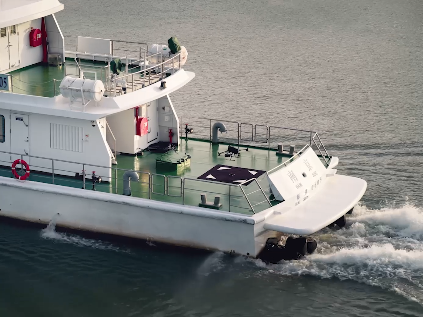
Ideal for maritime surveillance, offshore turbine inspection, and coastal security.
Intelligent Flight Modes
Cruise
Enables stable forward flight without continuously pushing the control sticks. Ideal for:
Long-distance missions
Linear inspections
Power lines, pipelines, or canal surveying
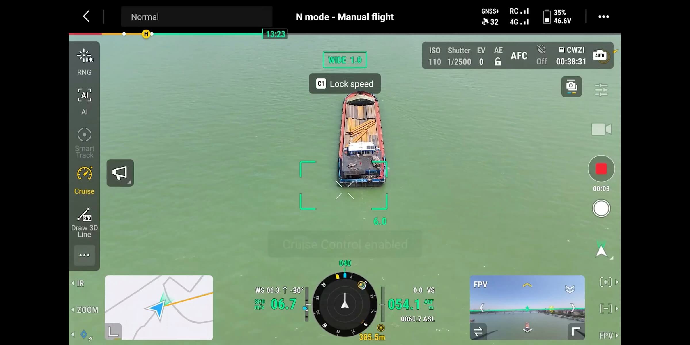
The pilot only makes minor adjustments for heading or speed.
FlyTo
In emergencies or hazardous environments, the Matrice 400 automatically adjusts:
Flight direction
Speed
Path
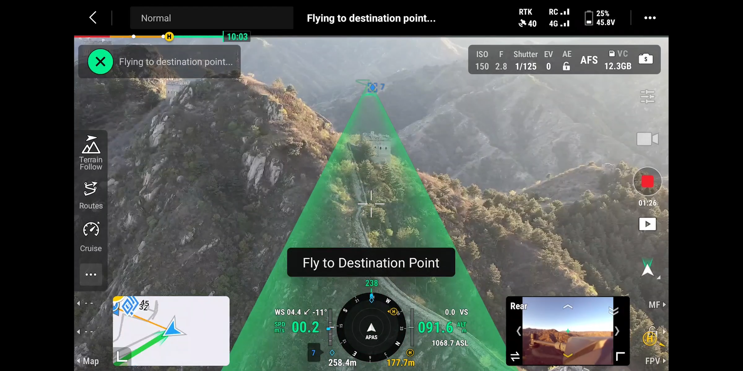
to reach a designated point safely with minimal manual input—especially effective in complex terrain.
Smart Track
Smart Track allows the drone to:
Automatically detect and follow subjects
Adjust zoom dynamically
Maintain clear visuals during tracking
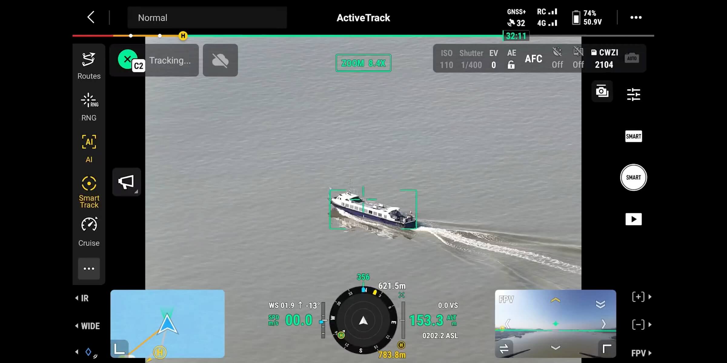
It can re-identify targets even when temporarily obstructed—ideal for:
Security missions
Ground activity monitoring
Search and rescue
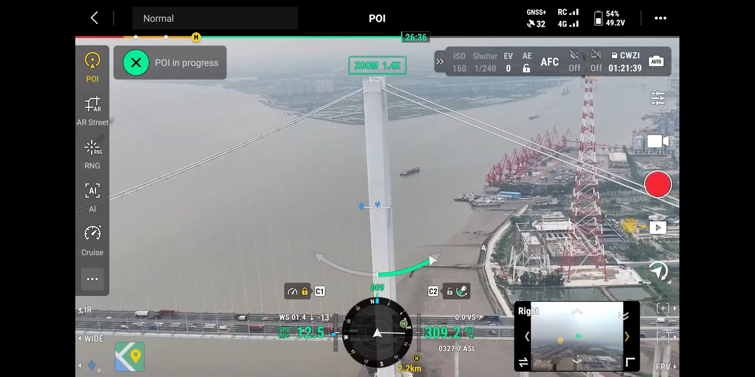
POI (Point of Interest)
POI mode allows the drone to orbit a selected point or area while keeping the camera fixed on the target. Useful for:
Detailed structural observation
Architectural or construction filming
3D modeling around buildings or objects
Mission Automation Made Easier
Power Line Follow – When Paired with Zenmuse L3/L2
With Zenmuse L3 or L2:
The drone can automatically fly along power lines
Rotating LiDAR continuously scans the environment
The aircraft autonomously avoids crossing lines or obstacles

Perfect for:
Distribution line inspection
Corridor safety assessment
Reducing pilot workload during long linear missions
Slope Route & Geometric Route
The Matrice 400 supports 3D or slope-based route planning via DJI Pilot 2 or DJI FlightHub 2. Operators can:
Scan vertical building façades
Survey cliffs, steep terrain, or sloped land
Collect site-specific mapping data
Generate high-accuracy 3D models
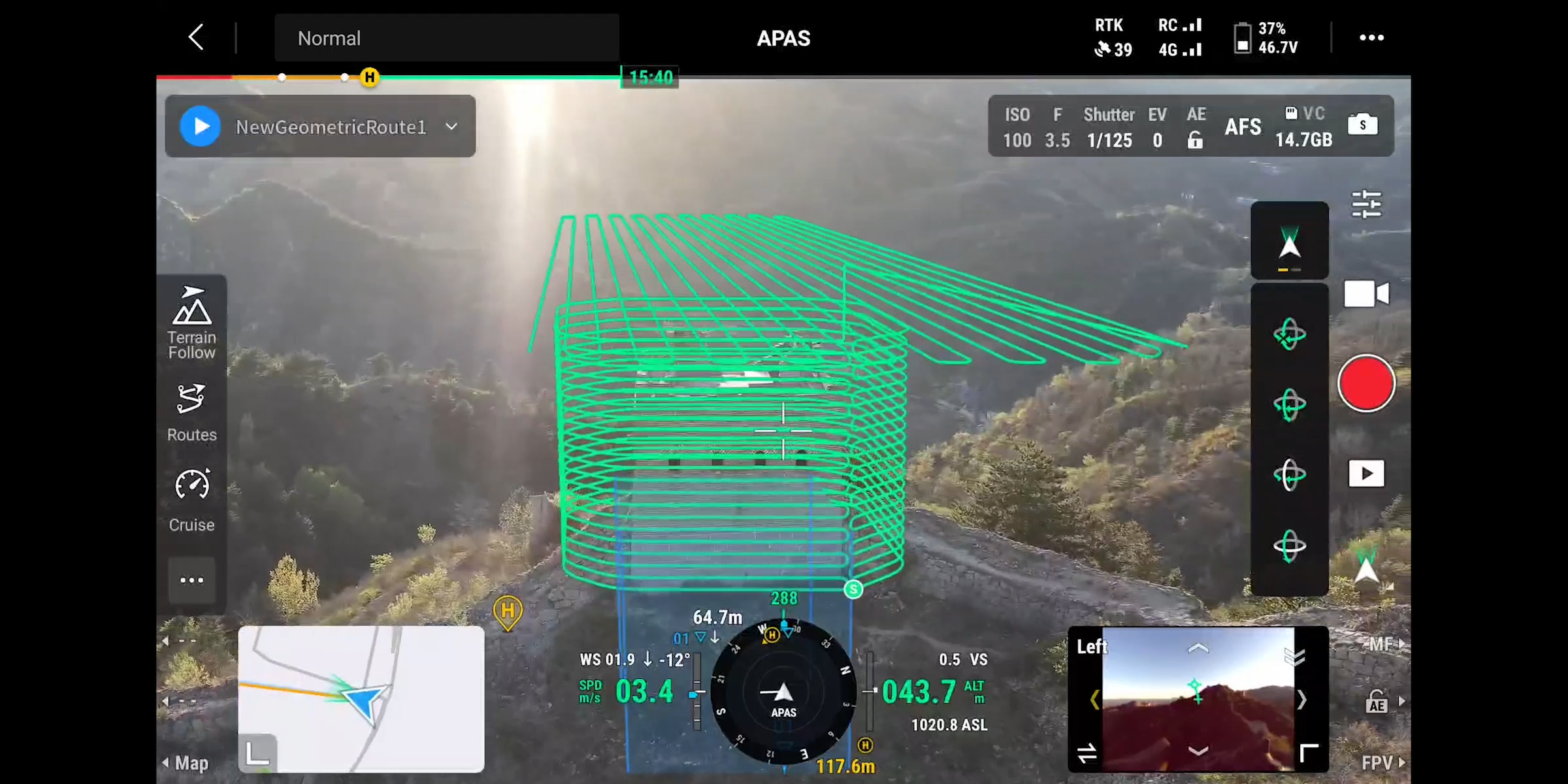
Simply define the surface, and the aircraft automatically creates and executes an optimal route for the highest data quality in the shortest time.